Lowrance M68C$394.00 to $526.00
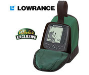
Combining the 256-color technology of the sonar industry and the superior precision of Lowrance GPS units, the M-68c sonar/map gives you all the capabilities of the extreme high-end combo units in a smaller, more affordable package. Features a full 12-parallel channel GPS and WAAS receiver and 40 map ranges from .02 to 4,000 miles with easy zoom. The high-bright 3.5" diagonal TFT active matrix transflective display delivers a wide viewing angle and superb readability in direct sunlight. And, it includes an advanced LED screen and keypad backlighting for night and low-light operation.Minimize
Manufacturer:Lowrance Product MPN MPN | 3842201200 | Key Features GPS Type | Marine | Form Factor | Fixed | Map capabilities | Internal | Enhanced accuracy | WAAS enabled | Input Method | Keypad | Receiver Type | 12 Channels | Display Display Size | 3.5 in. | Display Type | 256 Color LCD TFT Display | Resolutions | 320 X 240 | Technical Features Marine Features | Fish Finder, Split Screen, MOB (Man Over Board) | Special Features | Waypoint Icons | Audible Features | Proximity Alarm, Anchor Alarm, Arrival Alarm, Off-Course Alarm, Fish Alarm, Shallow/Deep Alarm | Trip calculator | Trip Timers, Time of sunrise/sunset | Other Features Antenna | Built-in | GPS System Number of routes | 100 | Waypoints | 1000 | Warranty Warranty | 1 Year | Dimensions Width | 4.23 in. | Depth | 3.26 in. | Height | 6.26 in. |
Tags:lowrance, m68c,
| AmbiCom GPS-CF$63.00 to $83.00
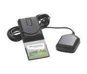
The AmbiCom GPS Navigation Receiver CompactFlash Card is the Global Positioning System Receiver for your mobile device and the perfect accessory to your Pocket PC device. The GPS Navigation Receiver comes with a full feature 30-day trial version software that is loaded with fantastic features such as dynamic voice navigation, off-route warning, and detailed street maps. Now you can turn your Pocket PC into a true GPS navigation system and never worry about getting lost!Minimize
Manufacturer:AmbiCom Product MPN MPN | GPS-CF | Key Features GPS Type | Automobile | Form Factor | Handheld, Plug-in | Receiver Type | 12 Channels | Technical Features Audible Features | Voice Navigation Instructions | Other Features PC Interface | NMEA-0183 | Expansion Slot Type | CompactFlash Type I | Antenna | Built-in | GPS System Accuisition Time - Cold | 36 sec | Max. Horizontal accuracy | PDA Features | Compatible PDA OS | Pocket PC, Windows XP, Windows 2000, Windows 98, Windows ME | Compatible Devices | Pocket PC Based PDA | Dimensions Width | 1.7 in. | Depth | 3.7 in. | Height | 0.4 in. | Weight | 0.09 lb. | Miscellaneous UPC | 646543199377 |
Tags:ambicom, gps-cf,
| Garmin GPSMAP 4212$2,200.00 to $3,000.00

This preloaded, offshore chartplotter combines the power of networking with brilliant color and slim-line design. The GPSMAP 4212 has preloaded BlueChart® g2 maps of the U.S. coast and displays them on a whopping 12.1” XGA display with crisp, video-quality resolution. By connecting to the Garmin Marine Network, you can add sonar, radar and weather. For even more enhanced features, you can add the optional Bluechart g2 Vision card.Minimize
Manufacturer:Garmin Product MPN MPN | 010-00592-01 | Key Features GPS Type | Marine | Form Factor | Fixed | Map capabilities | Internal | Enhanced accuracy | WAAS enabled | Input Method | Keypad | Receiver Type | 12 Channels | Screen Size | 12.1 in. | Display Display Size | 9.7 in. x 7.3 in. | Resolutions | 640 X 480 | Technical Features Audible Features | Proximity Alarm, Anchor Alarm, Arrival Alarm, Off-Course Alarm, Clock Alarm, Accuracy Alarm, Low Battary/Voltage Alarm | Trip calculator | Track Log, Points-of-Interest (POI) | Included Software/Maps | Marine Cartography | Other Features Expansion Slot Type | SD (Secure Digital) Card Slot | GPS System Number of routes | 20 | Waypoints | 1500 | Dimensions Width | 14.8 in. | Depth | 4.6 in. | Height | 9.5 in. | Weight | 10 lb. | Miscellaneous Family Line | Garmin GPSMAP | UPC | 753759066062 |
Tags:garmin, gpsmap, 4212,
|
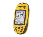
For serious outdoor use, the eXplorist series handheld GPS navigation systems are built to cover all requirements. With their tough, impact-resistant, waterproof exterior and their proven Magellan technology inside that packs powerful functionality into an easy-to-use operating system, your outdoor needs will be covered.Minimize
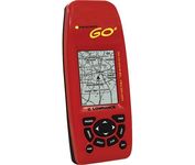
Just grab this bright yellow handheld iFINDER Go 64MB GPS and go, go, go. It's easy to use, waterproof, has a 2.2 diagonal Film SuperTwist display with backlighting and a built-in 64MB background map with coverage of the continental U.S. and Hawaii. The GPS also includes up to 1,000 waypoints, 1,000 event markers and 100 routes; up to 100 retraceable plot trails and up to 10,000 points in any trail; 30+ map zoom ranges and 42 graphic icons to mark spots.Minimize

The eTrex Summit comes on the heels of the extremely popular eTrex, which was designed for both marine and recreation use. This new all-in-one navigation device for the outdoor enthusiast is the first combination GPS, altimeter, and electronic compass. The electronic compass provides bearing information when you're standing still and the altimeter determines precise altitude, so you can tell how high you've climbed and your rate of ascent. Like its predecessor, the eTrex Summit boasts a powerful 12 parallel channel GPS receiver and comes packaged in a small, sleek case with operating buttons located on either side of the unit. The case is completely waterproof to withstand immersion in one meter of water for up to 30 minutes.Minimize
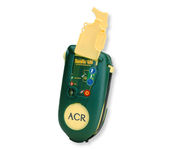
Accidents happen every day in the outdoors, whether you fall out of a tree stand, break a leg during a hike, or roll over on an ATV. In the outdoors, an every day accident instantly can become a life threatening situation, and rescues may take days or weeks if you’re not prepared.