Products reviews
Garmin StreetPilot c580
$270.00 to $940.00
Receive door-to-door directions while staying on top of weather, traffic and localized information with the StreetPilot c580. Similar to the c550, StreetPilot c580 comes with hands-free calling, preloaded maps and an MP3 player, then takes it up a notch by adding dynamic content from MSN® Direct.
| MPN | 010-00522-06 |
| GPS Type | Automobile | Form Factor | Fixed | Map capabilities | Internal, Download maps | Enhanced accuracy | WAAS enabled, EGNOS enabled | Input Method | Touch Screen | Receiver Type | 18 Channels | Screen Size | 3.5 in. |
| Display Size | 2.8 in. x 2.1 in. | Display Type | 16-bit Color LCD TFT Display | Resolutions | 320 X 240 |
| Special Features | MP3 Player, JPEG Image Viewer, 3D Map View | Trip calculator | Shortest time, Maximum speed, Current speed, Route Recalculation, Points-of-Interest (POI) | Included Software/Maps | North America Maps, Canada Maps, Europe Maps, Australia Maps, South Africa Maps, South America Maps, Middle East Maps, Great Britain |
| PC Interface | USB | Expansion Slot Type | SD (Secure Digital) Card Slot | Antenna | Built-in, External Antenna Hookup |
| Accuisition Time - Cold | 38 sec | Accuisition Time - Initial Time | 1 sec | Update rate | 1 per second, continuous | Waypoints | 500 |
| Compatible PDA OS | Windows 2000 | Compatible Devices | Notebook |
| Battery Type and Quantity | Proprietary Li-Ion | Battery Life | 8 Hours |
| Warranty | 1 Year |
| Width | 4.4 in. | Depth | 2.2 in. | Height | 3.2 in. | Weight | 0.59 lb. |
| Family Line | Garmin StreetPilot | UPC | 753759068004 |
Tags:
garmin, streetpilot, c580,Garmin GPSMAP 440s

Offshore fishermen and boaters will gravitate toward this sleek, space-saving chartplotter. The GPSMAP 440 features preloaded detailed maps for the U.S. coast as well as an ultra-bright 4” QVGA display; built-in, satellite-enhanced worldwide basemap and simplified user operation.
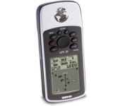
Garmin GPS 76

The GPS 76 is designed to provide precise GPS positioning using correction data obtained from the Wide Area Augmentation System (WAAS). This unit features a built-in quad helix antenna for superior reception and can provide position accuracy to less than three meters when receiving WAAS corrections.The GPS 76 provides 1 megabyte of internal user memory to be used for storing downloaded Points of Interest data. This 1 megabyte of storage area is preloaded from the factory with worldwide cities (populations greater than 200,000) and nautical navigation aids such as lights, buoys, sound signals and day beacons, and is perfect for downloading points of interest detail from GARMIN's line of MapSource CD-ROMs. The GPS 76 is also preloaded with tide data for the United States.Minimize
AmbiCom GPS-CF

The AmbiCom GPS Navigation Receiver CompactFlash Card is the Global Positioning System Receiver for your mobile device and the perfect accessory to your Pocket PC device. The GPS Navigation Receiver comes with a full feature 30-day trial version software that is loaded with fantastic features such as dynamic voice navigation, off-route warning, and detailed street maps. Now you can turn your Pocket PC into a true GPS navigation system and never worry about getting lost!Minimize
Garmin GPSMAP 76CSx

Safely find your way through the great outdoors with the Garmin GPSMAP 76CSx. Sporting a highly sensitive GPS receiver, the GPSMAP 76CSx can quickly and accurately chart a course through the wilderness without being impeded by dense tree cover or deep canyons. An included barometric altimeter and electronic compass give you an unprecedented level of accuracy over pinpointing your location and with the bright, color TFT display you can easily distinguish details on the screen, even while viewing in direct sunlight. The GPSMAP 76CSx is also fully waterproof and even floats in water.Minimize