Lowrance M68C$394.00 to $526.00

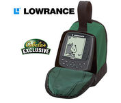
Combining the 256-color technology of the sonar industry and the superior precision of Lowrance GPS units, the M-68c sonar/map gives you all the capabilities of the extreme high-end combo units in a smaller, more affordable package. Features a full 12-parallel channel GPS and WAAS receiver and 40 map ranges from .02 to 4,000 miles with easy zoom. The high-bright 3.5" diagonal TFT active matrix transflective display delivers a wide viewing angle and superb readability in direct sunlight. And, it includes an advanced LED screen and keypad backlighting for night and low-light operation.Minimize
Manufacturer:Lowrance Product MPN MPN | 3842201200 | Key Features GPS Type | Marine | Form Factor | Fixed | Map capabilities | Internal | Enhanced accuracy | WAAS enabled | Input Method | Keypad | Receiver Type | 12 Channels | Display Display Size | 3.5 in. | Display Type | 256 Color LCD TFT Display | Resolutions | 320 X 240 | Technical Features Marine Features | Fish Finder, Split Screen, MOB (Man Over Board) | Special Features | Waypoint Icons | Audible Features | Proximity Alarm, Anchor Alarm, Arrival Alarm, Off-Course Alarm, Fish Alarm, Shallow/Deep Alarm | Trip calculator | Trip Timers, Time of sunrise/sunset | Other Features Antenna | Built-in | GPS System Number of routes | 100 | Waypoints | 1000 | Warranty Warranty | 1 Year | Dimensions Width | 4.23 in. | Depth | 3.26 in. | Height | 6.26 in. |
Tags:lowrance, m68c,
| Garmin Rino 120$167.00 to $628.00

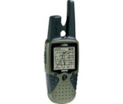
The Rino 120 is state-of-the-art GPS navigation and two-way communications combined, with enough memory to download detailed mapping for driving, hiking, hunting, fishing--or just about anything else you can dream up.
Manufacturer:Garmin Product MPN MPN | RINO120 | Key Features GPS Type | Handheld (Outdoor) | Form Factor | Handheld | Map capabilities | Internal, Download maps | Enhanced accuracy | WAAS enabled | Input Method | Thumb Stick | Receiver Type | 12 Channels | Screen Size | 2 in. | Display Display Size | 1.4 in. x 1.4 in. | Display Type | LCD Display | Resolutions | 160 X 160 | Technical Features Marine Features | Fishing Calcluator | Special Features | Waypoint Icons | Audible Features | Proximity Alarm | Trip calculator | Maximum speed, Current speed, Trip Timers, Time of sunrise/sunset, Track Log, Points-of-Interest (POI) | Included Software/Maps | Marine Cartography, North America Maps, South America Maps | Grids | Lat/Lon, MGRS, UTM, Loran TD position format, Maidenhead | Other Features PC Interface | Serial RS-232, NMEA-0183 | Environmental Protection | IPX7 Waterproof Standard | Antenna | Quadrifilar Helix | GPS System Accuisition Time - Cold | 45 sec | Accuisition Time - Initial Time | 15 sec | Update rate | 1 per second, continuous | Max. Horizontal accuracy | | Enhanced position accuracy | | Differential standards | DGPS Ready | Number of routes | 20 | Waypoints | 500 | Battery Battery Type and Quantity | 3 x AA Batteries | Battery Life | 28 Hours | Warranty Warranty | 1 Year | Dimensions Width | 2.3 in. | Depth | 1.6 in. | Height | 4.5 in. | Weight | 0.48 lb. | Miscellaneous Family Line | Garmin Rino | UPC | 689076630887 |
Tags:garmin, rino, 120,
| Garmin Edge 205$138.00 to $286.00

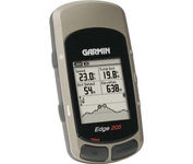
Take your ride to the next level with the Edge 205Garmin's GPS-enabled personal trainer and cycle computer. Perfect for touring and the trails, the lightweight Edge is the ultimate fitness partner. With the easy-to-use Edge 205 on your bike, you always know where you're going and how far you've gone. For advanced cyclists, the Edge 305 is available with either a heart rate monitor or a wireless speed/pedaling cadence sensor to help you achieve your personal best.Minimize
Manufacturer:Garmin Product MPN MPN | 0100044710 | Key Features GPS Type | Handheld (Outdoor) | Form Factor | Handheld | Input Method | Keypad | Screen Size | 1.9 in. | Display Display Size | 1.17 in. x 1.44 in. | Display Type | 4 Level Grayscale LCD Display | Technical Features Special Features | Training Computer | Trip calculator | Maximum speed | Other Features PC Interface | USB | Environmental Protection | IPX7 Waterproof Standard | Antenna | Built-in | Battery Battery Type and Quantity | Proprietary Lithium | Battery Life | 12 Hours | Warranty Warranty | 1 Year | Dimensions Width | 1.75 in. | Depth | 0.9 in. | Height | 3.7 in. | Weight | 0.19 lb. | Miscellaneous UPC | 753759051754 |
Tags:garmin, edge, 205,
|

With the eTrex Legend, GARMIN has loaded a full basemap of North and South America into one small unit. The Legend is also designed to provide precise GPS positioning using correction data obtained from the Wide Area Augmentation System (WAAS). This product will provide position accuracy to less than three meters when receiving WAAS corrections.Minimize

The F20, provides you with a lot for very little. Loaded with features normally found in other, more expensive car navigators, the F20 packs them all into a neat, pocket-sized compact unit. It’s the advanced features that separate the F20 from other entry-level navigators. The ‘Nearest Parking and Petrol’ buttons, previously only found on our more expensive models, are a simple but brilliant idea, exclusive to Navman.Minimize

Designed specifically for motorcycles, the Garmin zumo 550 has a host of features that make it the easiest way to get GPS navigation on two wheels. Durable, waterproof, and built with fuel-resistant plastics, the zumo 550 can take a beating and hold up against even the most intense driving conditions. Right out of the box you’ll be able to chart out your ride with preloaded City Navigator NT street maps that are loaded with useful points of interest including restaurants, gas stations, and motels. Turn-by-turn voice directions keep you on track and with real-time traffic and weather updates you can avoid obstacles that might interfere with your otherwise, easy ride.Minimize

The GP-7000F/NT is a GPS/WAAS plotter designed for a variety of vessels desiring video plotting and echo sounding capabilities. With the GP-7000 series, you can see the highly accurate position of your boat on the chart. The GP-7000 series has four display modes: Course Plot, Nav Data, Steering, and Highway modes. The course plot mode is useful for obtaining general information about surrounding sea areas. The Nav data mode clearly shows important navigational information with large text, which is easy to see even from a distance. The steering mode and highway mode assist the operator in following a predetermined route.Minimize