Garmin StreetPilot i5$181.00 to $450.00

It may be tiny, but the StreetPilot i5 is packed with state-of-the-art navigation features. The StreetPilot i5 comes preloaded with incredibly detailed City Navigator NT street maps that are packed with nearly 6 million points of interest including hotels, restaurants, ATMs and much more. A simple rolling-wheel interface allows you to quickly adjust settings and alter routes to your destination. Built for portability and power, the StreetPilot i5 is a cost effective portable GPS solution. Minimize
Manufacturer:Garmin Product MPN MPN | SPI5 | Key Features GPS Type | Automobile | Form Factor | Handheld | Enhanced accuracy | WAAS enabled | Receiver Type | 12 Channels | Screen Size | 2.1 in. | Display Display Size | 1.7 in. x 1.3 in. | Display Type | 32k Colors LCD TFT Display | Resolutions | 220 x 176 | Technical Features Audible Features | Voice Navigation Instructions | Trip calculator | Detour Feature, Points-of-Interest (POI) | Other Features PC Interface | USB | Battery Battery Type and Quantity | 2 x AA Batteries | Battery Life | 7 Hours | Dimensions Width | 3 in. | Depth | 2.15 in. | Height | 2.74 in. | Weight | 0.32 lb. | Miscellaneous Family Line | Garmin StreetPilot | UPC | 840356505404 |
Tags:garmin, streetpilot, i5,
| Garmin StreetPilot c550$199.00 to $400.00

From Garmin, the leader in portable GPS solutions, the StreetPilot c550 is easy to use, and rich with features. The StreetPilot c550 comes preloaded with City Navigator NT street maps and includes a large database of points of interest including motels, restaurants, gas stations, and grocery stores. The simple touch screen interface gives you excellent control over menus and settings, and with Bluetooth support, you can even use the c550 for hands-free calling using the built-in speaker and microphone.Minimize
Manufacturer:Garmin Product MPN MPN | 010-00522-02 | Key Features GPS Type | Automobile | Form Factor | Fixed | Map capabilities | Internal, Map cartridges / Data cards | Enhanced accuracy | WAAS enabled | Input Method | Touch Screen | Screen Size | 3.5 in. | Display Display Size | 2.8 in. x 2.1 in. | Display Type | LCD TFT Display | Resolutions | 320 X 240 | Technical Features Special Features | Waypoint Icons, MP3 Player, 3D Map View | Audible Features | Voice Navigation Instructions | Trip calculator | Maximum speed, Odometer, Route Recalculation, Trip Timers, Real-time Traffic Reports, Detour Feature, Points-of-Interest (POI) | Included Software/Maps | North America Maps, Europe Maps | Other Features PC Interface | USB 2.0, Bluetooth | Expansion Slot Type | SD (Secure Digital) Card Slot | Antenna | Built-in, External Antenna Hookup | GPS System Waypoints | 500 | Battery Battery Life | 8 Hours | Warranty Warranty | 1 Year | Dimensions Width | 4.4 in. | Depth | 2.2 in. | Height | 3.2 in. | Weight | 0.59 lb. | Miscellaneous Family Line | Garmin StreetPilot | UPC | 753759054489 |
Tags:garmin, streetpilot, c550,
| Garmin Forerunner 101$89.00 to $114.00

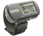
The Forerunner 101 offers athletes and recreational walkers and runners an entry-level personal training device with GPS. It has the same features as the Forerunner 201, but operates on two AAA batteries. The Forerunner 101 stores lap histories for up to two years to provide an archive of workout performance over time. Users can retrieve lap data for previous workouts by date, week, month, or over a specific time interval. For business travelers who want to train on the road, the Forerunner 101 also doubles as a navigator. Users can mark their hotel as a specific location, see their current position on the plotter display, and follow an electronic breadcrumb trail back to their starting point.Minimize
Manufacturer:Garmin Product MPN MPN | 010-00329-00 | Key Features GPS Type | Handheld (Outdoor) | Form Factor | Handheld | Receiver Type | 12 Channels | Screen Size | 1.7 in. | Display Display Size | 1.5 in. x 0.9 in. | Display Type | LCD Display | Resolutions | 100 X 64 | Technical Features Special Features | Built-In Altimeter | Audible Features | Arrival Alarm | Trip calculator | Maximum speed | Other Features Environmental Protection | IPX7 Waterproof Standard | Antenna | Built-in | GPS System Accuisition Time - Cold | 45 sec | Accuisition Time - Initial Time | 15 sec | Waypoints | 100 | Battery Battery Type and Quantity | 2 x AAA Batteries | Battery Life | 15 Hours | Warranty Warranty | 1 Year | Dimensions Width | 3.3 in. | Depth | 0.9 in. | Height | 1.7 in. | Weight | 0.16 lb. | Miscellaneous Family Line | Garmin Forerunner | UPC | 0753759044114 |
Tags:garmin, forerunner, 101,
|

Offshore fishermen and boaters will gravitate toward this sleek, space-saving chartplotter. The GPSMAP 440 features preloaded detailed maps for the U.S. coast as well as an ultra-bright 4” QVGA display; built-in, satellite-enhanced worldwide basemap and simplified user operation.

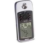
The GPS 76 is designed to provide precise GPS positioning using correction data obtained from the Wide Area Augmentation System (WAAS). This unit features a built-in quad helix antenna for superior reception and can provide position accuracy to less than three meters when receiving WAAS corrections.The GPS 76 provides 1 megabyte of internal user memory to be used for storing downloaded Points of Interest data. This 1 megabyte of storage area is preloaded from the factory with worldwide cities (populations greater than 200,000) and nautical navigation aids such as lights, buoys, sound signals and day beacons, and is perfect for downloading points of interest detail from GARMIN's line of MapSource CD-ROMs. The GPS 76 is also preloaded with tide data for the United States.Minimize

No matter where your outdoor activities take you, the Rino® 530 keeps you on track and in touch. Similar to the 520, this rugged, two-way radio with GPS packs a bold color display, 14-mile communication range, and turn-by-turn directions - giving you peace of mind in the great outdoors. Taking it a step further, the Rino 530 adds an electronic compass, barometric altimeter, and NOAA weather receiver, making it a favorite with hikers and climbers.Minimize

Rugged, lightweight Edge attaches easily to the stem or handlebars of your bike with the included bike mount. Just turn it on, acquire GPS satellites and go. Edge 305 automatically measures your speed, distance, time, calories burned, altitude, climb and descent, and also records the route you have taken for review. For extra-precise climb and descent data, Edge 305 also incorporates a barometric altimeter to pinpoint changes in elevation.Minimize


