Garmin StreetPilot i5$181.00 to $450.00

It may be tiny, but the StreetPilot i5 is packed with state-of-the-art navigation features. The StreetPilot i5 comes preloaded with incredibly detailed City Navigator NT street maps that are packed with nearly 6 million points of interest including hotels, restaurants, ATMs and much more. A simple rolling-wheel interface allows you to quickly adjust settings and alter routes to your destination. Built for portability and power, the StreetPilot i5 is a cost effective portable GPS solution. Minimize
Manufacturer:Garmin Product MPN MPN | SPI5 | Key Features GPS Type | Automobile | Form Factor | Handheld | Enhanced accuracy | WAAS enabled | Receiver Type | 12 Channels | Screen Size | 2.1 in. | Display Display Size | 1.7 in. x 1.3 in. | Display Type | 32k Colors LCD TFT Display | Resolutions | 220 x 176 | Technical Features Audible Features | Voice Navigation Instructions | Trip calculator | Detour Feature, Points-of-Interest (POI) | Other Features PC Interface | USB | Battery Battery Type and Quantity | 2 x AA Batteries | Battery Life | 7 Hours | Dimensions Width | 3 in. | Depth | 2.15 in. | Height | 2.74 in. | Weight | 0.32 lb. | Miscellaneous Family Line | Garmin StreetPilot | UPC | 840356505404 |
Tags:garmin, streetpilot, i5,
| Acr Electronics TerraFix 406$234.00 to $487.00
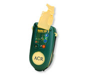
Accidents happen every day in the outdoors, whether you fall out of a tree stand, break a leg during a hike, or roll over on an ATV. In the outdoors, an every day accident instantly can become a life threatening situation, and rescues may take days or weeks if you’re not prepared.
Manufacturer:Acr Electronics Product MPN MPN | 210218942 | Key Features GPS Type | Automobile | Form Factor | Wireless Receiver Module | Dimensions Weight | 0.83 lb. | Miscellaneous UPC | 791659001806 |
Tags:acr, electronics, terrafix, 406,
| Garmin GPSMAP 76Cx$233.00 to $432.00
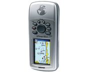
The GPSMAP 76CSx is a refreshing upgrade of the GPSMAP 76CS, one of our most popular models for outdoor and marine use. This unit features a removable microSD card for detailed mapping memory and a waterproof, rugged housing. The microSD card slot is located inside the waterproof battery compartment. Users can load map data and transfer routes and waypoints through the unit’s fast USB connection.Minimize
Manufacturer:Garmin Product MPN MPN | 010-00468-00 | Key Features GPS Type | Marine | Form Factor | Handheld | Map capabilities | Internal | Enhanced accuracy | WAAS enabled | Receiver Type | 12 Channels | Screen Size | 2.7 in. | Display Display Size | 1.5 in. x 2.2 in. | Display Type | 256 Color LCD TFT Display | Resolutions | 160 X 240 | Technical Features Marine Features | Fishing Calcluator, MOB (Man Over Board) | Special Features | Waypoint Icons | Audible Features | Proximity Alarm, Anchor Alarm, Arrival Alarm, Off-Course Alarm, Clock Alarm, Shallow/Deep Alarm | Trip calculator | Moving average, Total average, Odometer, Time of sunrise/sunset, Track Log, Points-of-Interest (POI) | Included Software/Maps | North America Maps, South America Maps | Grids | Lat/Lon, MGRS, User Grid, UTM, Loran TD position format, Maidenhead | Other Features PC Interface | USB, NMEA-0183 | Environmental Protection | IPX7 Waterproof Standard, High Impact Plastic Alloy Body | Antenna | Built-in, Quadrifilar Helix | GPS System Accuisition Time - Cold | 38 sec | Accuisition Time - Initial Time | 1 sec | Update rate | 1 per second, continuous | Max. Horizontal accuracy | | Enhanced position accuracy | | Differential standards | DGPS Ready | Number of routes | 50 | Waypoints | 1000 | Battery Battery Type and Quantity | 2 x AA Batteries | Battery Life | 18 Hours | Warranty Warranty | 1 Year | Dimensions Width | 2.7 in. | Depth | 1.4 in. | Height | 6.2 in. | Weight | 0.48 lb. | Miscellaneous Family Line | Garmin GPSMAP | UPC | 753759051631 |
Tags:garmin, gpsmap, 76cx,
|
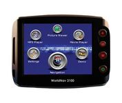
The TeleType WorldNav 3100 Deluxe Portable GPS Navigator is a simple, stylish and user-friendly street navigator at a reasonable price. With the WorldNav 3100 Deluxe you get affordable, in-car navigation with the added benefits of easy touch-screen use, pre-loaded maps, as well as MP3 and video entertainment capabilities.Minimize
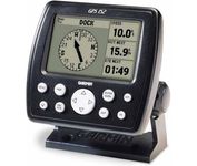
The GPS 152 is a 12 parallel channel GPS receiver loaded with a database of American cities and nautical navigation aids such as lights, buoys, sound signals, day beacons and tide data. Built-in memory of one megabyte makes the GPS 152 compatible with GARMIN's MapSource Points of Interest CD. With this CD and the GPS 152, you add additional marine navaid detail to your unit.In addition to larger memory, the GPS 152 is compatible with the Wide Area Augmentation System (WAAS), a technology designed to improve the accuracy of GPS positioning to about three meters.On the outside, the GPS 152 comes housed in a waterproof case that's about four inches high and five inches wide. A large four-inch diagonal, high-contrast display features 100x160 pixels for the ultimate in readability. A simple keypad at the bottom of the unit makes entering information easy, without blocking your view of the display.Minimize
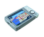
Transferable from car-to-car in seconds, the easy-to-use iCN510 can effortlessly guide drivers to their desired destination using accurate and clear turn-by-turn voice instructions and 3D-map view. Users can also now Drive Away this compact and sleek system straight from the box, with software applications and complete U.K. street-level mapping loaded on a single memory card. The iCN510 incorporates Version 3.0 of Navmans award winning SmartST software, which includes new features such as My POI customable points of interest with approach notification settings, multiple destinations for planning trips with several stops along the way, and a nearest POI search facility.Minimize

The GP-7000F/NT is a GPS/WAAS plotter designed for a variety of vessels desiring video plotting and echo sounding capabilities. With the GP-7000 series, you can see the highly accurate position of your boat on the chart. The GP-7000 series has four display modes: Course Plot, Nav Data, Steering, and Highway modes. The course plot mode is useful for obtaining general information about surrounding sea areas. The Nav data mode clearly shows important navigational information with large text, which is easy to see even from a distance. The steering mode and highway mode assist the operator in following a predetermined route.Minimize