Products reviews

Garmin StreetPilot c530

$180.00


StreetPilot c530 comes ready to go right out of the box with preloaded City Navigator® NT street maps and a hefty points of interest (POIs) database, including motels, restaurants, fuel, ATMs and more. Simply touch the super-bright sunlight-readable color screen to enter a destination, and the c530 takes you there with 2D or 3D maps and turn-by-turn voice directions. In addition, the c530 accepts custom points of interest (POIs) such as school zones and safety cameras and lets you set proximity alerts to warn you of upcoming POIs.Minimize

Manufacturer:Garmin Product MPNKey FeaturesDisplayTechnical FeaturesOther FeaturesGPS SystemPDA FeaturesBatteryDimensionsMiscellaneous
MPNSTREETC530
GPS Type   Automobile
Form FactorFixed
Map capabilities   Internal, Map cartridges / Data cards
Input Method   Touch Screen
Screen Size3.5 in.
Display Size2.8 in. x 2.1 in.
Display TypeLCD TFT Display
Resolutions320 X 240
Special Features   Audio Book Player
Trip calculator   Shortest time, Shortest distance, Route Recalculation, Avoid toll roads
Included Software/Maps   North America Maps
PC InterfaceUSB, Bluetooth
Expansion Slot TypeSD (Secure Digital) Card Slot
Waypoints   500
Plug-in Interface   Secure Digital (SD)
Compatible PDA OSWindows 2000
Compatible DevicesNotebook
Battery Type and QuantityRechargeable Li-Ion Battery
Battery Life8 Hours
Width4.4 in.
Depth2.25 in.
Height3.2 in.
Weight0.56 lb.
Family LineGarmin StreetPilot
UPC053759054473


Tags:

garmin, streetpilot, c530,

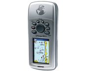
Garmin GPSMAP 76Cx

$233.00 to $432.00


The GPSMAP 76CSx is a refreshing upgrade of the GPSMAP 76CS, one of our most popular models for outdoor and marine use. This unit features a removable microSD card for detailed mapping memory and a waterproof, rugged housing. The microSD card slot is located inside the waterproof battery compartment. Users can load map data and transfer routes and waypoints through the unit’s fast USB connection.Minimize

Manufacturer:Garmin Product MPNKey FeaturesDisplayTechnical FeaturesOther FeaturesGPS SystemBatteryWarrantyDimensionsMiscellaneous
MPN010-00468-00
GPS Type   Marine
Form FactorHandheld
Map capabilities   Internal
Enhanced accuracyWAAS enabled
Receiver Type12 Channels
Screen Size2.7 in.
Display Size1.5 in. x 2.2 in.
Display Type256 Color LCD TFT Display
Resolutions160 X 240
Marine FeaturesFishing Calcluator, MOB (Man Over Board)
Special Features   Waypoint Icons
Audible Features   Proximity Alarm, Anchor Alarm, Arrival Alarm, Off-Course Alarm, Clock Alarm, Shallow/Deep Alarm
Trip calculator   Moving average, Total average, Odometer, Time of sunrise/sunset, Track Log, Points-of-Interest (POI)
Included Software/Maps   North America Maps, South America Maps
Grids   Lat/Lon, MGRS, User Grid, UTM, Loran TD position format, Maidenhead
PC InterfaceUSB, NMEA-0183
Environmental ProtectionIPX7 Waterproof Standard, High Impact Plastic Alloy Body
AntennaBuilt-in, Quadrifilar Helix
Accuisition Time - Cold38 sec
Accuisition Time - Initial Time1 sec
Update rate1 per second, continuous
Max. Horizontal accuracy   Enhanced position accuracy Differential standardsDGPS Ready
Number of routes50
Waypoints   1000
Battery Type and Quantity2 x AA Batteries
Battery Life18 Hours
Warranty1 Year
Width2.7 in.
Depth1.4 in.
Height6.2 in.
Weight0.48 lb.
Family LineGarmin GPSMAP
UPC753759051631


Tags:

garmin, gpsmap, 76cx,

Pharos Science iGPS-360

$50.00 to $134.00


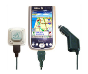
Compatible with most Pocket PCs with a CompactFlash slot, the Pharos Pocket GPS Navigator with CompactFlash inlcludes Pharos' iGPS-360 convertible receiver with a CompactFlash adaptor.Use it directly connected to the CompactFlash Adaptor, or for added flexibilty use the CF extension cable for placement and reception.Threre is no need for an external antenna!With Ostia, Pharos' award-winning navigation software installed on your Pocket PC, you can drive or walk through any city in the US, and locate your current position or quickly find a destination or point of interest. Routes can be calculated and viewed. The automated voice prompts will instruct you when and where to turn. If by chance you go "off-route," the automated voice will give an off-route warning and the system will automatically reroute you to your destination from your current position. Minimize

Manufacturer:Pharos Science Product MPNKey FeaturesOther FeaturesGPS SystemMiscellaneous
MPNREC20
GPS Type   Handheld (Outdoor)
Form FactorPlug-in
Enhanced accuracyWAAS enabled, EGNOS enabled
Receiver Type12 Channels
PC InterfaceUSB, Serial RS-232, Bluetooth
AntennaBuilt-in
Accuisition Time - Cold60 sec
Accuisition Time - Initial Time40 sec
Accuisition Time - Hot5 sec
Max. Horizontal accuracy   Dimensions
Width1.93 in.
Depth0.63 in.
Height2.17 in.
Weight0.09 lb.
UPC818948001382


Tags:

pharos, science, igps-360,


Garmin eTrex Legend Cx


The eTrex Legend Cx is loaded with the same popular features found in the eTrex Legend C, including sunlight-readable color and advanced GPS routing capabilities — all in a waterproof design. In addition, it comes with a blank 32 MB microSD card for storage of optional map detail. Download maps directly to the card or purchase microSD cards preloaded with MapSource® Topo and inland lake maps, BlueChart® marine cartography, and City Navigator™ street maps.Minimize


Furuno GP37


The new GP37 DGPS/WAAS Navigator is compact in size, yet big on power, features and performance. This waterproof unit is perfect for a wide range of boats. It is equipped with a WAAS and a DGPS receiver as standard supply. It utilizes both WAAS and differential radio beacon correction methods to give you the most accurate position fix available. The GP37 offers extremely accurate position fixes -- 10m for basic GPS, 5m or better with DGPS and 3m or better where WAAS service is available. It should be noted that DGPS is more reliable and accurate, as the WAAS system is still currently under development. There is no guarantee of accuracy, integrity, continuity or availability of the WAAS signal. For that reason, the GP37 runs with DGPS as the default setting in auto selection mode. In this mode, if the DGPS signal can not be received for any reason, the WAAS mode is automatically selected. Manual setting is also available. The display modes include Plotter, two Customizable displays, Steering, Highway and SpeedMinimize


Garmin GPS 18


Turn your laptop PC into a powerful street navigator with the GPS 18 a GPS sensor bundled with nRoute and City Select software that automatically guides you with turn-by-turn directions and voice prompts to get you safely to your destination.


TomTom Navigator 3


Get moving with TomTom Navigator 3. The flexible and personal car navigation system works on your Pocket PC. TomTom Navigator 3 guides you effortlessly from door to door via the best route. Clear 3D colour maps and spoken instructions take the stress out of driving. Plan the best route when you have multiple stops: pick up colleagues on the way to a meeting or friends on the way to a restaurant. Route around areas you would like to avoid due to traffic jams or road works. The Major Roads of Europe feature makes planning and navigating international trips easier than ever. Plan the best route from Munich to Lyon, and TomTom will guide you there.Minimize