Products reviews

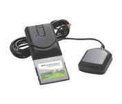
AmbiCom GPS-CF

$63.00 to $83.00


The AmbiCom GPS Navigation Receiver CompactFlash Card is the Global Positioning System Receiver for your mobile device and the perfect accessory to your Pocket PC device. The GPS Navigation Receiver comes with a full feature 30-day trial version software that is loaded with fantastic features such as dynamic voice navigation, off-route warning, and detailed street maps. Now you can turn your Pocket PC into a true GPS navigation system and never worry about getting lost!Minimize

Manufacturer:AmbiCom Product MPNKey FeaturesTechnical FeaturesOther FeaturesGPS SystemDimensionsMiscellaneous
MPNGPS-CF
GPS Type   Automobile
Form FactorHandheld, Plug-in
Receiver Type12 Channels
Audible Features   Voice Navigation Instructions
PC InterfaceNMEA-0183
Expansion Slot TypeCompactFlash Type I
AntennaBuilt-in
Accuisition Time - Cold36 sec
Max. Horizontal accuracy   PDA Features
Compatible PDA OSPocket PC, Windows XP, Windows 2000, Windows 98, Windows ME
Compatible DevicesPocket PC Based PDA
Width1.7 in.
Depth3.7 in.
Height0.4 in.
Weight0.09 lb.
UPC646543199377


Tags:

ambicom, gps-cf,

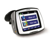
Garmin StreetPilot c580

$270.00 to $940.00


Receive door-to-door directions while staying on top of weather, traffic and localized information with the StreetPilot c580. Similar to the c550, StreetPilot c580 comes with hands-free calling, preloaded maps and an MP3 player, then takes it up a notch by adding dynamic content from MSN® Direct.

Manufacturer:Garmin Product MPNKey FeaturesDisplayTechnical FeaturesOther FeaturesGPS SystemPDA FeaturesBatteryWarrantyDimensionsMiscellaneous
MPN010-00522-06
GPS Type   Automobile
Form FactorFixed
Map capabilities   Internal, Download maps
Enhanced accuracyWAAS enabled, EGNOS enabled
Input Method   Touch Screen
Receiver Type18 Channels
Screen Size3.5 in.
Display Size2.8 in. x 2.1 in.
Display Type16-bit Color LCD TFT Display
Resolutions320 X 240
Special Features   MP3 Player, JPEG Image Viewer, 3D Map View
Trip calculator   Shortest time, Maximum speed, Current speed, Route Recalculation, Points-of-Interest (POI)
Included Software/Maps   North America Maps, Canada Maps, Europe Maps, Australia Maps, South Africa Maps, South America Maps, Middle East Maps, Great Britain
PC InterfaceUSB
Expansion Slot TypeSD (Secure Digital) Card Slot
AntennaBuilt-in, External Antenna Hookup
Accuisition Time - Cold38 sec
Accuisition Time - Initial Time1 sec
Update rate1 per second, continuous
Waypoints   500
Compatible PDA OSWindows 2000
Compatible DevicesNotebook
Battery Type and QuantityProprietary Li-Ion
Battery Life8 Hours
Warranty1 Year
Width4.4 in.
Depth2.2 in.
Height3.2 in.
Weight0.59 lb.
Family LineGarmin StreetPilot
UPC753759068004


Tags:

garmin, streetpilot, c580,

Garmin Edge 305

$175.00 to $449.00


Rugged, lightweight Edge attaches easily to the stem or handlebars of your bike with the included bike mount. Just turn it on, acquire GPS satellites and go. Edge 305 automatically measures your speed, distance, time, calories burned, altitude, climb and descent, and also records the route you have taken for review. For extra-precise climb and descent data, Edge 305 also incorporates a barometric altimeter to pinpoint changes in elevation.Minimize

Manufacturer:Garmin Product MPNKey FeaturesDisplayTechnical FeaturesOther FeaturesBatteryWarrantyDimensionsMiscellaneous
MPNGE305CAD
GPS Type   Handheld (Outdoor)
Form FactorHandheld
Screen Size1.9 in.
Display Size1.17 in. x 1.44 in.
Display Type4 Level Grayscale LCD Display
Resolutions128 x 160
Special Features   Built-In Barometer, Built-In Altimeter, Heart Rate Monitor, Training Computer
Trip calculator   Maximum speed, Elevation Computer
PC InterfaceUSB
Environmental ProtectionIPX7 Waterproof Standard
AntennaBuilt-in
Battery Type and QuantityProprietary Lithium
Battery Life12 Hours
Warranty1 Year
Width1.75 in.
Depth0.9 in.
Height3.7 in.
Weight0.19 lb.
UPC753759051716


Tags:

garmin, edge, 305,


Nextar X3B


The Nextar GPS X3B mobile navigation system assures that your days of getting lost are over! Finding an address or any of 1.6 million points of interest such as the nearest gas station or restaurant is a snap anywhere in the U.S. or Canada. Just enter information in the X3B's 3.5 inch touch screen and let the voice prompt and detailed map guide you to the destination. With the latest TTS (Text to Speech) function, street names are clrearly pronounced in English. The X3B's built in MP3 player will entertain you with your favorite tunes while en route. Just copy your favorite play list onto an SD card and insert into the slot. The X3B moves easily from car to car using the convenient vent mount. A recharageable lithium ion battery assures that the unit stays active. Other features of the X3B include built-in maps of the 50 United States and Canada, 1GB built in Flash Memory.Minimize


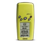
Garmin Forerunner 101


The Forerunner 101 offers athletes and recreational walkers and runners an entry-level personal training device with GPS. It has the same features as the Forerunner 201, but operates on two AAA batteries. The Forerunner 101 stores lap histories for up to two years to provide an archive of workout performance over time. Users can retrieve lap data for previous workouts by date, week, month, or over a specific time interval. For business travelers who want to train on the road, the Forerunner 101 also doubles as a navigator. Users can mark their hotel as a specific location, see their current position on the plotter display, and follow an electronic breadcrumb trail back to their starting point.Minimize


Garmin Rino 120


The Rino 120 is state-of-the-art GPS navigation and two-way communications combined, with enough memory to download detailed mapping for driving, hiking, hunting, fishing--or just about anything else you can dream up.


Garmin eTrex Summit


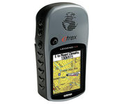
The eTrex Summit comes on the heels of the extremely popular eTrex, which was designed for both marine and recreation use. This new all-in-one navigation device for the outdoor enthusiast is the first combination GPS, altimeter, and electronic compass. The electronic compass provides bearing information when you're standing still and the altimeter determines precise altitude, so you can tell how high you've climbed and your rate of ascent. Like its predecessor, the eTrex Summit boasts a powerful 12 parallel channel GPS receiver and comes packaged in a small, sleek case with operating buttons located on either side of the unit. The case is completely waterproof to withstand immersion in one meter of water for up to 30 minutes.Minimize