AmbiCom GPS-CF$63.00 to $83.00
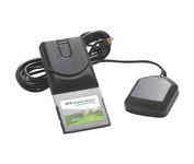
The AmbiCom GPS Navigation Receiver CompactFlash Card is the Global Positioning System Receiver for your mobile device and the perfect accessory to your Pocket PC device. The GPS Navigation Receiver comes with a full feature 30-day trial version software that is loaded with fantastic features such as dynamic voice navigation, off-route warning, and detailed street maps. Now you can turn your Pocket PC into a true GPS navigation system and never worry about getting lost!Minimize
Manufacturer:AmbiCom Product MPN MPN | GPS-CF | Key Features GPS Type | Automobile | Form Factor | Handheld, Plug-in | Receiver Type | 12 Channels | Technical Features Audible Features | Voice Navigation Instructions | Other Features PC Interface | NMEA-0183 | Expansion Slot Type | CompactFlash Type I | Antenna | Built-in | GPS System Accuisition Time - Cold | 36 sec | Max. Horizontal accuracy | PDA Features | Compatible PDA OS | Pocket PC, Windows XP, Windows 2000, Windows 98, Windows ME | Compatible Devices | Pocket PC Based PDA | Dimensions Width | 1.7 in. | Depth | 3.7 in. | Height | 0.4 in. | Weight | 0.09 lb. | Miscellaneous UPC | 646543199377 |
Tags:ambicom, gps-cf,
| Dual Electronics XNAV3550$219.00 to $228.00

The Dual XNA3550 features an easy to use touch screen graphic interface with MP3 playback capability. Turn-by-turn instructions with voice guidance. Visual left/right LED indicators. 3D Map view. Level selectable map view. Start route guidance search by:- Address/intersection- Points of interest- Address book- Recent destination. GPS status indicator.Minimize
Manufacturer:Dual Electronics Product MPN MPN | XNAV3550 | Key Features GPS Type | Automobile | Form Factor | Fixed | Map capabilities | Internal | Input Method | Touch Screen | Receiver Type | 12 Channels | Display Display Size | 3.5 in. | Display Type | 16.7M Colors LCD TFT Display | Resolutions | 320 X 240 | Technical Features Special Features | Address Book, MP3 Player, 3D Map View | Trip calculator | Route Recalculation, Points-of-Interest (POI) | Included Software/Maps | USA Maps | Other Features Built in memory | 64 MB | Expansion Slot Type | SD (Secure Digital) Card Slot | Antenna | Built-in | PDA Features Plug-in Interface | Secure Digital (SD) | Compatible PDA OS | Windows CE | Battery Battery Type and Quantity | Rechargeable Li-Ion Battery | Battery Life | 2 Hours | Dimensions Width | 5.25 in. | Depth | 1.25 in. | Height | 3.13 in. | Weight | 2.1 lb. | Miscellaneous UPC | 827204101636 |
Tags:dual, electronics, xnav3550,
| Magellan eXplorist 200$95.00 to $250.00
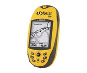
For serious outdoor use, the eXplorist series handheld GPS navigation systems are built to cover all requirements. With their tough, impact-resistant, waterproof exterior and their proven Magellan technology inside that packs powerful functionality into an easy-to-use operating system, your outdoor needs will be covered.Minimize
Manufacturer:Magellan Product MPN MPN | eXplorist 200 | Key Features GPS Type | Handheld (Outdoor) | Form Factor | Handheld | Map capabilities | Internal | Enhanced accuracy | WAAS enabled, EGNOS enabled | Input Method | Keypad | Receiver Type | 14 Channels | Screen Size | 2.3 in. | Display Display Size | 1.4 in. x 1.8 in. | Display Type | 4 Level Grayscale LCD Display | Resolutions | 160 X 120 | Technical Features Special Features | Compass | Trip calculator | Track Log, Points-of-Interest (POI) | Included Software/Maps | North America Maps | Grids | Finnish, French, German, Irish, Lat/Lon, MGRS, OSGB, Swedish, Swiss, User Grid, USNG, UTM | Other Features PC Interface | NMEA-0183 | Built in memory | 8 MB | Environmental Protection | IPX7 Waterproof Standard, Rubber Armored Impact Resistant Plastic | GPS System Accuisition Time - Cold | 120 sec | Accuisition Time - Initial Time | 60 sec | Accuisition Time - Hot | 15 sec | Update rate | 1 per second, continuous | Max. Horizontal accuracy | | Enhanced position accuracy | | Number of routes | 20 | Waypoints | 500 | Battery Battery Type and Quantity | 2 x AA Batteries | Warranty Warranty | 1 Year | Dimensions Width | 2.1 in. | Depth | 1.3 in. | Height | 4.6 in. | Weight | 0.25 lb. | Miscellaneous Family Line | Magellan eXplorist | UPC | 763357109375 |
Tags:magellan, explorist, 200,
|

One of the first things a boater will notice about the Chart Master V6 series is their vertically oriented high-definition (234x320 pixel) six-inch super-bright color LCD displays. They provide clear visibility even in full sunlight, and the Chart Master V6I, with it's built-in GPS antenna is a great choice for boats with open cockpits, center consoles and flying bridges and can serve well as a back-up unitMinimize
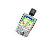
The Pharos Pocket GPS Navigator is an excellent navigation solution for your Dell Pocket PC. The package comes with a compact iGPS-SD receiver and the Ostia Smart Navigator software with detailed street-level maps of entire US. It even includes a car charger that powers the GPS while charging your Pocket PC simultaneously. The iGPS-SD receiver is a small, slim and sensitive GPS receiver that plugs in the Pocket PC's SDIO slot. Ostia helps you locate your current position, find a destination or point of interest (POI) and get a route to your destination. Simply activate the GPS navigation program and begin traveling; the automated voice-prompts will tell you when and where to turn. If by chance you go 'off route', the Pocket GPS Navigator will always reroute you to your destination from your current GPS position.Minimize
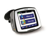
Receive door-to-door directions while staying on top of weather, traffic and localized information with the StreetPilot c580. Similar to the c550, StreetPilot c580 comes with hands-free calling, preloaded maps and an MP3 player, then takes it up a notch by adding dynamic content from MSN® Direct.
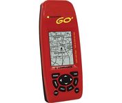
Just grab this bright yellow handheld iFINDER Go 64MB GPS and go, go, go. It's easy to use, waterproof, has a 2.2 diagonal Film SuperTwist display with backlighting and a built-in 64MB background map with coverage of the continental U.S. and Hawaii. The GPS also includes up to 1,000 waypoints, 1,000 event markers and 100 routes; up to 100 retraceable plot trails and up to 10,000 points in any trail; 30+ map zoom ranges and 42 graphic icons to mark spots.Minimize