Bushnell NAV500$164.00 to $285.00
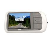
Bushnell has announced their entry into the portable auto GPS navigation market with the announcement of the Bushnell Nav 500. The Nav 500 offers many features found on other navigation devices in its class such as a 3.5 inch touch screen display, pre-installed maps of the USA and Canada, and an MP3 player.
Manufacturer:Bushnell Product MPN MPN | 36-5001 | Key Features GPS Type | Automobile | Form Factor | Fixed | Map capabilities | Internal, Map cartridges / Data cards, DVD | Enhanced accuracy | WAAS enabled | Input Method | Keypad, Touch Screen | Receiver Type | 20 Channels | Display Display Size | 3.5 in. | Display Type | LCD Display | Resolutions | 320 X 240 | Technical Features Marine Features | Split Screen | Special Features | Compass, MP3 Player | Audible Features | Voice Navigation Instructions | Trip calculator | Route Recalculation | Included Software/Maps | Canada Maps | Grids | Lat/Lon | Other Features PC Interface | USB, Bluetooth | Expansion Slot Type | SD (Secure Digital) Card Slot | Battery Battery Type and Quantity | Rechargeable Li-Ion Battery | Warranty Warranty | 1 Year | Dimensions Width | 5.63 in. | Depth | 0.91 in. | Height | 3 in. | Weight | 0.75 lb. | Miscellaneous UPC | 029757365002 |
Tags:bushnell, nav500,
| Garmin GPSMAP 440s$437.00 to $1,032.00

Offshore fishermen and boaters will gravitate toward this sleek, space-saving chartplotter. The GPSMAP 440 features preloaded detailed maps for the U.S. coast as well as an ultra-bright 4” QVGA display; built-in, satellite-enhanced worldwide basemap and simplified user operation.
Manufacturer:Garmin Product MPN MPN | 010-00516-44 | Key Features GPS Type | Marine | Form Factor | Fixed | Map capabilities | Internal, Map cartridges / Data cards | Enhanced accuracy | WAAS enabled, EGNOS enabled | Input Method | Keypad | Receiver Type | 12 Channels | Screen Size | 4 in. | Display Display Size | 2.4 in. x 3.2 in. | Display Type | LCD Display | Resolutions | 240 X 320 | Technical Features Marine Features | Tide Prediction, Split Screen, Water Temp. Sensor, Depth Display, Chart Plotter, Sonar / Sounder, MOB (Man Over Board) | Audible Features | Anchor Alarm, Arrival Alarm, Clock Alarm, Accuracy Alarm, Fish Alarm, Shallow/Deep Alarm, Low Battary/Voltage Alarm, Water Temperature Alarm | Trip calculator | Route Recalculation, Trip Timers, Points-of-Interest (POI) | Included Software/Maps | Marine Cartography | Other Features PC Interface | NMEA-0183 | Environmental Protection | IPX7 Waterproof Standard | Expansion Slot Type | SD (Secure Digital) Card Slot | Antenna | Built-in, External Antenna Hookup | GPS System Accuisition Time - Cold | 45 sec | Accuisition Time - Initial Time | 15 sec | Update rate | 1 per second, continuous | Waypoints | 1500 | Warranty Warranty | 1 Year | Dimensions Width | 5.7 in. | Depth | 2.7 in. | Height | 5 in. | Weight | 1.3 lb. | Miscellaneous Family Line | Garmin GPSMAP | UPC | 753759065836 |
Tags:garmin, gpsmap, 440s,
| Kenwood KNA-G510$250.00 to $799.00
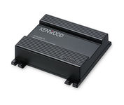
You'll give your Kenwood in-dash mobile video system a potent extra dimension when you connect the KNA-G510 navigation system. You'll drive with confidence as it guides you to your destination efficiently and accurately. The system can even keep you up to date on what's happening with traffic flow along your programmed route.Minimize
Manufacturer:Kenwood Product MPN MPN | KNA-G510 | Key Features GPS Type | Automobile | Form Factor | Fixed | Map capabilities | Internal | Enhanced accuracy | WAAS enabled | Input Method | Touch Screen | Receiver Type | 12 Channels | Technical Features Audible Features | Voice Navigation Instructions | Trip calculator | Trip Timers, Points-of-Interest (POI) | Included Software/Maps | North America Maps | Other Features Expansion Slot Type | SD (Secure Digital) Card Slot | Antenna | Built-in | Dimensions Width | 4.5 in. | Depth | 1.5 in. | Height | 4 in. |
Tags:kenwood, kna-g510,
|
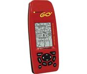
Just grab this bright yellow handheld iFINDER Go 64MB GPS and go, go, go. It's easy to use, waterproof, has a 2.2 diagonal Film SuperTwist display with backlighting and a built-in 64MB background map with coverage of the continental U.S. and Hawaii. The GPS also includes up to 1,000 waypoints, 1,000 event markers and 100 routes; up to 100 retraceable plot trails and up to 10,000 points in any trail; 30+ map zoom ranges and 42 graphic icons to mark spots.Minimize

This preloaded, offshore chartplotter combines the power of networking with brilliant color and slim-line design. The GPSMAP 4212 has preloaded BlueChart® g2 maps of the U.S. coast and displays them on a whopping 12.1” XGA display with crisp, video-quality resolution. By connecting to the Garmin Marine Network, you can add sonar, radar and weather. For even more enhanced features, you can add the optional Bluechart g2 Vision card.Minimize
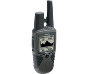
The Rino 130 is the most feature-rich unit in the Rino family with a built-in electronic compass barometric sensor weather receiver for seven NOAA weather channels and 24 MBs of internal memory This handheld radio has a built-in electronic compass to give a heading while the user is standing still and a barometric altimeter to provide extremely accurate elevation and pressure information which will assist users in identifying weather data The Rino 130 provides two-way radio communication with a transmission range of up to two miles using FRS channels and up to five miles with GMRS The integration of two-way radio and GPS enables users to transmit their position with a simple button press allowing others to navigate to their position The Rino 130 also has a polling feature which allows a user to manually request GPS location information from other Rino unitsMinimize

The Rino 110 is a GPS-enabled handheld that integrates radio functionality to provide two-way communications. It's waterproof, can send communications up to five miles (using GMRS channels), and can "beam" your exact location to another Rino user within a two-mile range (on the FRS spectrum) using "Position Reporting". And because the Rino 110 has standard FRS capabilities, you can talk to friends or family who own conventional FRS radios.The Rino 110 has a built-in city point data base, with 1 MB of internal memory for additional points-of-interest data that can be downloaded from a MapSource Points of Interest CD-ROM.Minimize