Bushnell NAV500$164.00 to $285.00
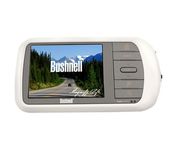
Bushnell has announced their entry into the portable auto GPS navigation market with the announcement of the Bushnell Nav 500. The Nav 500 offers many features found on other navigation devices in its class such as a 3.5 inch touch screen display, pre-installed maps of the USA and Canada, and an MP3 player.
Manufacturer:Bushnell Product MPN MPN | 36-5001 | Key Features GPS Type | Automobile | Form Factor | Fixed | Map capabilities | Internal, Map cartridges / Data cards, DVD | Enhanced accuracy | WAAS enabled | Input Method | Keypad, Touch Screen | Receiver Type | 20 Channels | Display Display Size | 3.5 in. | Display Type | LCD Display | Resolutions | 320 X 240 | Technical Features Marine Features | Split Screen | Special Features | Compass, MP3 Player | Audible Features | Voice Navigation Instructions | Trip calculator | Route Recalculation | Included Software/Maps | Canada Maps | Grids | Lat/Lon | Other Features PC Interface | USB, Bluetooth | Expansion Slot Type | SD (Secure Digital) Card Slot | Battery Battery Type and Quantity | Rechargeable Li-Ion Battery | Warranty Warranty | 1 Year | Dimensions Width | 5.63 in. | Depth | 0.91 in. | Height | 3 in. | Weight | 0.75 lb. | Miscellaneous UPC | 029757365002 |
Tags:bushnell, nav500,
| Teletype Gps WorldNav 3100 Deluxe$225.00 to $484.00
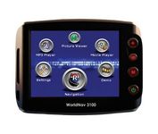
The TeleType WorldNav 3100 Deluxe Portable GPS Navigator is a simple, stylish and user-friendly street navigator at a reasonable price. With the WorldNav 3100 Deluxe you get affordable, in-car navigation with the added benefits of easy touch-screen use, pre-loaded maps, as well as MP3 and video entertainment capabilities.Minimize
Manufacturer:Teletype Gps Product MPN MPN | 31002 | Key Features GPS Type | Automobile | Form Factor | Fixed | Map capabilities | Map cartridges / Data cards | Input Method | Touch Screen | Receiver Type | 20 Channels | Display Display Size | 3.5 in. | Display Type | LCD TFT Display | Technical Features Special Features | MP3 Player | Audible Features | Voice Navigation Instructions | Trip calculator | Shortest time, Shortest distance, Odometer, Trip Timers, Elevation Computer | Included Software/Maps | City Navigation Maps, USA Maps, Puerto Rico | Grids | Lat/Lon | Other Features PC Interface | Mini-USB | Built in memory | 64 MB | Expansion Slot Type | SD (Secure Digital) Card Slot, MultiMediaCard (MMC) slot | Antenna | External Antenna Hookup | PDA Features Compatible PDA OS | Windows CE | Battery Battery Type and Quantity | Rechargeable Li-Ion Battery | Battery Life | 4 Hours | Warranty Warranty | 1 Year | Dimensions Width | 4.37 in. | Depth | 1 in. | Height | 3.12 in. | Weight | 0.38 lb. | Miscellaneous UPC | 745311031007 |
Tags:teletype, gps, worldnav, 3100, deluxe,
| Garmin GPSMAP 3205$520.00 to $1,095.00
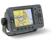
Plug into the power of the Garmin Marine network with the Garmin 3200 series. Rugged, waterproof, and easy to install, these chartplotters come preloaded with Garmin's detail-rich marine cartography utilizing BlueChart® g2 technology.
Manufacturer:Garmin Product MPN MPN | 010-00526-00 | Key Features GPS Type | Marine | Form Factor | Fixed | Map capabilities | Internal, Map cartridges / Data cards | Enhanced accuracy | WAAS enabled | Input Method | Keypad | Receiver Type | 12 Channels | Display Display Size | 5 in. | Display Type | 256 Color LCD TFT Display | Resolutions | 640 X 480 | Technical Features Marine Features | Chart Plotter | Special Features | 3D Map View | Audible Features | Proximity Alarm, Anchor Alarm, Arrival Alarm, Off-Course Alarm, Clock Alarm, Low Battary/Voltage Alarm | Included Software/Maps | Marine Cartography | Other Features PC Interface | NMEA-0183 | Environmental Protection | IPX7 Waterproof Standard | GPS System Accuisition Time - Cold | 45 sec | Accuisition Time - Initial Time | 15 sec | Update rate | 1 per second, continuous | Max. Horizontal accuracy | | Enhanced position accuracy | | Differential standards | DGPS Ready | Number of routes | 50 | Waypoints | 4000 | Warranty Warranty | 1 Year | Dimensions Width | 7.8 in. | Depth | 3 in. | Height | 4.7 in. | Weight | 1.8 lb. | Miscellaneous Family Line | Garmin GPSMAP | UPC | 753759053048 |
Tags:garmin, gpsmap, 3205,
|
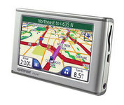
The Garmin nuvi 650 isn’t just a portable GPS system; it’s a fully featured multimedia device capable of MP3 playback and JPEG picture viewing. The nuvi 650 comes preloaded with City Navigator NT street maps that are loaded with hundreds of useful points of interest including gas stations, restaurants, and movie theaters. The touch screen interface gives you quick and easy access the nuvi 650’s many functions, and with the slim, sleek design you can easily stow it in your purse, backpack, or pocket. A rechargeable lithium-ion battery makes it suitable for navigation while in the car or even on foot.Minimize

The GPS 76 is designed to provide precise GPS positioning using correction data obtained from the Wide Area Augmentation System (WAAS). This unit features a built-in quad helix antenna for superior reception and can provide position accuracy to less than three meters when receiving WAAS corrections.The GPS 76 provides 1 megabyte of internal user memory to be used for storing downloaded Points of Interest data. This 1 megabyte of storage area is preloaded from the factory with worldwide cities (populations greater than 200,000) and nautical navigation aids such as lights, buoys, sound signals and day beacons, and is perfect for downloading points of interest detail from GARMIN's line of MapSource CD-ROMs. The GPS 76 is also preloaded with tide data for the United States.Minimize

It may be tiny, but the StreetPilot i5 is packed with state-of-the-art navigation features. The StreetPilot i5 comes preloaded with incredibly detailed City Navigator NT street maps that are packed with nearly 6 million points of interest including hotels, restaurants, ATMs and much more. A simple rolling-wheel interface allows you to quickly adjust settings and alter routes to your destination. Built for portability and power, the StreetPilot i5 is a cost effective portable GPS solution. Minimize

The eTrex Summit comes on the heels of the extremely popular eTrex, which was designed for both marine and recreation use. This new all-in-one navigation device for the outdoor enthusiast is the first combination GPS, altimeter, and electronic compass. The electronic compass provides bearing information when you're standing still and the altimeter determines precise altitude, so you can tell how high you've climbed and your rate of ascent. Like its predecessor, the eTrex Summit boasts a powerful 12 parallel channel GPS receiver and comes packaged in a small, sleek case with operating buttons located on either side of the unit. The case is completely waterproof to withstand immersion in one meter of water for up to 30 minutes.Minimize