Products reviews

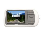
Bushnell NAV500

$164.00 to $285.00


Bushnell has announced their entry into the portable auto GPS navigation market with the announcement of the Bushnell Nav 500. The Nav 500 offers many features found on other navigation devices in its class such as a 3.5 inch touch screen display, pre-installed maps of the USA and Canada, and an MP3 player.

Manufacturer:Bushnell Product MPNKey FeaturesDisplayTechnical FeaturesOther FeaturesBatteryWarrantyDimensionsMiscellaneous
MPN36-5001
GPS Type   Automobile
Form FactorFixed
Map capabilities   Internal, Map cartridges / Data cards, DVD
Enhanced accuracyWAAS enabled
Input Method   Keypad, Touch Screen
Receiver Type20 Channels
Display Size3.5 in.
Display TypeLCD Display
Resolutions320 X 240
Marine FeaturesSplit Screen
Special Features   Compass, MP3 Player
Audible Features   Voice Navigation Instructions
Trip calculator   Route Recalculation
Included Software/Maps   Canada Maps
Grids   Lat/Lon
PC InterfaceUSB, Bluetooth
Expansion Slot TypeSD (Secure Digital) Card Slot
Battery Type and QuantityRechargeable Li-Ion Battery
Warranty1 Year
Width5.63 in.
Depth0.91 in.
Height3 in.
Weight0.75 lb.
UPC029757365002


Tags:

bushnell, nav500,

Garmin Edge 305

$175.00 to $449.00


Rugged, lightweight Edge attaches easily to the stem or handlebars of your bike with the included bike mount. Just turn it on, acquire GPS satellites and go. Edge 305 automatically measures your speed, distance, time, calories burned, altitude, climb and descent, and also records the route you have taken for review. For extra-precise climb and descent data, Edge 305 also incorporates a barometric altimeter to pinpoint changes in elevation.Minimize

Manufacturer:Garmin Product MPNKey FeaturesDisplayTechnical FeaturesOther FeaturesBatteryWarrantyDimensionsMiscellaneous
MPNGE305CAD
GPS Type   Handheld (Outdoor)
Form FactorHandheld
Screen Size1.9 in.
Display Size1.17 in. x 1.44 in.
Display Type4 Level Grayscale LCD Display
Resolutions128 x 160
Special Features   Built-In Barometer, Built-In Altimeter, Heart Rate Monitor, Training Computer
Trip calculator   Maximum speed, Elevation Computer
PC InterfaceUSB
Environmental ProtectionIPX7 Waterproof Standard
AntennaBuilt-in
Battery Type and QuantityProprietary Lithium
Battery Life12 Hours
Warranty1 Year
Width1.75 in.
Depth0.9 in.
Height3.7 in.
Weight0.19 lb.
UPC753759051716


Tags:

garmin, edge, 305,

GlobalSat BT-359

$40.00 to $90.00


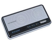
The GlobalSat BT-359 Bluetooth GPS receiver is our solution of the line Bluetooth GPS, which have both stylish and functional in true GlobalSat tradition. Taking its design criteria from the market leading BT-338 we have pushed the limits of GPS even further with greater sensitivity, more accuracy, and longer battery life than ever beforeMinimize

Manufacturer:GlobalSat Product MPNKey FeaturesOther FeaturesGPS SystemDimensionsMiscellaneous
MPNBT-359
GPS Type   Handheld (Outdoor)
Form FactorWireless Receiver Module
Enhanced accuracyWAAS enabled, EGNOS enabled
Receiver Type20 Channels
PC InterfaceNMEA-0183, Bluetooth
AntennaBuilt-in
Accuisition Time - Cold42 sec
Accuisition Time - Initial Time38 sec
Accuisition Time - Hot1 sec
Max. Horizontal accuracy   Battery
Battery Type and QuantityProprietary Lithium
Battery Life11 Hours
Width3.23 in.
Depth0.53 in.
Height1.61 in.
UPC4043619603046


Tags:

globalsat, bt-359,


Garmin GPS 72


The GPS 72 is a low-cost solution for land or marine navigation designed to provide precise GPS positioning using correction data obtained from the Wide Area Augmentation System (WAAS). The GPS 72 can provide position accuracy to less than three meters when receiving WAAS corrections. This rugged, waterproof, unsinkable GPS receiver offers a large, 4-level grayscale screen. It's designed as the next generation in basic, entry-level GARMIN GPS.Minimize


Garmin Rino 130
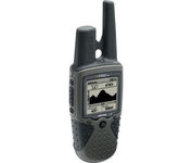

The Rino 130 is the most feature-rich unit in the Rino family with a built-in electronic compass barometric sensor weather receiver for seven NOAA weather channels and 24 MBs of internal memory This handheld radio has a built-in electronic compass to give a heading while the user is standing still and a barometric altimeter to provide extremely accurate elevation and pressure information which will assist users in identifying weather data The Rino 130 provides two-way radio communication with a transmission range of up to two miles using FRS channels and up to five miles with GMRS The integration of two-way radio and GPS enables users to transmit their position with a simple button press allowing others to navigate to their position The Rino 130 also has a polling feature which allows a user to manually request GPS location information from other Rino unitsMinimize


Furuno GP37


The new GP37 DGPS/WAAS Navigator is compact in size, yet big on power, features and performance. This waterproof unit is perfect for a wide range of boats. It is equipped with a WAAS and a DGPS receiver as standard supply. It utilizes both WAAS and differential radio beacon correction methods to give you the most accurate position fix available. The GP37 offers extremely accurate position fixes -- 10m for basic GPS, 5m or better with DGPS and 3m or better where WAAS service is available. It should be noted that DGPS is more reliable and accurate, as the WAAS system is still currently under development. There is no guarantee of accuracy, integrity, continuity or availability of the WAAS signal. For that reason, the GP37 runs with DGPS as the default setting in auto selection mode. In this mode, if the DGPS signal can not be received for any reason, the WAAS mode is automatically selected. Manual setting is also available. The display modes include Plotter, two Customizable displays, Steering, Highway and SpeedMinimize


Garmin eTrex Legend Cx
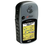

The eTrex Legend Cx is loaded with the same popular features found in the eTrex Legend C, including sunlight-readable color and advanced GPS routing capabilities — all in a waterproof design. In addition, it comes with a blank 32 MB microSD card for storage of optional map detail. Download maps directly to the card or purchase microSD cards preloaded with MapSource® Topo and inland lake maps, BlueChart® marine cartography, and City Navigator™ street maps.Minimize