Products reviews
Bushnell NAV500$164.00 to $285.00
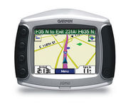
Tags:bushnell, nav500, | Garmin zumo 550$544.00 to $1,300.00
Tags:garmin, zumo, 550, | Garmin Geko 201$90.00 to $140.00
Tags:garmin, geko, 201, |
Magellan eXplorist 200

For serious outdoor use, the eXplorist series handheld GPS navigation systems are built to cover all requirements. With their tough, impact-resistant, waterproof exterior and their proven Magellan technology inside that packs powerful functionality into an easy-to-use operating system, your outdoor needs will be covered.Minimize
Garmin GPSMAP 76Cx

The GPSMAP 76CSx is a refreshing upgrade of the GPSMAP 76CS, one of our most popular models for outdoor and marine use. This unit features a removable microSD card for detailed mapping memory and a waterproof, rugged housing. The microSD card slot is located inside the waterproof battery compartment. Users can load map data and transfer routes and waypoints through the unit’s fast USB connection.Minimize
Garmin Forerunner 305

Get the most out of your workouts with the Garmin Forerunner 305, a GPS personal trainer. Whether you’re going for a daily jog or training for a triathlon, the Forerunner 305 tracks and stores vital information that you can analyze on your computer with interactive graphs that chart your pace, time, distance traveled, and heart rate. Upload your information to MotionBased.com, Garmin’s web-based application that allows you to track your fitness statistics online, giving you the tools you need to take your training to the next level.Minimize
Furuno GP32

Compact in size, waterproof, yet big on power, features and performance, Furunos GP32 is perfect for a wide range of smaller fishing boats and pleasure craft. This advanced unit, based on the popular GP31, provides accurate and reliable position fixing, thanks to a super sensitive, 12-channel GPS receiver combined with integrated WAAS technology. The unit has a waterproof display and is built to stand up to tough marine conditions. This durable casing houses an impressive memory, capable of storing up to 1,000 points of ships track, 999 points for marks and waypoints, and 50 routes of up to 30 waypoints each. Vital navigation data is presented on a 4.5-inch diagonal Silver Bright LCD screen with adjustable brilliance. Innovative graphic displays include Nav, Highway, Steering, Track Plotting, and two operator programmable modes, all extremely easy to use. The GP32, like all Furuno nav receivers, feature Furunos NMEA 0183 programmable interface system for feeding highly accurate nav data to your Furuno radar, Minimize


