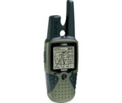
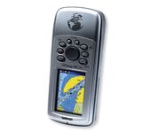
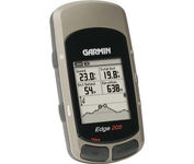
Magellan eXplorist 200$95.00 to $250.00
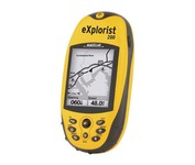
For serious outdoor use, the eXplorist series handheld GPS navigation systems are built to cover all requirements. With their tough, impact-resistant, waterproof exterior and their proven Magellan technology inside that packs powerful functionality into an easy-to-use operating system, your outdoor needs will be covered.Minimize
Manufacturer:Magellan Product MPN MPN | eXplorist 200 | Key Features GPS Type | Handheld (Outdoor) | Form Factor | Handheld | Map capabilities | Internal | Enhanced accuracy | WAAS enabled, EGNOS enabled | Input Method | Keypad | Receiver Type | 14 Channels | Screen Size | 2.3 in. | Display Display Size | 1.4 in. x 1.8 in. | Display Type | 4 Level Grayscale LCD Display | Resolutions | 160 X 120 | Technical Features Special Features | Compass | Trip calculator | Track Log, Points-of-Interest (POI) | Included Software/Maps | North America Maps | Grids | Finnish, French, German, Irish, Lat/Lon, MGRS, OSGB, Swedish, Swiss, User Grid, USNG, UTM | Other Features PC Interface | NMEA-0183 | Built in memory | 8 MB | Environmental Protection | IPX7 Waterproof Standard, Rubber Armored Impact Resistant Plastic | GPS System Accuisition Time - Cold | 120 sec | Accuisition Time - Initial Time | 60 sec | Accuisition Time - Hot | 15 sec | Update rate | 1 per second, continuous | Max. Horizontal accuracy | | Enhanced position accuracy | | Number of routes | 20 | Waypoints | 500 | Battery Battery Type and Quantity | 2 x AA Batteries | Warranty Warranty | 1 Year | Dimensions Width | 2.1 in. | Depth | 1.3 in. | Height | 4.6 in. | Weight | 0.25 lb. | Miscellaneous Family Line | Magellan eXplorist | UPC | 763357109375 |
Tags:magellan, explorist, 200,
| Garmin StreetPilot c580$270.00 to $940.00
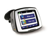
Receive door-to-door directions while staying on top of weather, traffic and localized information with the StreetPilot c580. Similar to the c550, StreetPilot c580 comes with hands-free calling, preloaded maps and an MP3 player, then takes it up a notch by adding dynamic content from MSN® Direct.
Manufacturer:Garmin Product MPN MPN | 010-00522-06 | Key Features GPS Type | Automobile | Form Factor | Fixed | Map capabilities | Internal, Download maps | Enhanced accuracy | WAAS enabled, EGNOS enabled | Input Method | Touch Screen | Receiver Type | 18 Channels | Screen Size | 3.5 in. | Display Display Size | 2.8 in. x 2.1 in. | Display Type | 16-bit Color LCD TFT Display | Resolutions | 320 X 240 | Technical Features Special Features | MP3 Player, JPEG Image Viewer, 3D Map View | Trip calculator | Shortest time, Maximum speed, Current speed, Route Recalculation, Points-of-Interest (POI) | Included Software/Maps | North America Maps, Canada Maps, Europe Maps, Australia Maps, South Africa Maps, South America Maps, Middle East Maps, Great Britain | Other Features PC Interface | USB | Expansion Slot Type | SD (Secure Digital) Card Slot | Antenna | Built-in, External Antenna Hookup | GPS System Accuisition Time - Cold | 38 sec | Accuisition Time - Initial Time | 1 sec | Update rate | 1 per second, continuous | Waypoints | 500 | PDA Features Compatible PDA OS | Windows 2000 | Compatible Devices | Notebook | Battery Battery Type and Quantity | Proprietary Li-Ion | Battery Life | 8 Hours | Warranty Warranty | 1 Year | Dimensions Width | 4.4 in. | Depth | 2.2 in. | Height | 3.2 in. | Weight | 0.59 lb. | Miscellaneous Family Line | Garmin StreetPilot | UPC | 753759068004 |
Tags:garmin, streetpilot, c580,
| Garmin Quest 2$441.00 to $649.00
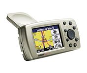
The Garmin® Quest 2 in-car GPS unit comes pre-loaded with City Select® with NT data providing mapping detail throughout the United States, Canada and Puerto Rico (including rural areas). Since there's no need to download, the Quest 2 comes to you ready to go. Its built-in database features nearly 6 million points of interest, including hotels, restaurants, gas stations, ATM's, and attractions.Minimize
Manufacturer:Garmin Product MPN MPN | 010-00454-00 | Key Features GPS Type | Automobile | Form Factor | Handheld | Map capabilities | Internal, Download maps | Enhanced accuracy | WAAS enabled | Input Method | Keypad | Receiver Type | 12 Channels | Screen Size | 2.7 in. | Display Display Size | 2.2 in. x 1.5 in. | Display Type | 256 Color LCD TFT Display | Resolutions | 240 X 160 | Technical Features Audible Features | Voice Navigation Instructions | Trip calculator | Moving average, Maximum speed, Odometer, Route Recalculation, Detour Feature, Points-of-Interest (POI) | Included Software/Maps | USA Maps, Canada Maps | Grids | Lat/Lon, MGRS, User Grid, UTM, Loran TD position format, Maidenhead | Other Features PC Interface | USB 1.1 | Built in memory | 140 MB | Environmental Protection | IPX7 Waterproof Standard | Antenna | Built-in | GPS System Accuisition Time - Cold | 45 sec | Accuisition Time - Initial Time | 15 sec | Update rate | 1 per second, continuous | Max. Horizontal accuracy | | Number of routes | 50 | Waypoints | 500 | Battery Battery Type and Quantity | Proprietary Lithium | Battery Life | 20 Hours | Dimensions Width | 4.5 in. | Depth | 0.9 in. | Height | 2.2 in. | Weight | 0.34 lb. | Miscellaneous UPC | 753759049263 |
Tags:garmin, quest, 2,
|