Products reviews

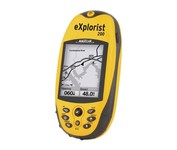
Magellan eXplorist 200

$95.00 to $250.00


For serious outdoor use, the eXplorist series handheld GPS navigation systems are built to cover all requirements. With their tough, impact-resistant, waterproof exterior and their proven Magellan technology inside that packs powerful functionality into an easy-to-use operating system, your outdoor needs will be covered.Minimize

Manufacturer:Magellan Product MPNKey FeaturesDisplayTechnical FeaturesOther FeaturesGPS SystemBatteryWarrantyDimensionsMiscellaneous
MPNeXplorist 200
GPS Type   Handheld (Outdoor)
Form FactorHandheld
Map capabilities   Internal
Enhanced accuracyWAAS enabled, EGNOS enabled
Input Method   Keypad
Receiver Type14 Channels
Screen Size2.3 in.
Display Size1.4 in. x 1.8 in.
Display Type4 Level Grayscale LCD Display
Resolutions160 X 120
Special Features   Compass
Trip calculator   Track Log, Points-of-Interest (POI)
Included Software/Maps   North America Maps
Grids   Finnish, French, German, Irish, Lat/Lon, MGRS, OSGB, Swedish, Swiss, User Grid, USNG, UTM
PC InterfaceNMEA-0183
Built in memory8 MB
Environmental ProtectionIPX7 Waterproof Standard, Rubber Armored Impact Resistant Plastic
Accuisition Time - Cold120 sec
Accuisition Time - Initial Time60 sec
Accuisition Time - Hot15 sec
Update rate1 per second, continuous
Max. Horizontal accuracy   Enhanced position accuracy Number of routes20
Waypoints   500
Battery Type and Quantity2 x AA Batteries
Warranty1 Year
Width2.1 in.
Depth1.3 in.
Height4.6 in.
Weight0.25 lb.
Family LineMagellan eXplorist
UPC763357109375


Tags:

magellan, explorist, 200,

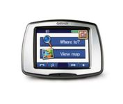
Garmin StreetPilot c550

$199.00 to $400.00


From Garmin, the leader in portable GPS solutions, the StreetPilot c550 is easy to use, and rich with features. The StreetPilot c550 comes preloaded with City Navigator NT street maps and includes a large database of points of interest including motels, restaurants, gas stations, and grocery stores. The simple touch screen interface gives you excellent control over menus and settings, and with Bluetooth support, you can even use the c550 for hands-free calling using the built-in speaker and microphone.Minimize

Manufacturer:Garmin Product MPNKey FeaturesDisplayTechnical FeaturesOther FeaturesGPS SystemBatteryWarrantyDimensionsMiscellaneous
MPN010-00522-02
GPS Type   Automobile
Form FactorFixed
Map capabilities   Internal, Map cartridges / Data cards
Enhanced accuracyWAAS enabled
Input Method   Touch Screen
Screen Size3.5 in.
Display Size2.8 in. x 2.1 in.
Display TypeLCD TFT Display
Resolutions320 X 240
Special Features   Waypoint Icons, MP3 Player, 3D Map View
Audible Features   Voice Navigation Instructions
Trip calculator   Maximum speed, Odometer, Route Recalculation, Trip Timers, Real-time Traffic Reports, Detour Feature, Points-of-Interest (POI)
Included Software/Maps   North America Maps, Europe Maps
PC InterfaceUSB 2.0, Bluetooth
Expansion Slot TypeSD (Secure Digital) Card Slot
AntennaBuilt-in, External Antenna Hookup
Waypoints   500
Battery Life8 Hours
Warranty1 Year
Width4.4 in.
Depth2.2 in.
Height3.2 in.
Weight0.59 lb.
Family LineGarmin StreetPilot
UPC753759054489


Tags:

garmin, streetpilot, c550,

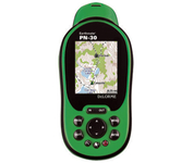
DeLorme Earthmate

$142.00 to $550.00


Never Get Lost Again When was the last time you wasted valuable travel time because you took a wrong turn in an unfamiliar location? Now there's an affordable and reliable solution - the new Earthmate GPS receiver. The small and flexible Earthmate GPS receiver is a high-performance, easy-to-use link to the satellite navigation technology of the Global Positioning System (GPS). Accessing these satellites is available for no additional charge. Earthmate, connected to a USB laptop PC, shows your real-time position on detailed Street Atlas USA maps anywhere in the U.S. (software included). You will always know where you are and where you need to go.Minimize

Manufacturer:DeLorme Product MPNKey FeaturesTechnical FeaturesOther FeaturesGPS SystemDimensions
MPNAE-006761-201
GPS Type   Automobile
Form FactorWireless Receiver Module
Map capabilities   Internal
Enhanced accuracyWAAS enabled
Receiver Type12 Channels
Included Software/Maps   USA Maps
PC InterfaceUSB
Accuisition Time - Cold45 sec
Max. Horizontal accuracy   Enhanced position accuracyPDA Features
Compatible PDA OSWindows XP, Windows 2000, Windows ME, Windows 98SE
Compatible DevicesNotebook
Width1.88 in.
Height2.09 in.


Tags:

delorme, earthmate,


Furuno GP7000F NT


The GP-7000F/NT is a GPS/WAAS plotter designed for a variety of vessels desiring video plotting and echo sounding capabilities. With the GP-7000 series, you can see the highly accurate position of your boat on the chart. The GP-7000 series has four display modes: Course Plot, Nav Data, Steering, and Highway modes. The course plot mode is useful for obtaining general information about surrounding sea areas. The Nav data mode clearly shows important navigational information with large text, which is easy to see even from a distance. The steering mode and highway mode assist the operator in following a predetermined route.Minimize


Garmin GPSMAP 276C
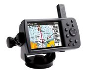

This portable GPS navigator features a 256-color TFT display that's easy to read in bright sun along with a built-in basemap and auto routing to provide you with turn-by-turn directions to the marina for a day of boating.


Navman iCN 510
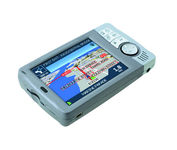

Transferable from car-to-car in seconds, the easy-to-use iCN510 can effortlessly guide drivers to their desired destination using accurate and clear turn-by-turn voice instructions and 3D-map view. Users can also now Drive Away this compact and sleek system straight from the box, with software applications and complete U.K. street-level mapping loaded on a single memory card. The iCN510 incorporates Version 3.0 of Navmans award winning SmartST software, which includes new features such as My POI customable points of interest with approach notification settings, multiple destinations for planning trips with several stops along the way, and a nearest POI search facility.Minimize


Interphase Corporation Chart Master V6i


One of the first things a boater will notice about the Chart Master V6 series is their vertically oriented high-definition (234x320 pixel) six-inch super-bright color LCD displays. They provide clear visibility even in full sunlight, and the Chart Master V6I, with it's built-in GPS antenna is a great choice for boats with open cockpits, center consoles and flying bridges and can serve well as a back-up unitMinimize