Magellan eXplorist 200$95.00 to $250.00
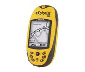
For serious outdoor use, the eXplorist series handheld GPS navigation systems are built to cover all requirements. With their tough, impact-resistant, waterproof exterior and their proven Magellan technology inside that packs powerful functionality into an easy-to-use operating system, your outdoor needs will be covered.Minimize
Manufacturer:Magellan Product MPN MPN | eXplorist 200 | Key Features GPS Type | Handheld (Outdoor) | Form Factor | Handheld | Map capabilities | Internal | Enhanced accuracy | WAAS enabled, EGNOS enabled | Input Method | Keypad | Receiver Type | 14 Channels | Screen Size | 2.3 in. | Display Display Size | 1.4 in. x 1.8 in. | Display Type | 4 Level Grayscale LCD Display | Resolutions | 160 X 120 | Technical Features Special Features | Compass | Trip calculator | Track Log, Points-of-Interest (POI) | Included Software/Maps | North America Maps | Grids | Finnish, French, German, Irish, Lat/Lon, MGRS, OSGB, Swedish, Swiss, User Grid, USNG, UTM | Other Features PC Interface | NMEA-0183 | Built in memory | 8 MB | Environmental Protection | IPX7 Waterproof Standard, Rubber Armored Impact Resistant Plastic | GPS System Accuisition Time - Cold | 120 sec | Accuisition Time - Initial Time | 60 sec | Accuisition Time - Hot | 15 sec | Update rate | 1 per second, continuous | Max. Horizontal accuracy | | Enhanced position accuracy | | Number of routes | 20 | Waypoints | 500 | Battery Battery Type and Quantity | 2 x AA Batteries | Warranty Warranty | 1 Year | Dimensions Width | 2.1 in. | Depth | 1.3 in. | Height | 4.6 in. | Weight | 0.25 lb. | Miscellaneous Family Line | Magellan eXplorist | UPC | 763357109375 |
Tags:magellan, explorist, 200,
| Garmin Forerunner 101$89.00 to $114.00
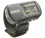
The Forerunner 101 offers athletes and recreational walkers and runners an entry-level personal training device with GPS. It has the same features as the Forerunner 201, but operates on two AAA batteries. The Forerunner 101 stores lap histories for up to two years to provide an archive of workout performance over time. Users can retrieve lap data for previous workouts by date, week, month, or over a specific time interval. For business travelers who want to train on the road, the Forerunner 101 also doubles as a navigator. Users can mark their hotel as a specific location, see their current position on the plotter display, and follow an electronic breadcrumb trail back to their starting point.Minimize
Manufacturer:Garmin Product MPN MPN | 010-00329-00 | Key Features GPS Type | Handheld (Outdoor) | Form Factor | Handheld | Receiver Type | 12 Channels | Screen Size | 1.7 in. | Display Display Size | 1.5 in. x 0.9 in. | Display Type | LCD Display | Resolutions | 100 X 64 | Technical Features Special Features | Built-In Altimeter | Audible Features | Arrival Alarm | Trip calculator | Maximum speed | Other Features Environmental Protection | IPX7 Waterproof Standard | Antenna | Built-in | GPS System Accuisition Time - Cold | 45 sec | Accuisition Time - Initial Time | 15 sec | Waypoints | 100 | Battery Battery Type and Quantity | 2 x AAA Batteries | Battery Life | 15 Hours | Warranty Warranty | 1 Year | Dimensions Width | 3.3 in. | Depth | 0.9 in. | Height | 1.7 in. | Weight | 0.16 lb. | Miscellaneous Family Line | Garmin Forerunner | UPC | 0753759044114 |
Tags:garmin, forerunner, 101,
| Furuno GP7000F NT$1,689.00 to $2,637.00

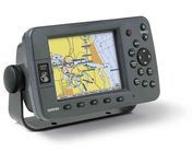
The GP-7000F/NT is a GPS/WAAS plotter designed for a variety of vessels desiring video plotting and echo sounding capabilities. With the GP-7000 series, you can see the highly accurate position of your boat on the chart. The GP-7000 series has four display modes: Course Plot, Nav Data, Steering, and Highway modes. The course plot mode is useful for obtaining general information about surrounding sea areas. The Nav data mode clearly shows important navigational information with large text, which is easy to see even from a distance. The steering mode and highway mode assist the operator in following a predetermined route.Minimize
Manufacturer:Furuno Product MPN MPN | GP7000FNT | Key Features GPS Type | Marine | Form Factor | Fixed | Map capabilities | Map cartridges / Data cards | Enhanced accuracy | WAAS enabled | Display Display Size | 7 in. | Display Type | LCD TFT Display | Resolutions | 480 x 234 | Technical Features Marine Features | Split Screen, Chart Plotter | Audible Features | Proximity Alarm, Arrival Alarm | Other Features Environmental Protection | IPX5 Waterproof Standard, IPX6 Waterproof Standard | Expansion Slot Type | SD (Secure Digital) Card Slot | GPS System Accuisition Time - Initial Time | 12 sec | Max. Horizontal accuracy | | Enhanced position accuracy | | Number of routes | 200 | Waypoints | 2000 | Dimensions Width | 10.2 in. | Depth | 3.2 in. | Height | 6.1 in. | Miscellaneous UPC | 611679280558 |
Tags:furuno, gp7000f, nt,
|