Products reviews

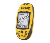
Magellan eXplorist 200

$95.00 to $250.00


For serious outdoor use, the eXplorist series handheld GPS navigation systems are built to cover all requirements. With their tough, impact-resistant, waterproof exterior and their proven Magellan technology inside that packs powerful functionality into an easy-to-use operating system, your outdoor needs will be covered.Minimize

Manufacturer:Magellan Product MPNKey FeaturesDisplayTechnical FeaturesOther FeaturesGPS SystemBatteryWarrantyDimensionsMiscellaneous
MPNeXplorist 200
GPS Type   Handheld (Outdoor)
Form FactorHandheld
Map capabilities   Internal
Enhanced accuracyWAAS enabled, EGNOS enabled
Input Method   Keypad
Receiver Type14 Channels
Screen Size2.3 in.
Display Size1.4 in. x 1.8 in.
Display Type4 Level Grayscale LCD Display
Resolutions160 X 120
Special Features   Compass
Trip calculator   Track Log, Points-of-Interest (POI)
Included Software/Maps   North America Maps
Grids   Finnish, French, German, Irish, Lat/Lon, MGRS, OSGB, Swedish, Swiss, User Grid, USNG, UTM
PC InterfaceNMEA-0183
Built in memory8 MB
Environmental ProtectionIPX7 Waterproof Standard, Rubber Armored Impact Resistant Plastic
Accuisition Time - Cold120 sec
Accuisition Time - Initial Time60 sec
Accuisition Time - Hot15 sec
Update rate1 per second, continuous
Max. Horizontal accuracy   Enhanced position accuracy Number of routes20
Waypoints   500
Battery Type and Quantity2 x AA Batteries
Warranty1 Year
Width2.1 in.
Depth1.3 in.
Height4.6 in.
Weight0.25 lb.
Family LineMagellan eXplorist
UPC763357109375


Tags:

magellan, explorist, 200,

Garmin Edge 305

$175.00 to $449.00


Rugged, lightweight Edge attaches easily to the stem or handlebars of your bike with the included bike mount. Just turn it on, acquire GPS satellites and go. Edge 305 automatically measures your speed, distance, time, calories burned, altitude, climb and descent, and also records the route you have taken for review. For extra-precise climb and descent data, Edge 305 also incorporates a barometric altimeter to pinpoint changes in elevation.Minimize

Manufacturer:Garmin Product MPNKey FeaturesDisplayTechnical FeaturesOther FeaturesBatteryWarrantyDimensionsMiscellaneous
MPNGE305CAD
GPS Type   Handheld (Outdoor)
Form FactorHandheld
Screen Size1.9 in.
Display Size1.17 in. x 1.44 in.
Display Type4 Level Grayscale LCD Display
Resolutions128 x 160
Special Features   Built-In Barometer, Built-In Altimeter, Heart Rate Monitor, Training Computer
Trip calculator   Maximum speed, Elevation Computer
PC InterfaceUSB
Environmental ProtectionIPX7 Waterproof Standard
AntennaBuilt-in
Battery Type and QuantityProprietary Lithium
Battery Life12 Hours
Warranty1 Year
Width1.75 in.
Depth0.9 in.
Height3.7 in.
Weight0.19 lb.
UPC753759051716


Tags:

garmin, edge, 305,

Lowrance iFINDER Hunt C

$445.00 to $590.00


The handheld mapping GPS designed by hunters for hunters lets you follow the big game in color with 16-channel GPS precision. The iFINDER® Hunt C with color display offers everything you'd expect in a versatile, precision mapping GPS unit made for the field, including hunting-specific icons, unique "Scout Mode", electronic compass, barometric altimeter, built-in microphone, and more.Minimize

Manufacturer:Lowrance Product MPNKey FeaturesDisplayTechnical FeaturesOther FeaturesGPS SystemBatteryWarrantyDimensionsMiscellaneous
MPN112-73
GPS Type   Handheld (Outdoor)
Form FactorHandheld
Map capabilities   Internal, Map cartridges / Data cards
Enhanced accuracyWAAS enabled, EGNOS enabled
Input Method   Keypad
Receiver Type16 Channels
Display Size2.62 in.
Display Type256 Color LCD TFT Display
Resolutions240 X 160
Marine FeaturesMOB (Man Over Board)
Special Features   Waypoint Icons, Compass, Built-In Barometer, Built-In Altimeter, MP3 Player, Voice Recorder
Included Software/Maps   USA Maps, Hawaii
Grids   Irish, WGS 84
PC InterfaceNMEA-0183
Environmental ProtectionIPX7 Waterproof Standard
Expansion Slot TypeSD (Secure Digital) Card Slot, MultiMediaCard (MMC) slot
AntennaExternal Antenna Hookup
Update rate1 per second, continuous
Enhanced position accuracy Number of routes100
Waypoints   2000
Battery Type and Quantity2 x AA Batteries
Battery Life16 Hours
Warranty1 Year
Width2.5 in.
Depth1.2 in.
Height5.6 in.
Weight0.54 lb.
Family LineLowrance iFINDER
UPC042194524757


Tags:

lowrance, ifinder, hunt, c,


Garmin Forerunner 101


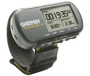
The Forerunner 101 offers athletes and recreational walkers and runners an entry-level personal training device with GPS. It has the same features as the Forerunner 201, but operates on two AAA batteries. The Forerunner 101 stores lap histories for up to two years to provide an archive of workout performance over time. Users can retrieve lap data for previous workouts by date, week, month, or over a specific time interval. For business travelers who want to train on the road, the Forerunner 101 also doubles as a navigator. Users can mark their hotel as a specific location, see their current position on the plotter display, and follow an electronic breadcrumb trail back to their starting point.Minimize


Pharos Science PF080
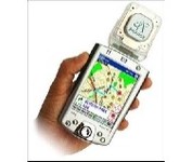

Pharos, the leader in advanced, affordable navigation solutions for handheld computing, has created the ultimate navigation tool for Windows Mobile-based Pocket PCs and mobile devices. Use Pharos Pocket GPS Navigator with CompactFlash to navigate door-to-door or point-to-point. Use it for hiking, walking tours or other outdoor activities. With audio voice prompts to guide you to your destination, the Pocket GPS Navigator is great for your car, too. In fact, the Pharos GPS Navigator performs just like more expensive, factory-installed, in-vehicle navigation systems, at a fraction of the cost yet, its easy to load into your Pocket PC and simple to use.Minimize


Garmin zumo 550
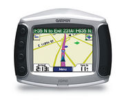

Designed specifically for motorcycles, the Garmin zumo 550 has a host of features that make it the easiest way to get GPS navigation on two wheels. Durable, waterproof, and built with fuel-resistant plastics, the zumo 550 can take a beating and hold up against even the most intense driving conditions. Right out of the box you’ll be able to chart out your ride with preloaded City Navigator NT street maps that are loaded with useful points of interest including restaurants, gas stations, and motels. Turn-by-turn voice directions keep you on track and with real-time traffic and weather updates you can avoid obstacles that might interfere with your otherwise, easy ride.Minimize


Furuno GP7000F NT


The GP-7000F/NT is a GPS/WAAS plotter designed for a variety of vessels desiring video plotting and echo sounding capabilities. With the GP-7000 series, you can see the highly accurate position of your boat on the chart. The GP-7000 series has four display modes: Course Plot, Nav Data, Steering, and Highway modes. The course plot mode is useful for obtaining general information about surrounding sea areas. The Nav data mode clearly shows important navigational information with large text, which is easy to see even from a distance. The steering mode and highway mode assist the operator in following a predetermined route.Minimize