Magellan eXplorist 200$95.00 to $250.00
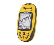
For serious outdoor use, the eXplorist series handheld GPS navigation systems are built to cover all requirements. With their tough, impact-resistant, waterproof exterior and their proven Magellan technology inside that packs powerful functionality into an easy-to-use operating system, your outdoor needs will be covered.Minimize
Manufacturer:Magellan Product MPN MPN | eXplorist 200 | Key Features GPS Type | Handheld (Outdoor) | Form Factor | Handheld | Map capabilities | Internal | Enhanced accuracy | WAAS enabled, EGNOS enabled | Input Method | Keypad | Receiver Type | 14 Channels | Screen Size | 2.3 in. | Display Display Size | 1.4 in. x 1.8 in. | Display Type | 4 Level Grayscale LCD Display | Resolutions | 160 X 120 | Technical Features Special Features | Compass | Trip calculator | Track Log, Points-of-Interest (POI) | Included Software/Maps | North America Maps | Grids | Finnish, French, German, Irish, Lat/Lon, MGRS, OSGB, Swedish, Swiss, User Grid, USNG, UTM | Other Features PC Interface | NMEA-0183 | Built in memory | 8 MB | Environmental Protection | IPX7 Waterproof Standard, Rubber Armored Impact Resistant Plastic | GPS System Accuisition Time - Cold | 120 sec | Accuisition Time - Initial Time | 60 sec | Accuisition Time - Hot | 15 sec | Update rate | 1 per second, continuous | Max. Horizontal accuracy | | Enhanced position accuracy | | Number of routes | 20 | Waypoints | 500 | Battery Battery Type and Quantity | 2 x AA Batteries | Warranty Warranty | 1 Year | Dimensions Width | 2.1 in. | Depth | 1.3 in. | Height | 4.6 in. | Weight | 0.25 lb. | Miscellaneous Family Line | Magellan eXplorist | UPC | 763357109375 |
Tags:magellan, explorist, 200,
| GlobalSat BT-359$40.00 to $90.00
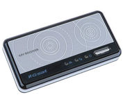
The GlobalSat BT-359 Bluetooth GPS receiver is our solution of the line Bluetooth GPS, which have both stylish and functional in true GlobalSat tradition. Taking its design criteria from the market leading BT-338 we have pushed the limits of GPS even further with greater sensitivity, more accuracy, and longer battery life than ever beforeMinimize
Manufacturer:GlobalSat Product MPN MPN | BT-359 | Key Features GPS Type | Handheld (Outdoor) | Form Factor | Wireless Receiver Module | Enhanced accuracy | WAAS enabled, EGNOS enabled | Receiver Type | 20 Channels | Other Features PC Interface | NMEA-0183, Bluetooth | Antenna | Built-in | GPS System Accuisition Time - Cold | 42 sec | Accuisition Time - Initial Time | 38 sec | Accuisition Time - Hot | 1 sec | Max. Horizontal accuracy | Battery | Battery Type and Quantity | Proprietary Lithium | Battery Life | 11 Hours | Dimensions Width | 3.23 in. | Depth | 0.53 in. | Height | 1.61 in. | Miscellaneous UPC | 4043619603046 |
Tags:globalsat, bt-359,
| Interphase Corporation Chart Master V6i$531.00 to $573.00

One of the first things a boater will notice about the Chart Master V6 series is their vertically oriented high-definition (234x320 pixel) six-inch super-bright color LCD displays. They provide clear visibility even in full sunlight, and the Chart Master V6I, with it's built-in GPS antenna is a great choice for boats with open cockpits, center consoles and flying bridges and can serve well as a back-up unitMinimize
Manufacturer:Interphase Corporation Product MPN MPN | U1CHRTV6I | Key Features GPS Type | Marine | Form Factor | Fixed | Map capabilities | Internal, Map cartridges / Data cards | Enhanced accuracy | WAAS enabled | Input Method | Keypad, Thumb Stick | Receiver Type | 12 Channels | Display Display Size | 5.7 in. | Display Type | 256 Color LCD TFT Display | Resolutions | 234 X 320 | Technical Features Marine Features | Tide Prediction, Depth Display, Chart Plotter, Sonar / Sounder, MOB (Man Over Board) | Special Features | Waypoint Icons, Compass | Audible Features | Shallow/Deep Alarm | Included Software/Maps | Marine Cartography | Grids | Lat/Lon | Other Features PC Interface | USB, NMEA-0183, NMEA-0180 | Antenna | Built-in | GPS System Accuisition Time - Cold | 45 sec | Accuisition Time - Hot | 8 sec | Update rate | 1 per second, continuous | Enhanced position accuracy | | Number of routes | 25 | Waypoints | 500 | Warranty Warranty | 5 Years | Dimensions Width | 3.38 in. | Depth | 2 in. | Height | 4.5 in. | Weight | 2 lb. | Miscellaneous UPC | 027037002692 |
Tags:interphase, corporation, chart, master, v6i,
|
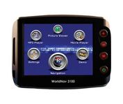
The TeleType WorldNav 3100 Deluxe Portable GPS Navigator is a simple, stylish and user-friendly street navigator at a reasonable price. With the WorldNav 3100 Deluxe you get affordable, in-car navigation with the added benefits of easy touch-screen use, pre-loaded maps, as well as MP3 and video entertainment capabilities.Minimize
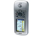
The GPSMAP 76CSx is a refreshing upgrade of the GPSMAP 76CS, one of our most popular models for outdoor and marine use. This unit features a removable microSD card for detailed mapping memory and a waterproof, rugged housing. The microSD card slot is located inside the waterproof battery compartment. Users can load map data and transfer routes and waypoints through the unit’s fast USB connection.Minimize
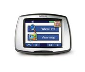
From Garmin, the leader in portable GPS solutions, the StreetPilot c550 is easy to use, and rich with features. The StreetPilot c550 comes preloaded with City Navigator NT street maps and includes a large database of points of interest including motels, restaurants, gas stations, and grocery stores. The simple touch screen interface gives you excellent control over menus and settings, and with Bluetooth support, you can even use the c550 for hands-free calling using the built-in speaker and microphone.Minimize
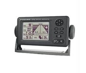
Compact in size, waterproof, yet big on power, features and performance, Furunos GP32 is perfect for a wide range of smaller fishing boats and pleasure craft. This advanced unit, based on the popular GP31, provides accurate and reliable position fixing, thanks to a super sensitive, 12-channel GPS receiver combined with integrated WAAS technology. The unit has a waterproof display and is built to stand up to tough marine conditions. This durable casing houses an impressive memory, capable of storing up to 1,000 points of ships track, 999 points for marks and waypoints, and 50 routes of up to 30 waypoints each. Vital navigation data is presented on a 4.5-inch diagonal Silver Bright LCD screen with adjustable brilliance. Innovative graphic displays include Nav, Highway, Steering, Track Plotting, and two operator programmable modes, all extremely easy to use. The GP32, like all Furuno nav receivers, feature Furunos NMEA 0183 programmable interface system for feeding highly accurate nav data to your Furuno radar, Minimize