Garmin Rino 530$405.00 to $499.00

No matter where your outdoor activities take you, the Rino® 530 keeps you on track and in touch. Similar to the 520, this rugged, two-way radio with GPS packs a bold color display, 14-mile communication range, and turn-by-turn directions - giving you peace of mind in the great outdoors. Taking it a step further, the Rino 530 adds an electronic compass, barometric altimeter, and NOAA weather receiver, making it a favorite with hikers and climbers.Minimize
Manufacturer:Garmin Product MPN MPN | 010-00392-21 | Key Features GPS Type | Handheld (Outdoor) | Form Factor | Handheld | Map capabilities | Internal, Download maps | Enhanced accuracy | WAAS enabled | Receiver Type | 12 Channels | Screen Size | 2.1 in. | Display Display Size | 1.3 in. x 1.7 in. | Display Type | 256 Color LCD TFT Display | Technical Features Special Features | Compass, Built-In Barometer, Calender, Built-In Altimeter, Two-way Radio | Trip calculator | Current speed, Route Recalculation, Trip Timers, Elevation Computer, Time of sunrise/sunset | Included Software/Maps | North America Maps, South America Maps | Grids | Lat/Lon, MGRS, UTM, Loran TD position format, Maidenhead | Other Features PC Interface | USB, Serial RS-232 | Built in memory | 56 MB | Environmental Protection | IPX7 Waterproof Standard | Antenna | Quadrifilar Helix | GPS System Accuisition Time - Cold | 45 sec | Accuisition Time - Initial Time | 15 sec | Update rate | 1 per second, continuous | Max. Horizontal accuracy | | Enhanced position accuracy | | Differential standards | DGPS Ready | Number of routes | 50 | Waypoints | 500 | Battery Battery Type and Quantity | Proprietary Lithium | Battery Life | 16 Hours | Warranty Warranty | 1 Year | Dimensions Width | 2.3 in. | Depth | 1.8 in. | Height | 7.5 in. | Weight | 0.64 lb. | Miscellaneous Family Line | Garmin Rino | UPC | 753759049089 |
Tags:garmin, rino, 530,
| DeLorme Earthmate$142.00 to $550.00
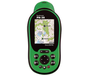
Never Get Lost Again When was the last time you wasted valuable travel time because you took a wrong turn in an unfamiliar location? Now there's an affordable and reliable solution - the new Earthmate GPS receiver. The small and flexible Earthmate GPS receiver is a high-performance, easy-to-use link to the satellite navigation technology of the Global Positioning System (GPS). Accessing these satellites is available for no additional charge. Earthmate, connected to a USB laptop PC, shows your real-time position on detailed Street Atlas USA maps anywhere in the U.S. (software included). You will always know where you are and where you need to go.Minimize
Manufacturer:DeLorme Product MPN MPN | AE-006761-201 | Key Features GPS Type | Automobile | Form Factor | Wireless Receiver Module | Map capabilities | Internal | Enhanced accuracy | WAAS enabled | Receiver Type | 12 Channels | Technical Features Included Software/Maps | USA Maps | Other Features PC Interface | USB | GPS System Accuisition Time - Cold | 45 sec | Max. Horizontal accuracy | | Enhanced position accuracy | PDA Features | Compatible PDA OS | Windows XP, Windows 2000, Windows ME, Windows 98SE | Compatible Devices | Notebook | Dimensions Width | 1.88 in. | Height | 2.09 in. |
Tags:delorme, earthmate,
| Garmin GPSMAP 3205$520.00 to $1,095.00
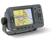
Plug into the power of the Garmin Marine network with the Garmin 3200 series. Rugged, waterproof, and easy to install, these chartplotters come preloaded with Garmin's detail-rich marine cartography utilizing BlueChart® g2 technology.
Manufacturer:Garmin Product MPN MPN | 010-00526-00 | Key Features GPS Type | Marine | Form Factor | Fixed | Map capabilities | Internal, Map cartridges / Data cards | Enhanced accuracy | WAAS enabled | Input Method | Keypad | Receiver Type | 12 Channels | Display Display Size | 5 in. | Display Type | 256 Color LCD TFT Display | Resolutions | 640 X 480 | Technical Features Marine Features | Chart Plotter | Special Features | 3D Map View | Audible Features | Proximity Alarm, Anchor Alarm, Arrival Alarm, Off-Course Alarm, Clock Alarm, Low Battary/Voltage Alarm | Included Software/Maps | Marine Cartography | Other Features PC Interface | NMEA-0183 | Environmental Protection | IPX7 Waterproof Standard | GPS System Accuisition Time - Cold | 45 sec | Accuisition Time - Initial Time | 15 sec | Update rate | 1 per second, continuous | Max. Horizontal accuracy | | Enhanced position accuracy | | Differential standards | DGPS Ready | Number of routes | 50 | Waypoints | 4000 | Warranty Warranty | 1 Year | Dimensions Width | 7.8 in. | Depth | 3 in. | Height | 4.7 in. | Weight | 1.8 lb. | Miscellaneous Family Line | Garmin GPSMAP | UPC | 753759053048 |
Tags:garmin, gpsmap, 3205,
|
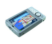
Transferable from car-to-car in seconds, the easy-to-use iCN510 can effortlessly guide drivers to their desired destination using accurate and clear turn-by-turn voice instructions and 3D-map view. Users can also now Drive Away this compact and sleek system straight from the box, with software applications and complete U.K. street-level mapping loaded on a single memory card. The iCN510 incorporates Version 3.0 of Navmans award winning SmartST software, which includes new features such as My POI customable points of interest with approach notification settings, multiple destinations for planning trips with several stops along the way, and a nearest POI search facility.Minimize
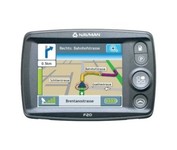
The F20, provides you with a lot for very little. Loaded with features normally found in other, more expensive car navigators, the F20 packs them all into a neat, pocket-sized compact unit. It’s the advanced features that separate the F20 from other entry-level navigators. The ‘Nearest Parking and Petrol’ buttons, previously only found on our more expensive models, are a simple but brilliant idea, exclusive to Navman.Minimize
The handheld mapping GPS designed by hunters for hunters lets you follow the big game in color with 16-channel GPS precision. The iFINDER® Hunt C with color display offers everything you'd expect in a versatile, precision mapping GPS unit made for the field, including hunting-specific icons, unique "Scout Mode", electronic compass, barometric altimeter, built-in microphone, and more.Minimize

The new GP37 DGPS/WAAS Navigator is compact in size, yet big on power, features and performance. This waterproof unit is perfect for a wide range of boats. It is equipped with a WAAS and a DGPS receiver as standard supply. It utilizes both WAAS and differential radio beacon correction methods to give you the most accurate position fix available. The GP37 offers extremely accurate position fixes -- 10m for basic GPS, 5m or better with DGPS and 3m or better where WAAS service is available. It should be noted that DGPS is more reliable and accurate, as the WAAS system is still currently under development. There is no guarantee of accuracy, integrity, continuity or availability of the WAAS signal. For that reason, the GP37 runs with DGPS as the default setting in auto selection mode. In this mode, if the DGPS signal can not be received for any reason, the WAAS mode is automatically selected. Manual setting is also available. The display modes include Plotter, two Customizable displays, Steering, Highway and SpeedMinimize