Products reviews

Dual Electronics XNAV3550

$219.00 to $228.00


The Dual XNA3550 features an easy to use touch screen graphic interface with MP3 playback capability. Turn-by-turn instructions with voice guidance. Visual left/right LED indicators. 3D Map view. Level selectable map view. Start route guidance search by:- Address/intersection- Points of interest- Address book- Recent destination. GPS status indicator.Minimize

Manufacturer:Dual Electronics Product MPNKey FeaturesDisplayTechnical FeaturesOther FeaturesPDA FeaturesBatteryDimensionsMiscellaneous
MPNXNAV3550
GPS Type   Automobile
Form FactorFixed
Map capabilities   Internal
Input Method   Touch Screen
Receiver Type12 Channels
Display Size3.5 in.
Display Type16.7M Colors LCD TFT Display
Resolutions320 X 240
Special Features   Address Book, MP3 Player, 3D Map View
Trip calculator   Route Recalculation, Points-of-Interest (POI)
Included Software/Maps   USA Maps
Built in memory64 MB
Expansion Slot TypeSD (Secure Digital) Card Slot
AntennaBuilt-in
Plug-in Interface   Secure Digital (SD)
Compatible PDA OSWindows CE
Battery Type and QuantityRechargeable Li-Ion Battery
Battery Life2 Hours
Width5.25 in.
Depth1.25 in.
Height3.13 in.
Weight2.1 lb.
UPC827204101636


Tags:

dual, electronics, xnav3550,

Garmin Edge 305

$175.00 to $449.00


Rugged, lightweight Edge attaches easily to the stem or handlebars of your bike with the included bike mount. Just turn it on, acquire GPS satellites and go. Edge 305 automatically measures your speed, distance, time, calories burned, altitude, climb and descent, and also records the route you have taken for review. For extra-precise climb and descent data, Edge 305 also incorporates a barometric altimeter to pinpoint changes in elevation.Minimize

Manufacturer:Garmin Product MPNKey FeaturesDisplayTechnical FeaturesOther FeaturesBatteryWarrantyDimensionsMiscellaneous
MPNGE305CAD
GPS Type   Handheld (Outdoor)
Form FactorHandheld
Screen Size1.9 in.
Display Size1.17 in. x 1.44 in.
Display Type4 Level Grayscale LCD Display
Resolutions128 x 160
Special Features   Built-In Barometer, Built-In Altimeter, Heart Rate Monitor, Training Computer
Trip calculator   Maximum speed, Elevation Computer
PC InterfaceUSB
Environmental ProtectionIPX7 Waterproof Standard
AntennaBuilt-in
Battery Type and QuantityProprietary Lithium
Battery Life12 Hours
Warranty1 Year
Width1.75 in.
Depth0.9 in.
Height3.7 in.
Weight0.19 lb.
UPC753759051716


Tags:

garmin, edge, 305,

Lowrance iFINDER GO2

$150.00 to $225.00


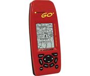
Just grab this bright yellow handheld iFINDER Go 64MB GPS and go, go, go. It's easy to use, waterproof, has a 2.2 diagonal Film SuperTwist display with backlighting and a built-in 64MB background map with coverage of the continental U.S. and Hawaii. The GPS also includes up to 1,000 waypoints, 1,000 event markers and 100 routes; up to 100 retraceable plot trails and up to 10,000 points in any trail; 30+ map zoom ranges and 42 graphic icons to mark spots.Minimize

Manufacturer:Lowrance Product MPNKey FeaturesDisplayTechnical FeaturesOther FeaturesGPS SystemBatteryWarrantyDimensionsMiscellaneous
MPN112-49
GPS Type   Handheld (Outdoor)
Form FactorHandheld
Map capabilities   Internal
Enhanced accuracyWAAS enabled
Input Method   Keypad
Receiver Type16 Channels
Display Size2 in.
Display Type16 Level Grayscale Display
Resolutions200 X 140
Marine FeaturesMOB (Man Over Board)
Special Features   Waypoint Icons
Included Software/Maps   USA Maps
Built in memory64 MB
Environmental ProtectionIPX7 Waterproof Standard
Number of routes100
Waypoints   1000
Battery Type and Quantity2 x AA Batteries
Battery Life48 Hours
Warranty1 Year
Width2.12 in.
Depth1.24 in.
Height5.15 in.
Weight0.34 lb.
Family LineLowrance iFINDER
UPC042194525426


Tags:

lowrance, ifinder, go2,


Navman iCN 510


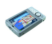
Transferable from car-to-car in seconds, the easy-to-use iCN510 can effortlessly guide drivers to their desired destination using accurate and clear turn-by-turn voice instructions and 3D-map view. Users can also now Drive Away this compact and sleek system straight from the box, with software applications and complete U.K. street-level mapping loaded on a single memory card. The iCN510 incorporates Version 3.0 of Navmans award winning SmartST software, which includes new features such as My POI customable points of interest with approach notification settings, multiple destinations for planning trips with several stops along the way, and a nearest POI search facility.Minimize


Garmin StreetPilot i5


It may be tiny, but the StreetPilot i5 is packed with state-of-the-art navigation features. The StreetPilot i5 comes preloaded with incredibly detailed City Navigator NT street maps that are packed with nearly 6 million points of interest including hotels, restaurants, ATMs and much more. A simple rolling-wheel interface allows you to quickly adjust settings and alter routes to your destination. Built for portability and power, the StreetPilot i5 is a cost effective portable GPS solution. Minimize


Garmin GPS 76


The GPS 76 is designed to provide precise GPS positioning using correction data obtained from the Wide Area Augmentation System (WAAS). This unit features a built-in quad helix antenna for superior reception and can provide position accuracy to less than three meters when receiving WAAS corrections.The GPS 76 provides 1 megabyte of internal user memory to be used for storing downloaded Points of Interest data. This 1 megabyte of storage area is preloaded from the factory with worldwide cities (populations greater than 200,000) and nautical navigation aids such as lights, buoys, sound signals and day beacons, and is perfect for downloading points of interest detail from GARMIN's line of MapSource CD-ROMs. The GPS 76 is also preloaded with tide data for the United States.Minimize


Kenwood KNA-G510
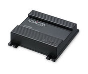

You'll give your Kenwood in-dash mobile video system a potent extra dimension when you connect the KNA-G510 navigation system. You'll drive with confidence as it guides you to your destination efficiently and accurately. The system can even keep you up to date on what's happening with traffic flow along your programmed route.Minimize