Dual Electronics XNAV3550$219.00 to $228.00

The Dual XNA3550 features an easy to use touch screen graphic interface with MP3 playback capability. Turn-by-turn instructions with voice guidance. Visual left/right LED indicators. 3D Map view. Level selectable map view. Start route guidance search by:- Address/intersection- Points of interest- Address book- Recent destination. GPS status indicator.Minimize
Manufacturer:Dual Electronics Product MPN MPN | XNAV3550 | Key Features GPS Type | Automobile | Form Factor | Fixed | Map capabilities | Internal | Input Method | Touch Screen | Receiver Type | 12 Channels | Display Display Size | 3.5 in. | Display Type | 16.7M Colors LCD TFT Display | Resolutions | 320 X 240 | Technical Features Special Features | Address Book, MP3 Player, 3D Map View | Trip calculator | Route Recalculation, Points-of-Interest (POI) | Included Software/Maps | USA Maps | Other Features Built in memory | 64 MB | Expansion Slot Type | SD (Secure Digital) Card Slot | Antenna | Built-in | PDA Features Plug-in Interface | Secure Digital (SD) | Compatible PDA OS | Windows CE | Battery Battery Type and Quantity | Rechargeable Li-Ion Battery | Battery Life | 2 Hours | Dimensions Width | 5.25 in. | Depth | 1.25 in. | Height | 3.13 in. | Weight | 2.1 lb. | Miscellaneous UPC | 827204101636 |
Tags:dual, electronics, xnav3550,
| Garmin Rino 120$167.00 to $628.00
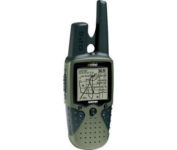
The Rino 120 is state-of-the-art GPS navigation and two-way communications combined, with enough memory to download detailed mapping for driving, hiking, hunting, fishing--or just about anything else you can dream up.
Manufacturer:Garmin Product MPN MPN | RINO120 | Key Features GPS Type | Handheld (Outdoor) | Form Factor | Handheld | Map capabilities | Internal, Download maps | Enhanced accuracy | WAAS enabled | Input Method | Thumb Stick | Receiver Type | 12 Channels | Screen Size | 2 in. | Display Display Size | 1.4 in. x 1.4 in. | Display Type | LCD Display | Resolutions | 160 X 160 | Technical Features Marine Features | Fishing Calcluator | Special Features | Waypoint Icons | Audible Features | Proximity Alarm | Trip calculator | Maximum speed, Current speed, Trip Timers, Time of sunrise/sunset, Track Log, Points-of-Interest (POI) | Included Software/Maps | Marine Cartography, North America Maps, South America Maps | Grids | Lat/Lon, MGRS, UTM, Loran TD position format, Maidenhead | Other Features PC Interface | Serial RS-232, NMEA-0183 | Environmental Protection | IPX7 Waterproof Standard | Antenna | Quadrifilar Helix | GPS System Accuisition Time - Cold | 45 sec | Accuisition Time - Initial Time | 15 sec | Update rate | 1 per second, continuous | Max. Horizontal accuracy | | Enhanced position accuracy | | Differential standards | DGPS Ready | Number of routes | 20 | Waypoints | 500 | Battery Battery Type and Quantity | 3 x AA Batteries | Battery Life | 28 Hours | Warranty Warranty | 1 Year | Dimensions Width | 2.3 in. | Depth | 1.6 in. | Height | 4.5 in. | Weight | 0.48 lb. | Miscellaneous Family Line | Garmin Rino | UPC | 689076630887 |
Tags:garmin, rino, 120,
| Garmin StreetPilot c530$180.00

StreetPilot c530 comes ready to go right out of the box with preloaded City Navigator® NT street maps and a hefty points of interest (POIs) database, including motels, restaurants, fuel, ATMs and more. Simply touch the super-bright sunlight-readable color screen to enter a destination, and the c530 takes you there with 2D or 3D maps and turn-by-turn voice directions. In addition, the c530 accepts custom points of interest (POIs) such as school zones and safety cameras and lets you set proximity alerts to warn you of upcoming POIs.Minimize
Manufacturer:Garmin Product MPN MPN | STREETC530 | Key Features GPS Type | Automobile | Form Factor | Fixed | Map capabilities | Internal, Map cartridges / Data cards | Input Method | Touch Screen | Screen Size | 3.5 in. | Display Display Size | 2.8 in. x 2.1 in. | Display Type | LCD TFT Display | Resolutions | 320 X 240 | Technical Features Special Features | Audio Book Player | Trip calculator | Shortest time, Shortest distance, Route Recalculation, Avoid toll roads | Included Software/Maps | North America Maps | Other Features PC Interface | USB, Bluetooth | Expansion Slot Type | SD (Secure Digital) Card Slot | GPS System Waypoints | 500 | PDA Features Plug-in Interface | Secure Digital (SD) | Compatible PDA OS | Windows 2000 | Compatible Devices | Notebook | Battery Battery Type and Quantity | Rechargeable Li-Ion Battery | Battery Life | 8 Hours | Dimensions Width | 4.4 in. | Depth | 2.25 in. | Height | 3.2 in. | Weight | 0.56 lb. | Miscellaneous Family Line | Garmin StreetPilot | UPC | 053759054473 |
Tags:garmin, streetpilot, c530,
|
The handheld mapping GPS designed by hunters for hunters lets you follow the big game in color with 16-channel GPS precision. The iFINDER® Hunt C with color display offers everything you'd expect in a versatile, precision mapping GPS unit made for the field, including hunting-specific icons, unique "Scout Mode", electronic compass, barometric altimeter, built-in microphone, and more.Minimize
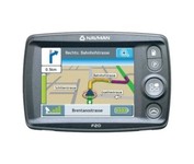
The F20, provides you with a lot for very little. Loaded with features normally found in other, more expensive car navigators, the F20 packs them all into a neat, pocket-sized compact unit. It’s the advanced features that separate the F20 from other entry-level navigators. The ‘Nearest Parking and Petrol’ buttons, previously only found on our more expensive models, are a simple but brilliant idea, exclusive to Navman.Minimize
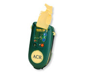
Accidents happen every day in the outdoors, whether you fall out of a tree stand, break a leg during a hike, or roll over on an ATV. In the outdoors, an every day accident instantly can become a life threatening situation, and rescues may take days or weeks if you’re not prepared.
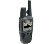
The Rino 130 is the most feature-rich unit in the Rino family with a built-in electronic compass barometric sensor weather receiver for seven NOAA weather channels and 24 MBs of internal memory This handheld radio has a built-in electronic compass to give a heading while the user is standing still and a barometric altimeter to provide extremely accurate elevation and pressure information which will assist users in identifying weather data The Rino 130 provides two-way radio communication with a transmission range of up to two miles using FRS channels and up to five miles with GMRS The integration of two-way radio and GPS enables users to transmit their position with a simple button press allowing others to navigate to their position The Rino 130 also has a polling feature which allows a user to manually request GPS location information from other Rino unitsMinimize