Products reviews

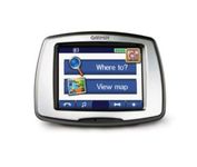
Garmin StreetPilot c550

$199.00 to $400.00


From Garmin, the leader in portable GPS solutions, the StreetPilot c550 is easy to use, and rich with features. The StreetPilot c550 comes preloaded with City Navigator NT street maps and includes a large database of points of interest including motels, restaurants, gas stations, and grocery stores. The simple touch screen interface gives you excellent control over menus and settings, and with Bluetooth support, you can even use the c550 for hands-free calling using the built-in speaker and microphone.Minimize

Manufacturer:Garmin Product MPNKey FeaturesDisplayTechnical FeaturesOther FeaturesGPS SystemBatteryWarrantyDimensionsMiscellaneous
MPN010-00522-02
GPS Type   Automobile
Form FactorFixed
Map capabilities   Internal, Map cartridges / Data cards
Enhanced accuracyWAAS enabled
Input Method   Touch Screen
Screen Size3.5 in.
Display Size2.8 in. x 2.1 in.
Display TypeLCD TFT Display
Resolutions320 X 240
Special Features   Waypoint Icons, MP3 Player, 3D Map View
Audible Features   Voice Navigation Instructions
Trip calculator   Maximum speed, Odometer, Route Recalculation, Trip Timers, Real-time Traffic Reports, Detour Feature, Points-of-Interest (POI)
Included Software/Maps   North America Maps, Europe Maps
PC InterfaceUSB 2.0, Bluetooth
Expansion Slot TypeSD (Secure Digital) Card Slot
AntennaBuilt-in, External Antenna Hookup
Waypoints   500
Battery Life8 Hours
Warranty1 Year
Width4.4 in.
Depth2.2 in.
Height3.2 in.
Weight0.59 lb.
Family LineGarmin StreetPilot
UPC753759054489


Tags:

garmin, streetpilot, c550,

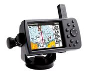
Garmin GPSMAP 276C

$615.00 to $1,000.00


This portable GPS navigator features a 256-color TFT display that's easy to read in bright sun along with a built-in basemap and auto routing to provide you with turn-by-turn directions to the marina for a day of boating.

Manufacturer:Garmin Product MPNKey FeaturesDisplayTechnical FeaturesOther FeaturesGPS SystemBatteryWarrantyDimensionsMiscellaneous
MPN010-00331-00
GPS Type   Automobile
Form FactorFixed
Map capabilities   Internal, Map cartridges / Data cards
Enhanced accuracyWAAS enabled
Input Method   Keypad
Receiver Type12 Channels
Display Size3.8 in.
Display Type256 Color LCD TFT Display
Resolutions480 X 320
Marine FeaturesChart Plotter
Audible Features   Proximity Alarm, Anchor Alarm, Arrival Alarm, Off-Course Alarm, Clock Alarm
Trip calculator   Points-of-Interest (POI)
Included Software/Maps   North America Maps, Canada Maps, Europe Maps
Grids   Lat/Lon, MGRS, User Grid, UTM, Loran TD position format, Maidenhead
PC InterfaceUSB
Environmental ProtectionIPX7 Waterproof Standard
AntennaQuadrifilar Helix
Accuisition Time - Cold45 sec
Accuisition Time - Initial Time15 sec
Update rate1 per second, continuous
Max. Horizontal accuracy   Enhanced position accuracy Differential standardsDGPS Ready
Number of routes50
Waypoints   3000
Battery Type and QuantityProprietary Lithium
Battery Life15 Hours
Warranty1 Year
Width5.7 in.
Depth1.9 in.
Height3.2 in.
Weight0.85 lb.
Family LineGarmin GPSMAP
UPC839438266340


Tags:

garmin, gpsmap, 276c,

Garmin Edge 305

$175.00 to $449.00


Rugged, lightweight Edge attaches easily to the stem or handlebars of your bike with the included bike mount. Just turn it on, acquire GPS satellites and go. Edge 305 automatically measures your speed, distance, time, calories burned, altitude, climb and descent, and also records the route you have taken for review. For extra-precise climb and descent data, Edge 305 also incorporates a barometric altimeter to pinpoint changes in elevation.Minimize

Manufacturer:Garmin Product MPNKey FeaturesDisplayTechnical FeaturesOther FeaturesBatteryWarrantyDimensionsMiscellaneous
MPNGE305CAD
GPS Type   Handheld (Outdoor)
Form FactorHandheld
Screen Size1.9 in.
Display Size1.17 in. x 1.44 in.
Display Type4 Level Grayscale LCD Display
Resolutions128 x 160
Special Features   Built-In Barometer, Built-In Altimeter, Heart Rate Monitor, Training Computer
Trip calculator   Maximum speed, Elevation Computer
PC InterfaceUSB
Environmental ProtectionIPX7 Waterproof Standard
AntennaBuilt-in
Battery Type and QuantityProprietary Lithium
Battery Life12 Hours
Warranty1 Year
Width1.75 in.
Depth0.9 in.
Height3.7 in.
Weight0.19 lb.
UPC753759051716


Tags:

garmin, edge, 305,


Garmin eTrex Summit


The eTrex Summit comes on the heels of the extremely popular eTrex, which was designed for both marine and recreation use. This new all-in-one navigation device for the outdoor enthusiast is the first combination GPS, altimeter, and electronic compass. The electronic compass provides bearing information when you're standing still and the altimeter determines precise altitude, so you can tell how high you've climbed and your rate of ascent. Like its predecessor, the eTrex Summit boasts a powerful 12 parallel channel GPS receiver and comes packaged in a small, sleek case with operating buttons located on either side of the unit. The case is completely waterproof to withstand immersion in one meter of water for up to 30 minutes.Minimize


AmbiCom GPS-CF
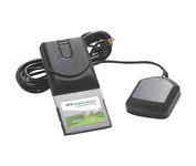

The AmbiCom GPS Navigation Receiver CompactFlash Card is the Global Positioning System Receiver for your mobile device and the perfect accessory to your Pocket PC device. The GPS Navigation Receiver comes with a full feature 30-day trial version software that is loaded with fantastic features such as dynamic voice navigation, off-route warning, and detailed street maps. Now you can turn your Pocket PC into a true GPS navigation system and never worry about getting lost!Minimize


Navman iCN 510
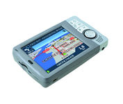

Transferable from car-to-car in seconds, the easy-to-use iCN510 can effortlessly guide drivers to their desired destination using accurate and clear turn-by-turn voice instructions and 3D-map view. Users can also now Drive Away this compact and sleek system straight from the box, with software applications and complete U.K. street-level mapping loaded on a single memory card. The iCN510 incorporates Version 3.0 of Navmans award winning SmartST software, which includes new features such as My POI customable points of interest with approach notification settings, multiple destinations for planning trips with several stops along the way, and a nearest POI search facility.Minimize


Garmin Rino 110


The Rino 110 is a GPS-enabled handheld that integrates radio functionality to provide two-way communications. It's waterproof, can send communications up to five miles (using GMRS channels), and can "beam" your exact location to another Rino user within a two-mile range (on the FRS spectrum) using "Position Reporting". And because the Rino 110 has standard FRS capabilities, you can talk to friends or family who own conventional FRS radios.The Rino 110 has a built-in city point data base, with 1 MB of internal memory for additional points-of-interest data that can be downloaded from a MapSource Points of Interest CD-ROM.Minimize