TomTom Navigator 3$150.00 to $160.00

Get moving with TomTom Navigator 3. The flexible and personal car navigation system works on your Pocket PC. TomTom Navigator 3 guides you effortlessly from door to door via the best route. Clear 3D colour maps and spoken instructions take the stress out of driving. Plan the best route when you have multiple stops: pick up colleagues on the way to a meeting or friends on the way to a restaurant. Route around areas you would like to avoid due to traffic jams or road works. The Major Roads of Europe feature makes planning and navigating international trips easier than ever. Plan the best route from Munich to Lyon, and TomTom will guide you there.Minimize
Manufacturer:TomTom Product MPN MPN | 1C90.080 | Key Features GPS Type | Handheld (Outdoor) | Form Factor | Handheld, Plug-in | Map capabilities | Internal, Download maps | Technical Features Audible Features | Voice Navigation Instructions | Trip calculator | Route Recalculation, Points-of-Interest (POI) | Included Software/Maps | Europe Maps | GPS System Accuisition Time - Cold | 51 sec | Accuisition Time - Initial Time | 37 sec | Accuisition Time - Hot | 3 sec | Waypoints | 1000 | PDA Features Compatible PDA OS | Pocket PC | Compatible Devices | Pocket PC Based PDA | Miscellaneous Family Line | Tomtom Navigator | UPC | 636926005876 |
Tags:tomtom, navigator, 3,
| Garmin nuvi 250$123.00 to $330.00
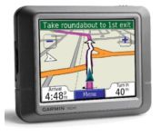
Packed with features and available in a variety of hip colors, the Garmin nuvi 250 is affordably priced and easy to use. The nuvi 250 comes preloaded with City Navigator map data giving you quick, turn-by-turn directions to anywhere in the continental United States. Pull up colorful, 2-D or 3-D maps on the sunlight-readable screen and voice directions will guide you safely and quickly to your selected destination. You can also set custom points of interest on the nuvi 250 such as your favorite restaurants or coffee shops, and with proximity alerts you’re always aware of where you’re going, and where you’ve been.Minimize
Manufacturer:Garmin Product MPN MPN | 010-N0621-00 | Key Features GPS Type | Automobile | Form Factor | Fixed | Map capabilities | Map cartridges / Data cards | Enhanced accuracy | WAAS enabled, EGNOS enabled | Input Method | Touch Screen | Receiver Type | 12 Channels | Screen Size | 3.5 in. | Display Display Size | 2.8 in. x 2.1 in. | Display Type | 65k Colors LCD TFT Display | Resolutions | 320 X 240 | Technical Features Special Features | Waypoint Icons, JPEG Image Viewer, Converter, Calculator, 3D Map View | Audible Features | Voice Navigation Instructions | Trip calculator | Shortest time, Shortest distance, Route Recalculation, Avoid toll roads, Detour Feature, Points-of-Interest (POI) | Included Software/Maps | Europe Maps, Great Britain | Other Features PC Interface | Bluetooth | Expansion Slot Type | SD (Secure Digital) Card Slot | Antenna | Built-in | GPS System Waypoints | 500 | Battery Battery Type and Quantity | Rechargeable Li-Ion Battery | Battery Life | 5 Hours | Dimensions Width | 3.8 in. | Depth | 0.8 in. | Height | 2.8 in. | Weight | 5.2 lb. | Miscellaneous Family Line | Garmin nuvi | UPC | 753759065539 |
Tags:garmin, nuvi, 250,
| Pharos Science iGPS-360$50.00 to $134.00
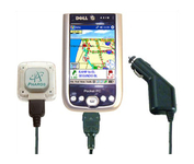
Compatible with most Pocket PCs with a CompactFlash slot, the Pharos Pocket GPS Navigator with CompactFlash inlcludes Pharos' iGPS-360 convertible receiver with a CompactFlash adaptor.Use it directly connected to the CompactFlash Adaptor, or for added flexibilty use the CF extension cable for placement and reception.Threre is no need for an external antenna!With Ostia, Pharos' award-winning navigation software installed on your Pocket PC, you can drive or walk through any city in the US, and locate your current position or quickly find a destination or point of interest. Routes can be calculated and viewed. The automated voice prompts will instruct you when and where to turn. If by chance you go "off-route," the automated voice will give an off-route warning and the system will automatically reroute you to your destination from your current position. Minimize
Manufacturer:Pharos Science Product MPN MPN | REC20 | Key Features GPS Type | Handheld (Outdoor) | Form Factor | Plug-in | Enhanced accuracy | WAAS enabled, EGNOS enabled | Receiver Type | 12 Channels | Other Features PC Interface | USB, Serial RS-232, Bluetooth | Antenna | Built-in | GPS System Accuisition Time - Cold | 60 sec | Accuisition Time - Initial Time | 40 sec | Accuisition Time - Hot | 5 sec | Max. Horizontal accuracy | Dimensions | Width | 1.93 in. | Depth | 0.63 in. | Height | 2.17 in. | Weight | 0.09 lb. | Miscellaneous UPC | 818948001382 |
Tags:pharos, science, igps-360,
|

One of the first things a boater will notice about the Chart Master V6 series is their vertically oriented high-definition (234x320 pixel) six-inch super-bright color LCD displays. They provide clear visibility even in full sunlight, and the Chart Master V6I, with it's built-in GPS antenna is a great choice for boats with open cockpits, center consoles and flying bridges and can serve well as a back-up unitMinimize
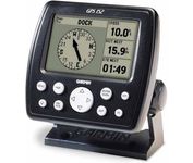
The GPS 152 is a 12 parallel channel GPS receiver loaded with a database of American cities and nautical navigation aids such as lights, buoys, sound signals, day beacons and tide data. Built-in memory of one megabyte makes the GPS 152 compatible with GARMIN's MapSource Points of Interest CD. With this CD and the GPS 152, you add additional marine navaid detail to your unit.In addition to larger memory, the GPS 152 is compatible with the Wide Area Augmentation System (WAAS), a technology designed to improve the accuracy of GPS positioning to about three meters.On the outside, the GPS 152 comes housed in a waterproof case that's about four inches high and five inches wide. A large four-inch diagonal, high-contrast display features 100x160 pixels for the ultimate in readability. A simple keypad at the bottom of the unit makes entering information easy, without blocking your view of the display.Minimize

Rugged, lightweight Edge attaches easily to the stem or handlebars of your bike with the included bike mount. Just turn it on, acquire GPS satellites and go. Edge 305 automatically measures your speed, distance, time, calories burned, altitude, climb and descent, and also records the route you have taken for review. For extra-precise climb and descent data, Edge 305 also incorporates a barometric altimeter to pinpoint changes in elevation.Minimize

The eTrex Summit comes on the heels of the extremely popular eTrex, which was designed for both marine and recreation use. This new all-in-one navigation device for the outdoor enthusiast is the first combination GPS, altimeter, and electronic compass. The electronic compass provides bearing information when you're standing still and the altimeter determines precise altitude, so you can tell how high you've climbed and your rate of ascent. Like its predecessor, the eTrex Summit boasts a powerful 12 parallel channel GPS receiver and comes packaged in a small, sleek case with operating buttons located on either side of the unit. The case is completely waterproof to withstand immersion in one meter of water for up to 30 minutes.Minimize