Products reviews

TomTom Navigator 3

$150.00 to $160.00


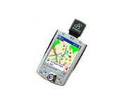
Get moving with TomTom Navigator 3. The flexible and personal car navigation system works on your Pocket PC. TomTom Navigator 3 guides you effortlessly from door to door via the best route. Clear 3D colour maps and spoken instructions take the stress out of driving. Plan the best route when you have multiple stops: pick up colleagues on the way to a meeting or friends on the way to a restaurant. Route around areas you would like to avoid due to traffic jams or road works. The Major Roads of Europe feature makes planning and navigating international trips easier than ever. Plan the best route from Munich to Lyon, and TomTom will guide you there.Minimize

Manufacturer:TomTom Product MPNKey FeaturesTechnical FeaturesGPS SystemPDA FeaturesMiscellaneous
MPN1C90.080
GPS Type   Handheld (Outdoor)
Form FactorHandheld, Plug-in
Map capabilities   Internal, Download maps
Audible Features   Voice Navigation Instructions
Trip calculator   Route Recalculation, Points-of-Interest (POI)
Included Software/Maps   Europe Maps
Accuisition Time - Cold51 sec
Accuisition Time - Initial Time37 sec
Accuisition Time - Hot3 sec
Waypoints   1000
Compatible PDA OSPocket PC
Compatible DevicesPocket PC Based PDA
Family LineTomtom Navigator
UPC636926005876


Tags:

tomtom, navigator, 3,

Garmin GPSMAP 440s

$437.00 to $1,032.00


Offshore fishermen and boaters will gravitate toward this sleek, space-saving chartplotter. The GPSMAP 440 features preloaded detailed maps for the U.S. coast as well as an ultra-bright 4” QVGA display; built-in, satellite-enhanced worldwide basemap and simplified user operation.

Manufacturer:Garmin Product MPNKey FeaturesDisplayTechnical FeaturesOther FeaturesGPS SystemWarrantyDimensionsMiscellaneous
MPN010-00516-44
GPS Type   Marine
Form FactorFixed
Map capabilities   Internal, Map cartridges / Data cards
Enhanced accuracyWAAS enabled, EGNOS enabled
Input Method   Keypad
Receiver Type12 Channels
Screen Size4 in.
Display Size2.4 in. x 3.2 in.
Display TypeLCD Display
Resolutions240 X 320
Marine FeaturesTide Prediction, Split Screen, Water Temp. Sensor, Depth Display, Chart Plotter, Sonar / Sounder, MOB (Man Over Board)
Audible Features   Anchor Alarm, Arrival Alarm, Clock Alarm, Accuracy Alarm, Fish Alarm, Shallow/Deep Alarm, Low Battary/Voltage Alarm, Water Temperature Alarm
Trip calculator   Route Recalculation, Trip Timers, Points-of-Interest (POI)
Included Software/Maps   Marine Cartography
PC InterfaceNMEA-0183
Environmental ProtectionIPX7 Waterproof Standard
Expansion Slot TypeSD (Secure Digital) Card Slot
AntennaBuilt-in, External Antenna Hookup
Accuisition Time - Cold45 sec
Accuisition Time - Initial Time15 sec
Update rate1 per second, continuous
Waypoints   1500
Warranty1 Year
Width5.7 in.
Depth2.7 in.
Height5 in.
Weight1.3 lb.
Family LineGarmin GPSMAP
UPC753759065836


Tags:

garmin, gpsmap, 440s,

Garmin StreetPilot c550

$199.00 to $400.00


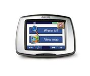
From Garmin, the leader in portable GPS solutions, the StreetPilot c550 is easy to use, and rich with features. The StreetPilot c550 comes preloaded with City Navigator NT street maps and includes a large database of points of interest including motels, restaurants, gas stations, and grocery stores. The simple touch screen interface gives you excellent control over menus and settings, and with Bluetooth support, you can even use the c550 for hands-free calling using the built-in speaker and microphone.Minimize

Manufacturer:Garmin Product MPNKey FeaturesDisplayTechnical FeaturesOther FeaturesGPS SystemBatteryWarrantyDimensionsMiscellaneous
MPN010-00522-02
GPS Type   Automobile
Form FactorFixed
Map capabilities   Internal, Map cartridges / Data cards
Enhanced accuracyWAAS enabled
Input Method   Touch Screen
Screen Size3.5 in.
Display Size2.8 in. x 2.1 in.
Display TypeLCD TFT Display
Resolutions320 X 240
Special Features   Waypoint Icons, MP3 Player, 3D Map View
Audible Features   Voice Navigation Instructions
Trip calculator   Maximum speed, Odometer, Route Recalculation, Trip Timers, Real-time Traffic Reports, Detour Feature, Points-of-Interest (POI)
Included Software/Maps   North America Maps, Europe Maps
PC InterfaceUSB 2.0, Bluetooth
Expansion Slot TypeSD (Secure Digital) Card Slot
AntennaBuilt-in, External Antenna Hookup
Waypoints   500
Battery Life8 Hours
Warranty1 Year
Width4.4 in.
Depth2.2 in.
Height3.2 in.
Weight0.59 lb.
Family LineGarmin StreetPilot
UPC753759054489


Tags:

garmin, streetpilot, c550,


Garmin GPSMAP 3205


Plug into the power of the Garmin Marine network with the Garmin 3200 series. Rugged, waterproof, and easy to install, these chartplotters come preloaded with Garmin's detail-rich marine cartography utilizing BlueChart® g2 technology.


Garmin eTrex Summit


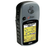
The eTrex Summit comes on the heels of the extremely popular eTrex, which was designed for both marine and recreation use. This new all-in-one navigation device for the outdoor enthusiast is the first combination GPS, altimeter, and electronic compass. The electronic compass provides bearing information when you're standing still and the altimeter determines precise altitude, so you can tell how high you've climbed and your rate of ascent. Like its predecessor, the eTrex Summit boasts a powerful 12 parallel channel GPS receiver and comes packaged in a small, sleek case with operating buttons located on either side of the unit. The case is completely waterproof to withstand immersion in one meter of water for up to 30 minutes.Minimize


Garmin GPS 152


The GPS 152 is a 12 parallel channel GPS receiver loaded with a database of American cities and nautical navigation aids such as lights, buoys, sound signals, day beacons and tide data. Built-in memory of one megabyte makes the GPS 152 compatible with GARMIN's MapSource Points of Interest CD. With this CD and the GPS 152, you add additional marine navaid detail to your unit.In addition to larger memory, the GPS 152 is compatible with the Wide Area Augmentation System (WAAS), a technology designed to improve the accuracy of GPS positioning to about three meters.On the outside, the GPS 152 comes housed in a waterproof case that's about four inches high and five inches wide. A large four-inch diagonal, high-contrast display features 100x160 pixels for the ultimate in readability. A simple keypad at the bottom of the unit makes entering information easy, without blocking your view of the display.Minimize


Garmin GPSMAP 76Cx


The GPSMAP 76CSx is a refreshing upgrade of the GPSMAP 76CS, one of our most popular models for outdoor and marine use. This unit features a removable microSD card for detailed mapping memory and a waterproof, rugged housing. The microSD card slot is located inside the waterproof battery compartment. Users can load map data and transfer routes and waypoints through the unit’s fast USB connection.Minimize