TomTom Navigator 3$150.00 to $160.00

Get moving with TomTom Navigator 3. The flexible and personal car navigation system works on your Pocket PC. TomTom Navigator 3 guides you effortlessly from door to door via the best route. Clear 3D colour maps and spoken instructions take the stress out of driving. Plan the best route when you have multiple stops: pick up colleagues on the way to a meeting or friends on the way to a restaurant. Route around areas you would like to avoid due to traffic jams or road works. The Major Roads of Europe feature makes planning and navigating international trips easier than ever. Plan the best route from Munich to Lyon, and TomTom will guide you there.Minimize
Manufacturer:TomTom Product MPN MPN | 1C90.080 | Key Features GPS Type | Handheld (Outdoor) | Form Factor | Handheld, Plug-in | Map capabilities | Internal, Download maps | Technical Features Audible Features | Voice Navigation Instructions | Trip calculator | Route Recalculation, Points-of-Interest (POI) | Included Software/Maps | Europe Maps | GPS System Accuisition Time - Cold | 51 sec | Accuisition Time - Initial Time | 37 sec | Accuisition Time - Hot | 3 sec | Waypoints | 1000 | PDA Features Compatible PDA OS | Pocket PC | Compatible Devices | Pocket PC Based PDA | Miscellaneous Family Line | Tomtom Navigator | UPC | 636926005876 |
Tags:tomtom, navigator, 3,
| Garmin GPSMAP 76Cx$233.00 to $432.00
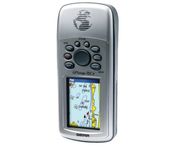
The GPSMAP 76CSx is a refreshing upgrade of the GPSMAP 76CS, one of our most popular models for outdoor and marine use. This unit features a removable microSD card for detailed mapping memory and a waterproof, rugged housing. The microSD card slot is located inside the waterproof battery compartment. Users can load map data and transfer routes and waypoints through the unit’s fast USB connection.Minimize
Manufacturer:Garmin Product MPN MPN | 010-00468-00 | Key Features GPS Type | Marine | Form Factor | Handheld | Map capabilities | Internal | Enhanced accuracy | WAAS enabled | Receiver Type | 12 Channels | Screen Size | 2.7 in. | Display Display Size | 1.5 in. x 2.2 in. | Display Type | 256 Color LCD TFT Display | Resolutions | 160 X 240 | Technical Features Marine Features | Fishing Calcluator, MOB (Man Over Board) | Special Features | Waypoint Icons | Audible Features | Proximity Alarm, Anchor Alarm, Arrival Alarm, Off-Course Alarm, Clock Alarm, Shallow/Deep Alarm | Trip calculator | Moving average, Total average, Odometer, Time of sunrise/sunset, Track Log, Points-of-Interest (POI) | Included Software/Maps | North America Maps, South America Maps | Grids | Lat/Lon, MGRS, User Grid, UTM, Loran TD position format, Maidenhead | Other Features PC Interface | USB, NMEA-0183 | Environmental Protection | IPX7 Waterproof Standard, High Impact Plastic Alloy Body | Antenna | Built-in, Quadrifilar Helix | GPS System Accuisition Time - Cold | 38 sec | Accuisition Time - Initial Time | 1 sec | Update rate | 1 per second, continuous | Max. Horizontal accuracy | | Enhanced position accuracy | | Differential standards | DGPS Ready | Number of routes | 50 | Waypoints | 1000 | Battery Battery Type and Quantity | 2 x AA Batteries | Battery Life | 18 Hours | Warranty Warranty | 1 Year | Dimensions Width | 2.7 in. | Depth | 1.4 in. | Height | 6.2 in. | Weight | 0.48 lb. | Miscellaneous Family Line | Garmin GPSMAP | UPC | 753759051631 |
Tags:garmin, gpsmap, 76cx,
| Garmin GPS 18$48.00 to $169.00
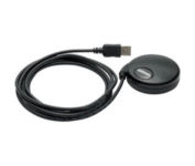
Turn your laptop PC into a powerful street navigator with the GPS 18 a GPS sensor bundled with nRoute and City Select software that automatically guides you with turn-by-turn directions and voice prompts to get you safely to your destination.
Manufacturer:Garmin Product MPN MPN | 010-00321-54 | Key Features GPS Type | Handheld (Outdoor) | Form Factor | Handheld, Plug-in | Map capabilities | Download maps | Enhanced accuracy | WAAS enabled | Receiver Type | 12 Channels | Technical Features Audible Features | Voice Navigation Instructions | Trip calculator | Points-of-Interest (POI) | Included Software/Maps | North America Maps, Europe Maps, South America Maps | Other Features PC Interface | USB 2.0, USB | GPS System Accuisition Time - Cold | 45 sec | Accuisition Time - Initial Time | 15 sec | Update rate | 1 per second, continuous | Max. Horizontal accuracy | | Enhanced position accuracy | | Differential standards | DGPS Ready | Warranty Warranty | 1 Year | Dimensions Width | 2.4 in. | Depth | 2.4 in. | Height | 0.77 in. | Weight | 0.22 lb. | Miscellaneous Family Line | Garmin GPS | UPC | 753759042714 |
Tags:garmin, gps, 18,
|

StreetPilot c530 comes ready to go right out of the box with preloaded City Navigator® NT street maps and a hefty points of interest (POIs) database, including motels, restaurants, fuel, ATMs and more. Simply touch the super-bright sunlight-readable color screen to enter a destination, and the c530 takes you there with 2D or 3D maps and turn-by-turn voice directions. In addition, the c530 accepts custom points of interest (POIs) such as school zones and safety cameras and lets you set proximity alerts to warn you of upcoming POIs.Minimize
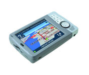
Transferable from car-to-car in seconds, the easy-to-use iCN510 can effortlessly guide drivers to their desired destination using accurate and clear turn-by-turn voice instructions and 3D-map view. Users can also now Drive Away this compact and sleek system straight from the box, with software applications and complete U.K. street-level mapping loaded on a single memory card. The iCN510 incorporates Version 3.0 of Navmans award winning SmartST software, which includes new features such as My POI customable points of interest with approach notification settings, multiple destinations for planning trips with several stops along the way, and a nearest POI search facility.Minimize
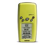
With its distinctive canopy-green case, the powerful Geko 201 from Garmin(r) allows more waypoint and route storage, as well as available PC and external power connectivity, and built-in WAAS capability. In addition, the Geko 201 boasts a user-configurable trip computer, 10,000 trackpoints, a new upcoming-turn feature, as well as PanTrack(tm) and TracBack(r).Minimize
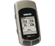
Take your ride to the next level with the Edge 205Garmin's GPS-enabled personal trainer and cycle computer. Perfect for touring and the trails, the lightweight Edge is the ultimate fitness partner. With the easy-to-use Edge 205 on your bike, you always know where you're going and how far you've gone. For advanced cyclists, the Edge 305 is available with either a heart rate monitor or a wireless speed/pedaling cadence sensor to help you achieve your personal best.Minimize