Acr Electronics TerraFix 406$234.00 to $487.00
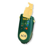
Accidents happen every day in the outdoors, whether you fall out of a tree stand, break a leg during a hike, or roll over on an ATV. In the outdoors, an every day accident instantly can become a life threatening situation, and rescues may take days or weeks if you’re not prepared.
Manufacturer:Acr Electronics Product MPN MPN | 210218942 | Key Features GPS Type | Automobile | Form Factor | Wireless Receiver Module | Dimensions Weight | 0.83 lb. | Miscellaneous UPC | 791659001806 |
Tags:acr, electronics, terrafix, 406,
| Garmin StreetPilot c530$180.00

StreetPilot c530 comes ready to go right out of the box with preloaded City Navigator® NT street maps and a hefty points of interest (POIs) database, including motels, restaurants, fuel, ATMs and more. Simply touch the super-bright sunlight-readable color screen to enter a destination, and the c530 takes you there with 2D or 3D maps and turn-by-turn voice directions. In addition, the c530 accepts custom points of interest (POIs) such as school zones and safety cameras and lets you set proximity alerts to warn you of upcoming POIs.Minimize
Manufacturer:Garmin Product MPN MPN | STREETC530 | Key Features GPS Type | Automobile | Form Factor | Fixed | Map capabilities | Internal, Map cartridges / Data cards | Input Method | Touch Screen | Screen Size | 3.5 in. | Display Display Size | 2.8 in. x 2.1 in. | Display Type | LCD TFT Display | Resolutions | 320 X 240 | Technical Features Special Features | Audio Book Player | Trip calculator | Shortest time, Shortest distance, Route Recalculation, Avoid toll roads | Included Software/Maps | North America Maps | Other Features PC Interface | USB, Bluetooth | Expansion Slot Type | SD (Secure Digital) Card Slot | GPS System Waypoints | 500 | PDA Features Plug-in Interface | Secure Digital (SD) | Compatible PDA OS | Windows 2000 | Compatible Devices | Notebook | Battery Battery Type and Quantity | Rechargeable Li-Ion Battery | Battery Life | 8 Hours | Dimensions Width | 4.4 in. | Depth | 2.25 in. | Height | 3.2 in. | Weight | 0.56 lb. | Miscellaneous Family Line | Garmin StreetPilot | UPC | 053759054473 |
Tags:garmin, streetpilot, c530,
| Interphase Corporation Chart Master V6i$531.00 to $573.00

One of the first things a boater will notice about the Chart Master V6 series is their vertically oriented high-definition (234x320 pixel) six-inch super-bright color LCD displays. They provide clear visibility even in full sunlight, and the Chart Master V6I, with it's built-in GPS antenna is a great choice for boats with open cockpits, center consoles and flying bridges and can serve well as a back-up unitMinimize
Manufacturer:Interphase Corporation Product MPN MPN | U1CHRTV6I | Key Features GPS Type | Marine | Form Factor | Fixed | Map capabilities | Internal, Map cartridges / Data cards | Enhanced accuracy | WAAS enabled | Input Method | Keypad, Thumb Stick | Receiver Type | 12 Channels | Display Display Size | 5.7 in. | Display Type | 256 Color LCD TFT Display | Resolutions | 234 X 320 | Technical Features Marine Features | Tide Prediction, Depth Display, Chart Plotter, Sonar / Sounder, MOB (Man Over Board) | Special Features | Waypoint Icons, Compass | Audible Features | Shallow/Deep Alarm | Included Software/Maps | Marine Cartography | Grids | Lat/Lon | Other Features PC Interface | USB, NMEA-0183, NMEA-0180 | Antenna | Built-in | GPS System Accuisition Time - Cold | 45 sec | Accuisition Time - Hot | 8 sec | Update rate | 1 per second, continuous | Enhanced position accuracy | | Number of routes | 25 | Waypoints | 500 | Warranty Warranty | 5 Years | Dimensions Width | 3.38 in. | Depth | 2 in. | Height | 4.5 in. | Weight | 2 lb. | Miscellaneous UPC | 027037002692 |
Tags:interphase, corporation, chart, master, v6i,
|

The GPS 72 is a low-cost solution for land or marine navigation designed to provide precise GPS positioning using correction data obtained from the Wide Area Augmentation System (WAAS). The GPS 72 can provide position accuracy to less than three meters when receiving WAAS corrections. This rugged, waterproof, unsinkable GPS receiver offers a large, 4-level grayscale screen. It's designed as the next generation in basic, entry-level GARMIN GPS.Minimize

The new GP37 DGPS/WAAS Navigator is compact in size, yet big on power, features and performance. This waterproof unit is perfect for a wide range of boats. It is equipped with a WAAS and a DGPS receiver as standard supply. It utilizes both WAAS and differential radio beacon correction methods to give you the most accurate position fix available. The GP37 offers extremely accurate position fixes -- 10m for basic GPS, 5m or better with DGPS and 3m or better where WAAS service is available. It should be noted that DGPS is more reliable and accurate, as the WAAS system is still currently under development. There is no guarantee of accuracy, integrity, continuity or availability of the WAAS signal. For that reason, the GP37 runs with DGPS as the default setting in auto selection mode. In this mode, if the DGPS signal can not be received for any reason, the WAAS mode is automatically selected. Manual setting is also available. The display modes include Plotter, two Customizable displays, Steering, Highway and SpeedMinimize

This preloaded, offshore chartplotter combines the power of networking with brilliant color and slim-line design. The GPSMAP 4212 has preloaded BlueChart® g2 maps of the U.S. coast and displays them on a whopping 12.1” XGA display with crisp, video-quality resolution. By connecting to the Garmin Marine Network, you can add sonar, radar and weather. For even more enhanced features, you can add the optional Bluechart g2 Vision card.Minimize
StreetPilot c530 comes ready to go right out of the box with preloaded City Navigator® NT street maps and a hefty points of interest (POIs) database, including motels, restaurants, fuel, ATMs and more. Simply touch the super-bright sunlight-readable color screen to enter a destination, and the c530 takes you there with 2D or 3D maps and turn-by-turn voice directions. In addition, the c530 accepts custom points of interest (POIs) such as school zones and safety cameras and lets you set proximity alerts to warn you of upcoming POIs.Minimize