Pharos Science PSD80$86.00 to $262.00
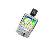
The Pharos Pocket GPS Navigator is an excellent navigation solution for your Dell Pocket PC. The package comes with a compact iGPS-SD receiver and the Ostia Smart Navigator software with detailed street-level maps of entire US. It even includes a car charger that powers the GPS while charging your Pocket PC simultaneously. The iGPS-SD receiver is a small, slim and sensitive GPS receiver that plugs in the Pocket PC's SDIO slot. Ostia helps you locate your current position, find a destination or point of interest (POI) and get a route to your destination. Simply activate the GPS navigation program and begin traveling; the automated voice-prompts will tell you when and where to turn. If by chance you go 'off route', the Pocket GPS Navigator will always reroute you to your destination from your current GPS position.Minimize
Manufacturer:Pharos Science Product MPN MPN | PSD80 | Key Features GPS Type | Handheld (Outdoor) | Form Factor | Plug-in | Map capabilities | Internal, Download maps | Receiver Type | 12 Channels | Technical Features Audible Features | Voice Navigation Instructions | Trip calculator | Real-time Traffic Reports, Points-of-Interest (POI) | Included Software/Maps | City Navigation Maps | Other Features PC Interface | NMEA-0183 | GPS System Accuisition Time - Cold | 8 sec | Accuisition Time - Initial Time | 45 sec | Accuisition Time - Hot | 60 sec | Max. Horizontal accuracy | PDA Features | Compatible PDA OS | Pocket PC | Compatible Devices | Pocket PC Based PDA | Dimensions Width | 1.2 in. | Depth | 0.55 in. | Height | 1.3 in. | Miscellaneous UPC | 818948001115 |
Tags:pharos, science, psd80,
| Garmin eTrex Legend$110.00 to $270.00
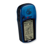
With the eTrex Legend, GARMIN has loaded a full basemap of North and South America into one small unit. The Legend is also designed to provide precise GPS positioning using correction data obtained from the Wide Area Augmentation System (WAAS). This product will provide position accuracy to less than three meters when receiving WAAS corrections.Minimize
Manufacturer:Garmin Product MPN MPN | ETREX LEGEND | Key Features GPS Type | Handheld (Outdoor) | Form Factor | Handheld | Map capabilities | Internal, Download maps | Enhanced accuracy | WAAS enabled | Input Method | Thumb Stick | Receiver Type | 12 Channels | Screen Size | 2.4 in. | Display Display Size | 1.1 in. x 2.1 in. | Display Type | LCD Display | Technical Features Special Features | Waypoint Icons | Trip calculator | Maximum speed, Current speed, Trip Timers, Time of sunrise/sunset, Track Log, Points-of-Interest (POI) | Included Software/Maps | Marine Cartography, City Navigation Maps, North America Maps, Europe Maps, Australia Maps, South Africa Maps, South America Maps, Middle East Maps, Asia Maps | Grids | Lat/Lon, MGRS, UTM, Loran TD position format, Maidenhead | Other Features PC Interface | Serial RS-232, NMEA-0183 | Built in memory | 8 MB | Environmental Protection | IPX7 Waterproof Standard | Antenna | Built-in | GPS System Accuisition Time - Cold | 45 sec | Accuisition Time - Initial Time | 15 sec | Update rate | 1 per second, continuous | Max. Horizontal accuracy | | Enhanced position accuracy | | Differential standards | DGPS Ready | Number of routes | 20 | Waypoints | 1000 | Battery Battery Type and Quantity | 2 x AA Batteries | Battery Life | 18 Hours | Warranty Warranty | 1 Year | Dimensions Width | 2 in. | Depth | 1.2 in. | Height | 4.4 in. | Weight | 0.33 lb. | Miscellaneous Family Line | Garmin eTrex | UPC | 753759030186 |
Tags:garmin, etrex, legend,
| Furuno GP7000F NT$1,689.00 to $2,637.00

The GP-7000F/NT is a GPS/WAAS plotter designed for a variety of vessels desiring video plotting and echo sounding capabilities. With the GP-7000 series, you can see the highly accurate position of your boat on the chart. The GP-7000 series has four display modes: Course Plot, Nav Data, Steering, and Highway modes. The course plot mode is useful for obtaining general information about surrounding sea areas. The Nav data mode clearly shows important navigational information with large text, which is easy to see even from a distance. The steering mode and highway mode assist the operator in following a predetermined route.Minimize
Manufacturer:Furuno Product MPN MPN | GP7000FNT | Key Features GPS Type | Marine | Form Factor | Fixed | Map capabilities | Map cartridges / Data cards | Enhanced accuracy | WAAS enabled | Display Display Size | 7 in. | Display Type | LCD TFT Display | Resolutions | 480 x 234 | Technical Features Marine Features | Split Screen, Chart Plotter | Audible Features | Proximity Alarm, Arrival Alarm | Other Features Environmental Protection | IPX5 Waterproof Standard, IPX6 Waterproof Standard | Expansion Slot Type | SD (Secure Digital) Card Slot | GPS System Accuisition Time - Initial Time | 12 sec | Max. Horizontal accuracy | | Enhanced position accuracy | | Number of routes | 200 | Waypoints | 2000 | Dimensions Width | 10.2 in. | Depth | 3.2 in. | Height | 6.1 in. | Miscellaneous UPC | 611679280558 |
Tags:furuno, gp7000f, nt,
|
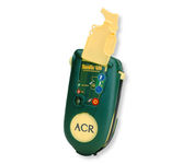
Accidents happen every day in the outdoors, whether you fall out of a tree stand, break a leg during a hike, or roll over on an ATV. In the outdoors, an every day accident instantly can become a life threatening situation, and rescues may take days or weeks if you’re not prepared.
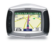
Designed specifically for motorcycles, the Garmin zumo 550 has a host of features that make it the easiest way to get GPS navigation on two wheels. Durable, waterproof, and built with fuel-resistant plastics, the zumo 550 can take a beating and hold up against even the most intense driving conditions. Right out of the box you’ll be able to chart out your ride with preloaded City Navigator NT street maps that are loaded with useful points of interest including restaurants, gas stations, and motels. Turn-by-turn voice directions keep you on track and with real-time traffic and weather updates you can avoid obstacles that might interfere with your otherwise, easy ride.Minimize
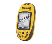
For serious outdoor use, the eXplorist series handheld GPS navigation systems are built to cover all requirements. With their tough, impact-resistant, waterproof exterior and their proven Magellan technology inside that packs powerful functionality into an easy-to-use operating system, your outdoor needs will be covered.Minimize
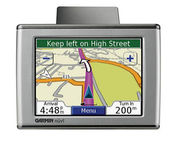
Sleek and portable, the Garmin nuvi 350 comes preloaded with City Navigator NT street maps that highlight countless points of interest including hotels, restaurants, gas stations, ATMs and much more. A simple touch-screen interface allows you to quickly pull up 2-D or 3-D maps, and with turn-by-turn voice directions, you’ll never have to take your eyes off the road to get your bearings. The nuvi 350 also includes MP3 playback, a JPEG picture viewer, currency converters, and a host of other travel handy applications.Minimize