Pharos Science PSD80$86.00 to $262.00

The Pharos Pocket GPS Navigator is an excellent navigation solution for your Dell Pocket PC. The package comes with a compact iGPS-SD receiver and the Ostia Smart Navigator software with detailed street-level maps of entire US. It even includes a car charger that powers the GPS while charging your Pocket PC simultaneously. The iGPS-SD receiver is a small, slim and sensitive GPS receiver that plugs in the Pocket PC's SDIO slot. Ostia helps you locate your current position, find a destination or point of interest (POI) and get a route to your destination. Simply activate the GPS navigation program and begin traveling; the automated voice-prompts will tell you when and where to turn. If by chance you go 'off route', the Pocket GPS Navigator will always reroute you to your destination from your current GPS position.Minimize
Manufacturer:Pharos Science Product MPN MPN | PSD80 | Key Features GPS Type | Handheld (Outdoor) | Form Factor | Plug-in | Map capabilities | Internal, Download maps | Receiver Type | 12 Channels | Technical Features Audible Features | Voice Navigation Instructions | Trip calculator | Real-time Traffic Reports, Points-of-Interest (POI) | Included Software/Maps | City Navigation Maps | Other Features PC Interface | NMEA-0183 | GPS System Accuisition Time - Cold | 8 sec | Accuisition Time - Initial Time | 45 sec | Accuisition Time - Hot | 60 sec | Max. Horizontal accuracy | PDA Features | Compatible PDA OS | Pocket PC | Compatible Devices | Pocket PC Based PDA | Dimensions Width | 1.2 in. | Depth | 0.55 in. | Height | 1.3 in. | Miscellaneous UPC | 818948001115 |
Tags:pharos, science, psd80,
| Garmin zumo 550$544.00 to $1,300.00

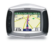
Designed specifically for motorcycles, the Garmin zumo 550 has a host of features that make it the easiest way to get GPS navigation on two wheels. Durable, waterproof, and built with fuel-resistant plastics, the zumo 550 can take a beating and hold up against even the most intense driving conditions. Right out of the box you’ll be able to chart out your ride with preloaded City Navigator NT street maps that are loaded with useful points of interest including restaurants, gas stations, and motels. Turn-by-turn voice directions keep you on track and with real-time traffic and weather updates you can avoid obstacles that might interfere with your otherwise, easy ride.Minimize
Manufacturer:Garmin Product MPN MPN | 901050 | Key Features GPS Type | Handheld (Outdoor) | Form Factor | Fixed | Map capabilities | Internal | Enhanced accuracy | WAAS enabled | Input Method | Touch Screen | Screen Size | 3.5 in. | Display Display Size | 2.8 in. x 2.1 in. | Display Type | 16-bit Color LCD Display | Resolutions | 320 X 240 | Technical Features Special Features | Waypoint Icons, MP3 Player, 3D Map View | Audible Features | Voice Navigation Instructions | Trip calculator | Maximum speed, Odometer, Route Recalculation, Trip Timers, Detour Feature, Points-of-Interest (POI) | Included Software/Maps | North America Maps, Europe Maps | Other Features PC Interface | USB 2.0, Bluetooth | Environmental Protection | IPX7 Waterproof Standard | Antenna | Built-in, External Antenna Hookup | GPS System Waypoints | 500 | Battery Battery Type and Quantity | Proprietary Li-Ion | Battery Life | 4 Hours | Warranty Warranty | 1 Year | Dimensions Width | 4.8 in. | Depth | 1.6 in. | Height | 3.9 in. | Weight | 0.66 lb. | Miscellaneous UPC | 753759061753 |
Tags:garmin, zumo, 550,
| Garmin nüvi 350$185.00 to $410.00

Sleek and portable, the Garmin nuvi 350 comes preloaded with City Navigator NT street maps that highlight countless points of interest including hotels, restaurants, gas stations, ATMs and much more. A simple touch-screen interface allows you to quickly pull up 2-D or 3-D maps, and with turn-by-turn voice directions, you’ll never have to take your eyes off the road to get your bearings. The nuvi 350 also includes MP3 playback, a JPEG picture viewer, currency converters, and a host of other travel handy applications.Minimize
Manufacturer:Garmin Product MPN MPN | NUVI350NOH | Key Features GPS Type | Automobile | Form Factor | Handheld, Fixed | Map capabilities | Internal, Map cartridges / Data cards | Enhanced accuracy | WAAS enabled | Input Method | Touch Screen | Screen Size | 3.5 in. | Display Display Size | 2.8 in. x 2.1 in. | Display Type | LCD TFT Display | Resolutions | 320 X 240 | Technical Features Special Features | MP3 Player, 3D Map View | Audible Features | Voice Navigation Instructions | Trip calculator | Maximum speed, Elevation Computer, Detour Feature, Points-of-Interest (POI) | Included Software/Maps | North America Maps, Canada Maps, Europe Maps | Other Features PC Interface | USB | Built in memory | 700 MB | Expansion Slot Type | SD (Secure Digital) Card Slot | Antenna | Flip-up | GPS System Accuisition Time - Cold | 38 sec | Accuisition Time - Initial Time | 1 sec | Max. Horizontal accuracy | | Enhanced position accuracy | Battery | Battery Type and Quantity | Proprietary Lithium | Battery Life | 8 Hours | Warranty Warranty | 1 Year | Dimensions Width | 3.87 in. | Depth | 0.87 in. | Height | 2.91 in. | Weight | 0.32 lb. | Miscellaneous UPC | 753759077174 |
Tags:garmin, nvi, 350,
|


