Products reviews

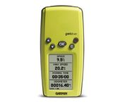
Garmin Geko 201

$90.00 to $140.00


With its distinctive canopy-green case, the powerful Geko 201 from Garmin(r) allows more waypoint and route storage, as well as available PC and external power connectivity, and built-in WAAS capability. In addition, the Geko 201 boasts a user-configurable trip computer, 10,000 trackpoints, a new upcoming-turn feature, as well as PanTrack(tm) and TracBack(r).Minimize

Manufacturer:Garmin Product MPNKey FeaturesDisplayTechnical FeaturesOther FeaturesGPS SystemBatteryWarrantyDimensionsMiscellaneous
MPN010-00318-00
GPS Type   Handheld (Outdoor)
Form FactorHandheld
Enhanced accuracyWAAS enabled
Input Method   Keypad
Receiver Type12 Channels
Screen Size1.7 in.
Display Size0.92 in. x 1.44 in.
Display Type4 Level Grayscale LCD Display
Resolutions64 X 100
Special Features   Waypoint Icons
Trip calculator   Maximum speed, Odometer, Current speed, Trip Timers, Time of sunrise/sunset, Track Log
Grids   Lat/Lon, MGRS, UTM, Maidenhead
PC InterfaceSerial RS-232, NMEA-0183
Environmental ProtectionIPX7 Waterproof Standard
AntennaBuilt-in
Accuisition Time - Cold45 sec
Accuisition Time - Initial Time15 sec
Update rate1 per second, continuous
Max. Horizontal accuracy   Enhanced position accuracy Differential standardsDGPS Ready
Number of routes20
Waypoints   500
Battery Type and Quantity2 x AAA Batteries
Battery Life12 Hours
Warranty1 Year
Width1.9 in.
Depth0.96 in.
Height3.9 in.
Weight0.14 lb.
Family LineGarmin Geko
UPC753759042066


Tags:

garmin, geko, 201,

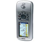
Garmin GPSMAP 76Cx

$233.00 to $432.00


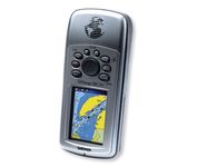
The GPSMAP 76CSx is a refreshing upgrade of the GPSMAP 76CS, one of our most popular models for outdoor and marine use. This unit features a removable microSD card for detailed mapping memory and a waterproof, rugged housing. The microSD card slot is located inside the waterproof battery compartment. Users can load map data and transfer routes and waypoints through the unit’s fast USB connection.Minimize

Manufacturer:Garmin Product MPNKey FeaturesDisplayTechnical FeaturesOther FeaturesGPS SystemBatteryWarrantyDimensionsMiscellaneous
MPN010-00468-00
GPS Type   Marine
Form FactorHandheld
Map capabilities   Internal
Enhanced accuracyWAAS enabled
Receiver Type12 Channels
Screen Size2.7 in.
Display Size1.5 in. x 2.2 in.
Display Type256 Color LCD TFT Display
Resolutions160 X 240
Marine FeaturesFishing Calcluator, MOB (Man Over Board)
Special Features   Waypoint Icons
Audible Features   Proximity Alarm, Anchor Alarm, Arrival Alarm, Off-Course Alarm, Clock Alarm, Shallow/Deep Alarm
Trip calculator   Moving average, Total average, Odometer, Time of sunrise/sunset, Track Log, Points-of-Interest (POI)
Included Software/Maps   North America Maps, South America Maps
Grids   Lat/Lon, MGRS, User Grid, UTM, Loran TD position format, Maidenhead
PC InterfaceUSB, NMEA-0183
Environmental ProtectionIPX7 Waterproof Standard, High Impact Plastic Alloy Body
AntennaBuilt-in, Quadrifilar Helix
Accuisition Time - Cold38 sec
Accuisition Time - Initial Time1 sec
Update rate1 per second, continuous
Max. Horizontal accuracy   Enhanced position accuracy Differential standardsDGPS Ready
Number of routes50
Waypoints   1000
Battery Type and Quantity2 x AA Batteries
Battery Life18 Hours
Warranty1 Year
Width2.7 in.
Depth1.4 in.
Height6.2 in.
Weight0.48 lb.
Family LineGarmin GPSMAP
UPC753759051631


Tags:

garmin, gpsmap, 76cx,

Garmin GPS 72

$190.00


The GPS 72 is a low-cost solution for land or marine navigation designed to provide precise GPS positioning using correction data obtained from the Wide Area Augmentation System (WAAS). The GPS 72 can provide position accuracy to less than three meters when receiving WAAS corrections. This rugged, waterproof, unsinkable GPS receiver offers a large, 4-level grayscale screen. It's designed as the next generation in basic, entry-level GARMIN GPS.Minimize

Manufacturer:Garmin Product MPNKey FeaturesDisplayTechnical FeaturesOther FeaturesGPS SystemBatteryWarrantyDimensionsMiscellaneous
MPN010-00309-00
GPS Type   Marine
Form FactorHandheld
Map capabilities   Internal, Download maps
Enhanced accuracyWAAS enabled
Input Method   Keypad
Receiver Type12 Channels
Screen Size2.7 in.
Display Size1.6 in. x 2.2 in.
Display Type4 Level Grayscale Display
Resolutions120 X 160
Audible Features   Proximity Alarm, Anchor Alarm, Arrival Alarm, Off-Course Alarm, Shallow/Deep Alarm
Trip calculator   Moving average, Total average, Maximum speed, Points-of-Interest (POI)
Included Software/Maps   Marine Cartography, City Navigation Maps
Grids   Lat/Lon, MGRS, User Grid, UTM, Loran TD position format, Maidenhead
PC InterfaceSerial RS-232
Built in memory1 MB
Environmental ProtectionIPX7 Waterproof Standard, High Impact Plastic Alloy Body
AntennaQuadrifilar Helix
Accuisition Time - Cold45 sec
Accuisition Time - Initial Time15 sec
Update rate1 per second, continuous
Max. Horizontal accuracy   Enhanced position accuracy Differential standardsDGPS Ready
Number of routes50
Waypoints   500
Battery Type and Quantity2 x AA Batteries
Battery Life16 Hours
Warranty1 Year
Width2.7 in.
Depth1.2 in.
Height6.2 in.
Weight0.48 lb.
Family LineGarmin GPS
UPC753759041540


Tags:

garmin, gps, 72,


Garmin GPSMAP 4212


This preloaded, offshore chartplotter combines the power of networking with brilliant color and slim-line design. The GPSMAP 4212 has preloaded BlueChart® g2 maps of the U.S. coast and displays them on a whopping 12.1” XGA display with crisp, video-quality resolution. By connecting to the Garmin Marine Network, you can add sonar, radar and weather. For even more enhanced features, you can add the optional Bluechart g2 Vision card.Minimize


Garmin StreetPilot c530


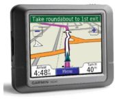
StreetPilot c530 comes ready to go right out of the box with preloaded City Navigator® NT street maps and a hefty points of interest (POIs) database, including motels, restaurants, fuel, ATMs and more. Simply touch the super-bright sunlight-readable color screen to enter a destination, and the c530 takes you there with 2D or 3D maps and turn-by-turn voice directions. In addition, the c530 accepts custom points of interest (POIs) such as school zones and safety cameras and lets you set proximity alerts to warn you of upcoming POIs.Minimize


Garmin GPS 76


The GPS 76 is designed to provide precise GPS positioning using correction data obtained from the Wide Area Augmentation System (WAAS). This unit features a built-in quad helix antenna for superior reception and can provide position accuracy to less than three meters when receiving WAAS corrections.The GPS 76 provides 1 megabyte of internal user memory to be used for storing downloaded Points of Interest data. This 1 megabyte of storage area is preloaded from the factory with worldwide cities (populations greater than 200,000) and nautical navigation aids such as lights, buoys, sound signals and day beacons, and is perfect for downloading points of interest detail from GARMIN's line of MapSource CD-ROMs. The GPS 76 is also preloaded with tide data for the United States.Minimize


Dual Electronics XNAV3550


The Dual XNA3550 features an easy to use touch screen graphic interface with MP3 playback capability. Turn-by-turn instructions with voice guidance. Visual left/right LED indicators. 3D Map view. Level selectable map view. Start route guidance search by:- Address/intersection- Points of interest- Address book- Recent destination. GPS status indicator.Minimize