Products reviews

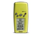
Garmin Geko 201

$90.00 to $140.00


With its distinctive canopy-green case, the powerful Geko 201 from Garmin(r) allows more waypoint and route storage, as well as available PC and external power connectivity, and built-in WAAS capability. In addition, the Geko 201 boasts a user-configurable trip computer, 10,000 trackpoints, a new upcoming-turn feature, as well as PanTrack(tm) and TracBack(r).Minimize

Manufacturer:Garmin Product MPNKey FeaturesDisplayTechnical FeaturesOther FeaturesGPS SystemBatteryWarrantyDimensionsMiscellaneous
MPN010-00318-00
GPS Type   Handheld (Outdoor)
Form FactorHandheld
Enhanced accuracyWAAS enabled
Input Method   Keypad
Receiver Type12 Channels
Screen Size1.7 in.
Display Size0.92 in. x 1.44 in.
Display Type4 Level Grayscale LCD Display
Resolutions64 X 100
Special Features   Waypoint Icons
Trip calculator   Maximum speed, Odometer, Current speed, Trip Timers, Time of sunrise/sunset, Track Log
Grids   Lat/Lon, MGRS, UTM, Maidenhead
PC InterfaceSerial RS-232, NMEA-0183
Environmental ProtectionIPX7 Waterproof Standard
AntennaBuilt-in
Accuisition Time - Cold45 sec
Accuisition Time - Initial Time15 sec
Update rate1 per second, continuous
Max. Horizontal accuracy   Enhanced position accuracy Differential standardsDGPS Ready
Number of routes20
Waypoints   500
Battery Type and Quantity2 x AAA Batteries
Battery Life12 Hours
Warranty1 Year
Width1.9 in.
Depth0.96 in.
Height3.9 in.
Weight0.14 lb.
Family LineGarmin Geko
UPC753759042066


Tags:

garmin, geko, 201,

DeLorme Earthmate

$142.00 to $550.00


Never Get Lost Again When was the last time you wasted valuable travel time because you took a wrong turn in an unfamiliar location? Now there's an affordable and reliable solution - the new Earthmate GPS receiver. The small and flexible Earthmate GPS receiver is a high-performance, easy-to-use link to the satellite navigation technology of the Global Positioning System (GPS). Accessing these satellites is available for no additional charge. Earthmate, connected to a USB laptop PC, shows your real-time position on detailed Street Atlas USA maps anywhere in the U.S. (software included). You will always know where you are and where you need to go.Minimize

Manufacturer:DeLorme Product MPNKey FeaturesTechnical FeaturesOther FeaturesGPS SystemDimensions
MPNAE-006761-201
GPS Type   Automobile
Form FactorWireless Receiver Module
Map capabilities   Internal
Enhanced accuracyWAAS enabled
Receiver Type12 Channels
Included Software/Maps   USA Maps
PC InterfaceUSB
Accuisition Time - Cold45 sec
Max. Horizontal accuracy   Enhanced position accuracyPDA Features
Compatible PDA OSWindows XP, Windows 2000, Windows ME, Windows 98SE
Compatible DevicesNotebook
Width1.88 in.
Height2.09 in.


Tags:

delorme, earthmate,

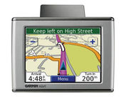
Garmin nüvi 350

$185.00 to $410.00


Sleek and portable, the Garmin nuvi 350 comes preloaded with City Navigator NT street maps that highlight countless points of interest including hotels, restaurants, gas stations, ATMs and much more. A simple touch-screen interface allows you to quickly pull up 2-D or 3-D maps, and with turn-by-turn voice directions, you’ll never have to take your eyes off the road to get your bearings. The nuvi 350 also includes MP3 playback, a JPEG picture viewer, currency converters, and a host of other travel handy applications.Minimize

Manufacturer:Garmin Product MPNKey FeaturesDisplayTechnical FeaturesOther FeaturesGPS SystemWarrantyDimensionsMiscellaneous
MPNNUVI350NOH
GPS Type   Automobile
Form FactorHandheld, Fixed
Map capabilities   Internal, Map cartridges / Data cards
Enhanced accuracyWAAS enabled
Input Method   Touch Screen
Screen Size3.5 in.
Display Size2.8 in. x 2.1 in.
Display TypeLCD TFT Display
Resolutions320 X 240
Special Features   MP3 Player, 3D Map View
Audible Features   Voice Navigation Instructions
Trip calculator   Maximum speed, Elevation Computer, Detour Feature, Points-of-Interest (POI)
Included Software/Maps   North America Maps, Canada Maps, Europe Maps
PC InterfaceUSB
Built in memory700 MB
Expansion Slot TypeSD (Secure Digital) Card Slot
AntennaFlip-up
Accuisition Time - Cold38 sec
Accuisition Time - Initial Time1 sec
Max. Horizontal accuracy   Enhanced position accuracyBattery
Battery Type and QuantityProprietary Lithium
Battery Life8 Hours
Warranty1 Year
Width3.87 in.
Depth0.87 in.
Height2.91 in.
Weight0.32 lb.
UPC753759077174


Tags:

garmin, nvi, 350,


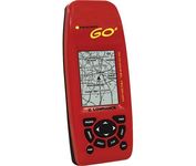
Lowrance iFINDER GO2


Just grab this bright yellow handheld iFINDER Go 64MB GPS and go, go, go. It's easy to use, waterproof, has a 2.2 diagonal Film SuperTwist display with backlighting and a built-in 64MB background map with coverage of the continental U.S. and Hawaii. The GPS also includes up to 1,000 waypoints, 1,000 event markers and 100 routes; up to 100 retraceable plot trails and up to 10,000 points in any trail; 30+ map zoom ranges and 42 graphic icons to mark spots.Minimize


Garmin nuvi 255W
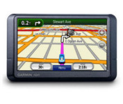

Go wide and get peace of mind with nuvi 255W. This affordable, widescreen navigator leads the way with voice-prompted turn-by-turn directions that speak street names and optional MSN Direct® services to get you there on time and keep you informed. It's packed with millions of destinations and maps for North America or Europe. Like the rest of the sleek nüvi 2x5-series, this portable navigator is priced right and ultra-easy to use.Minimize


Magellan Maestro 3100
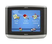

Magellan Maestro 3100 offers simple, sophisticated GPS navigation that's remarkably affordable. The most intuitive graphical 3.5" touch-screen interface available makes navigation easy. Enter virtually any destination and get turn-by-turn voice guidance to locations all over the contiguous United States. Smart touch-icons and Magellan's unique QuickSpell function enable error-free spelling, minimizing steps, so you get a customized route to your destination with just a few touches of the screen. Hundreds of thousands of preprogrammed points of interest make it easy to find restaurants, gas stations, ATM and more. Minimize


Garmin eTrex Summit


The eTrex Summit comes on the heels of the extremely popular eTrex, which was designed for both marine and recreation use. This new all-in-one navigation device for the outdoor enthusiast is the first combination GPS, altimeter, and electronic compass. The electronic compass provides bearing information when you're standing still and the altimeter determines precise altitude, so you can tell how high you've climbed and your rate of ascent. Like its predecessor, the eTrex Summit boasts a powerful 12 parallel channel GPS receiver and comes packaged in a small, sleek case with operating buttons located on either side of the unit. The case is completely waterproof to withstand immersion in one meter of water for up to 30 minutes.Minimize