Products reviews

Lowrance iFINDER Hunt C

$445.00 to $590.00


The handheld mapping GPS designed by hunters for hunters lets you follow the big game in color with 16-channel GPS precision. The iFINDER® Hunt C with color display offers everything you'd expect in a versatile, precision mapping GPS unit made for the field, including hunting-specific icons, unique "Scout Mode", electronic compass, barometric altimeter, built-in microphone, and more.Minimize

Manufacturer:Lowrance Product MPNKey FeaturesDisplayTechnical FeaturesOther FeaturesGPS SystemBatteryWarrantyDimensionsMiscellaneous
MPN112-73
GPS Type   Handheld (Outdoor)
Form FactorHandheld
Map capabilities   Internal, Map cartridges / Data cards
Enhanced accuracyWAAS enabled, EGNOS enabled
Input Method   Keypad
Receiver Type16 Channels
Display Size2.62 in.
Display Type256 Color LCD TFT Display
Resolutions240 X 160
Marine FeaturesMOB (Man Over Board)
Special Features   Waypoint Icons, Compass, Built-In Barometer, Built-In Altimeter, MP3 Player, Voice Recorder
Included Software/Maps   USA Maps, Hawaii
Grids   Irish, WGS 84
PC InterfaceNMEA-0183
Environmental ProtectionIPX7 Waterproof Standard
Expansion Slot TypeSD (Secure Digital) Card Slot, MultiMediaCard (MMC) slot
AntennaExternal Antenna Hookup
Update rate1 per second, continuous
Enhanced position accuracy Number of routes100
Waypoints   2000
Battery Type and Quantity2 x AA Batteries
Battery Life16 Hours
Warranty1 Year
Width2.5 in.
Depth1.2 in.
Height5.6 in.
Weight0.54 lb.
Family LineLowrance iFINDER
UPC042194524757


Tags:

lowrance, ifinder, hunt, c,

Garmin GPSMAP 440s

$437.00 to $1,032.00


Offshore fishermen and boaters will gravitate toward this sleek, space-saving chartplotter. The GPSMAP 440 features preloaded detailed maps for the U.S. coast as well as an ultra-bright 4” QVGA display; built-in, satellite-enhanced worldwide basemap and simplified user operation.

Manufacturer:Garmin Product MPNKey FeaturesDisplayTechnical FeaturesOther FeaturesGPS SystemWarrantyDimensionsMiscellaneous
MPN010-00516-44
GPS Type   Marine
Form FactorFixed
Map capabilities   Internal, Map cartridges / Data cards
Enhanced accuracyWAAS enabled, EGNOS enabled
Input Method   Keypad
Receiver Type12 Channels
Screen Size4 in.
Display Size2.4 in. x 3.2 in.
Display TypeLCD Display
Resolutions240 X 320
Marine FeaturesTide Prediction, Split Screen, Water Temp. Sensor, Depth Display, Chart Plotter, Sonar / Sounder, MOB (Man Over Board)
Audible Features   Anchor Alarm, Arrival Alarm, Clock Alarm, Accuracy Alarm, Fish Alarm, Shallow/Deep Alarm, Low Battary/Voltage Alarm, Water Temperature Alarm
Trip calculator   Route Recalculation, Trip Timers, Points-of-Interest (POI)
Included Software/Maps   Marine Cartography
PC InterfaceNMEA-0183
Environmental ProtectionIPX7 Waterproof Standard
Expansion Slot TypeSD (Secure Digital) Card Slot
AntennaBuilt-in, External Antenna Hookup
Accuisition Time - Cold45 sec
Accuisition Time - Initial Time15 sec
Update rate1 per second, continuous
Waypoints   1500
Warranty1 Year
Width5.7 in.
Depth2.7 in.
Height5 in.
Weight1.3 lb.
Family LineGarmin GPSMAP
UPC753759065836


Tags:

garmin, gpsmap, 440s,

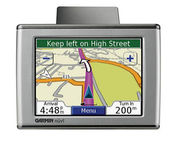
Garmin nüvi 350

$185.00 to $410.00


Sleek and portable, the Garmin nuvi 350 comes preloaded with City Navigator NT street maps that highlight countless points of interest including hotels, restaurants, gas stations, ATMs and much more. A simple touch-screen interface allows you to quickly pull up 2-D or 3-D maps, and with turn-by-turn voice directions, you’ll never have to take your eyes off the road to get your bearings. The nuvi 350 also includes MP3 playback, a JPEG picture viewer, currency converters, and a host of other travel handy applications.Minimize

Manufacturer:Garmin Product MPNKey FeaturesDisplayTechnical FeaturesOther FeaturesGPS SystemWarrantyDimensionsMiscellaneous
MPNNUVI350NOH
GPS Type   Automobile
Form FactorHandheld, Fixed
Map capabilities   Internal, Map cartridges / Data cards
Enhanced accuracyWAAS enabled
Input Method   Touch Screen
Screen Size3.5 in.
Display Size2.8 in. x 2.1 in.
Display TypeLCD TFT Display
Resolutions320 X 240
Special Features   MP3 Player, 3D Map View
Audible Features   Voice Navigation Instructions
Trip calculator   Maximum speed, Elevation Computer, Detour Feature, Points-of-Interest (POI)
Included Software/Maps   North America Maps, Canada Maps, Europe Maps
PC InterfaceUSB
Built in memory700 MB
Expansion Slot TypeSD (Secure Digital) Card Slot
AntennaFlip-up
Accuisition Time - Cold38 sec
Accuisition Time - Initial Time1 sec
Max. Horizontal accuracy   Enhanced position accuracyBattery
Battery Type and QuantityProprietary Lithium
Battery Life8 Hours
Warranty1 Year
Width3.87 in.
Depth0.87 in.
Height2.91 in.
Weight0.32 lb.
UPC753759077174


Tags:

garmin, nvi, 350,


Garmin Rino 110


The Rino 110 is a GPS-enabled handheld that integrates radio functionality to provide two-way communications. It's waterproof, can send communications up to five miles (using GMRS channels), and can "beam" your exact location to another Rino user within a two-mile range (on the FRS spectrum) using "Position Reporting". And because the Rino 110 has standard FRS capabilities, you can talk to friends or family who own conventional FRS radios.The Rino 110 has a built-in city point data base, with 1 MB of internal memory for additional points-of-interest data that can be downloaded from a MapSource Points of Interest CD-ROM.Minimize


Garmin Rino 530


No matter where your outdoor activities take you, the Rino® 530 keeps you on track and in touch. Similar to the 520, this rugged, two-way radio with GPS packs a bold color display, 14-mile communication range, and turn-by-turn directions - giving you peace of mind in the great outdoors. Taking it a step further, the Rino 530 adds an electronic compass, barometric altimeter, and NOAA weather receiver, making it a favorite with hikers and climbers.Minimize


Garmin Forerunner 101
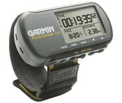

The Forerunner 101 offers athletes and recreational walkers and runners an entry-level personal training device with GPS. It has the same features as the Forerunner 201, but operates on two AAA batteries. The Forerunner 101 stores lap histories for up to two years to provide an archive of workout performance over time. Users can retrieve lap data for previous workouts by date, week, month, or over a specific time interval. For business travelers who want to train on the road, the Forerunner 101 also doubles as a navigator. Users can mark their hotel as a specific location, see their current position on the plotter display, and follow an electronic breadcrumb trail back to their starting point.Minimize


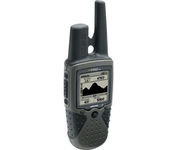
Garmin Rino 130

The Rino 130 is the most feature-rich unit in the Rino family with a built-in electronic compass barometric sensor weather receiver for seven NOAA weather channels and 24 MBs of internal memory This handheld radio has a built-in electronic compass to give a heading while the user is standing still and a barometric altimeter to provide extremely accurate elevation and pressure information which will assist users in identifying weather data The Rino 130 provides two-way radio communication with a transmission range of up to two miles using FRS channels and up to five miles with GMRS The integration of two-way radio and GPS enables users to transmit their position with a simple button press allowing others to navigate to their position The Rino 130 also has a polling feature which allows a user to manually request GPS location information from other Rino unitsMinimize