Products reviews

Lowrance iFINDER Hunt C

$445.00 to $590.00


The handheld mapping GPS designed by hunters for hunters lets you follow the big game in color with 16-channel GPS precision. The iFINDER® Hunt C with color display offers everything you'd expect in a versatile, precision mapping GPS unit made for the field, including hunting-specific icons, unique "Scout Mode", electronic compass, barometric altimeter, built-in microphone, and more.Minimize

Manufacturer:Lowrance Product MPNKey FeaturesDisplayTechnical FeaturesOther FeaturesGPS SystemBatteryWarrantyDimensionsMiscellaneous
MPN112-73
GPS Type   Handheld (Outdoor)
Form FactorHandheld
Map capabilities   Internal, Map cartridges / Data cards
Enhanced accuracyWAAS enabled, EGNOS enabled
Input Method   Keypad
Receiver Type16 Channels
Display Size2.62 in.
Display Type256 Color LCD TFT Display
Resolutions240 X 160
Marine FeaturesMOB (Man Over Board)
Special Features   Waypoint Icons, Compass, Built-In Barometer, Built-In Altimeter, MP3 Player, Voice Recorder
Included Software/Maps   USA Maps, Hawaii
Grids   Irish, WGS 84
PC InterfaceNMEA-0183
Environmental ProtectionIPX7 Waterproof Standard
Expansion Slot TypeSD (Secure Digital) Card Slot, MultiMediaCard (MMC) slot
AntennaExternal Antenna Hookup
Update rate1 per second, continuous
Enhanced position accuracy Number of routes100
Waypoints   2000
Battery Type and Quantity2 x AA Batteries
Battery Life16 Hours
Warranty1 Year
Width2.5 in.
Depth1.2 in.
Height5.6 in.
Weight0.54 lb.
Family LineLowrance iFINDER
UPC042194524757


Tags:

lowrance, ifinder, hunt, c,

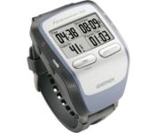
Garmin Forerunner 205

$128.00 to $413.00


The Forerunner 205 sports a unique design that wraps the GPS antenna around part of the wrist for a better view of the sky, and its high sensitivity GPS receiver can track under trees and near tall buildings.

Manufacturer:Garmin Product MPNKey FeaturesDisplayTechnical FeaturesOther FeaturesGPS SystemBatteryWarrantyDimensionsMiscellaneous
MPN010-00466-00
GPS Type   Handheld (Outdoor)
Form FactorHandheld
Input Method   Keypad
Screen Size1.5 in.
Display Size1.3 in. x 0.8 in.
Display TypeLCD Display
Resolutions160 X 100
Special Features   Training Computer, 3D Map View
Trip calculator   Maximum speed, Current speed, Trip Timers, Elevation Computer, Time of sunrise/sunset
PC InterfaceUSB
Environmental ProtectionIPX7 Waterproof Standard
AntennaBuilt-in
Accuisition Time - Cold45 sec
Accuisition Time - Initial Time38 sec
Accuisition Time - Hot1 sec
Update rate1 per second, continuous
Max. Horizontal accuracy   Number of routes50
Waypoints   100
Battery Type and QuantityProprietary Lithium
Battery Life10 Hours
Warranty1 Year
Width2.1 in.
Depth2.7 in.
Height0.7 in.
Weight0.17 lb.
Family LineGarmin Forerunner
UPC753759051914


Tags:

garmin, forerunner, 205,

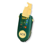
Acr Electronics TerraFix 406

$234.00 to $487.00


Accidents happen every day in the outdoors, whether you fall out of a tree stand, break a leg during a hike, or roll over on an ATV. In the outdoors, an every day accident instantly can become a life threatening situation, and rescues may take days or weeks if you’re not prepared.

Manufacturer:Acr Electronics Product MPNKey FeaturesDimensionsMiscellaneous
MPN210218942
GPS Type   Automobile
Form FactorWireless Receiver Module
Weight0.83 lb.
UPC791659001806


Tags:

acr, electronics, terrafix, 406,


Garmin Forerunner 101


The Forerunner 101 offers athletes and recreational walkers and runners an entry-level personal training device with GPS. It has the same features as the Forerunner 201, but operates on two AAA batteries. The Forerunner 101 stores lap histories for up to two years to provide an archive of workout performance over time. Users can retrieve lap data for previous workouts by date, week, month, or over a specific time interval. For business travelers who want to train on the road, the Forerunner 101 also doubles as a navigator. Users can mark their hotel as a specific location, see their current position on the plotter display, and follow an electronic breadcrumb trail back to their starting point.Minimize


Garmin StreetPilot c550


From Garmin, the leader in portable GPS solutions, the StreetPilot c550 is easy to use, and rich with features. The StreetPilot c550 comes preloaded with City Navigator NT street maps and includes a large database of points of interest including motels, restaurants, gas stations, and grocery stores. The simple touch screen interface gives you excellent control over menus and settings, and with Bluetooth support, you can even use the c550 for hands-free calling using the built-in speaker and microphone.Minimize


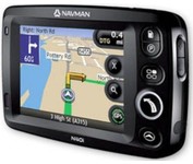
Navman iCN 510


Transferable from car-to-car in seconds, the easy-to-use iCN510 can effortlessly guide drivers to their desired destination using accurate and clear turn-by-turn voice instructions and 3D-map view. Users can also now Drive Away this compact and sleek system straight from the box, with software applications and complete U.K. street-level mapping loaded on a single memory card. The iCN510 incorporates Version 3.0 of Navmans award winning SmartST software, which includes new features such as My POI customable points of interest with approach notification settings, multiple destinations for planning trips with several stops along the way, and a nearest POI search facility.Minimize


Garmin Rino 130


The Rino 130 is the most feature-rich unit in the Rino family with a built-in electronic compass barometric sensor weather receiver for seven NOAA weather channels and 24 MBs of internal memory This handheld radio has a built-in electronic compass to give a heading while the user is standing still and a barometric altimeter to provide extremely accurate elevation and pressure information which will assist users in identifying weather data The Rino 130 provides two-way radio communication with a transmission range of up to two miles using FRS channels and up to five miles with GMRS The integration of two-way radio and GPS enables users to transmit their position with a simple button press allowing others to navigate to their position The Rino 130 also has a polling feature which allows a user to manually request GPS location information from other Rino unitsMinimize