Interphase Corporation Chart Master V6i$531.00 to $573.00

One of the first things a boater will notice about the Chart Master V6 series is their vertically oriented high-definition (234x320 pixel) six-inch super-bright color LCD displays. They provide clear visibility even in full sunlight, and the Chart Master V6I, with it's built-in GPS antenna is a great choice for boats with open cockpits, center consoles and flying bridges and can serve well as a back-up unitMinimize
Manufacturer:Interphase Corporation Product MPN MPN | U1CHRTV6I | Key Features GPS Type | Marine | Form Factor | Fixed | Map capabilities | Internal, Map cartridges / Data cards | Enhanced accuracy | WAAS enabled | Input Method | Keypad, Thumb Stick | Receiver Type | 12 Channels | Display Display Size | 5.7 in. | Display Type | 256 Color LCD TFT Display | Resolutions | 234 X 320 | Technical Features Marine Features | Tide Prediction, Depth Display, Chart Plotter, Sonar / Sounder, MOB (Man Over Board) | Special Features | Waypoint Icons, Compass | Audible Features | Shallow/Deep Alarm | Included Software/Maps | Marine Cartography | Grids | Lat/Lon | Other Features PC Interface | USB, NMEA-0183, NMEA-0180 | Antenna | Built-in | GPS System Accuisition Time - Cold | 45 sec | Accuisition Time - Hot | 8 sec | Update rate | 1 per second, continuous | Enhanced position accuracy | | Number of routes | 25 | Waypoints | 500 | Warranty Warranty | 5 Years | Dimensions Width | 3.38 in. | Depth | 2 in. | Height | 4.5 in. | Weight | 2 lb. | Miscellaneous UPC | 027037002692 |
Tags:interphase, corporation, chart, master, v6i,
| Garmin GPSMAP 276C$615.00 to $1,000.00
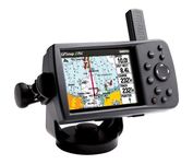
This portable GPS navigator features a 256-color TFT display that's easy to read in bright sun along with a built-in basemap and auto routing to provide you with turn-by-turn directions to the marina for a day of boating.
Manufacturer:Garmin Product MPN MPN | 010-00331-00 | Key Features GPS Type | Automobile | Form Factor | Fixed | Map capabilities | Internal, Map cartridges / Data cards | Enhanced accuracy | WAAS enabled | Input Method | Keypad | Receiver Type | 12 Channels | Display Display Size | 3.8 in. | Display Type | 256 Color LCD TFT Display | Resolutions | 480 X 320 | Technical Features Marine Features | Chart Plotter | Audible Features | Proximity Alarm, Anchor Alarm, Arrival Alarm, Off-Course Alarm, Clock Alarm | Trip calculator | Points-of-Interest (POI) | Included Software/Maps | North America Maps, Canada Maps, Europe Maps | Grids | Lat/Lon, MGRS, User Grid, UTM, Loran TD position format, Maidenhead | Other Features PC Interface | USB | Environmental Protection | IPX7 Waterproof Standard | Antenna | Quadrifilar Helix | GPS System Accuisition Time - Cold | 45 sec | Accuisition Time - Initial Time | 15 sec | Update rate | 1 per second, continuous | Max. Horizontal accuracy | | Enhanced position accuracy | | Differential standards | DGPS Ready | Number of routes | 50 | Waypoints | 3000 | Battery Battery Type and Quantity | Proprietary Lithium | Battery Life | 15 Hours | Warranty Warranty | 1 Year | Dimensions Width | 5.7 in. | Depth | 1.9 in. | Height | 3.2 in. | Weight | 0.85 lb. | Miscellaneous Family Line | Garmin GPSMAP | UPC | 839438266340 |
Tags:garmin, gpsmap, 276c,
| Garmin StreetPilot i5$181.00 to $450.00

It may be tiny, but the StreetPilot i5 is packed with state-of-the-art navigation features. The StreetPilot i5 comes preloaded with incredibly detailed City Navigator NT street maps that are packed with nearly 6 million points of interest including hotels, restaurants, ATMs and much more. A simple rolling-wheel interface allows you to quickly adjust settings and alter routes to your destination. Built for portability and power, the StreetPilot i5 is a cost effective portable GPS solution. Minimize
Manufacturer:Garmin Product MPN MPN | SPI5 | Key Features GPS Type | Automobile | Form Factor | Handheld | Enhanced accuracy | WAAS enabled | Receiver Type | 12 Channels | Screen Size | 2.1 in. | Display Display Size | 1.7 in. x 1.3 in. | Display Type | 32k Colors LCD TFT Display | Resolutions | 220 x 176 | Technical Features Audible Features | Voice Navigation Instructions | Trip calculator | Detour Feature, Points-of-Interest (POI) | Other Features PC Interface | USB | Battery Battery Type and Quantity | 2 x AA Batteries | Battery Life | 7 Hours | Dimensions Width | 3 in. | Depth | 2.15 in. | Height | 2.74 in. | Weight | 0.32 lb. | Miscellaneous Family Line | Garmin StreetPilot | UPC | 840356505404 |
Tags:garmin, streetpilot, i5,
|
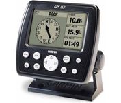
The GPS 152 is a 12 parallel channel GPS receiver loaded with a database of American cities and nautical navigation aids such as lights, buoys, sound signals, day beacons and tide data. Built-in memory of one megabyte makes the GPS 152 compatible with GARMIN's MapSource Points of Interest CD. With this CD and the GPS 152, you add additional marine navaid detail to your unit.In addition to larger memory, the GPS 152 is compatible with the Wide Area Augmentation System (WAAS), a technology designed to improve the accuracy of GPS positioning to about three meters.On the outside, the GPS 152 comes housed in a waterproof case that's about four inches high and five inches wide. A large four-inch diagonal, high-contrast display features 100x160 pixels for the ultimate in readability. A simple keypad at the bottom of the unit makes entering information easy, without blocking your view of the display.Minimize
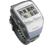
The Forerunner 205 sports a unique design that wraps the GPS antenna around part of the wrist for a better view of the sky, and its high sensitivity GPS receiver can track under trees and near tall buildings.
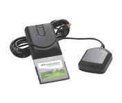
The AmbiCom GPS Navigation Receiver CompactFlash Card is the Global Positioning System Receiver for your mobile device and the perfect accessory to your Pocket PC device. The GPS Navigation Receiver comes with a full feature 30-day trial version software that is loaded with fantastic features such as dynamic voice navigation, off-route warning, and detailed street maps. Now you can turn your Pocket PC into a true GPS navigation system and never worry about getting lost!Minimize

Rugged, lightweight Edge attaches easily to the stem or handlebars of your bike with the included bike mount. Just turn it on, acquire GPS satellites and go. Edge 305 automatically measures your speed, distance, time, calories burned, altitude, climb and descent, and also records the route you have taken for review. For extra-precise climb and descent data, Edge 305 also incorporates a barometric altimeter to pinpoint changes in elevation.Minimize