Products reviews

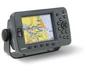
Interphase Corporation Chart Master V6i

$531.00 to $573.00


One of the first things a boater will notice about the Chart Master V6 series is their vertically oriented high-definition (234x320 pixel) six-inch super-bright color LCD displays. They provide clear visibility even in full sunlight, and the Chart Master V6I, with it's built-in GPS antenna is a great choice for boats with open cockpits, center consoles and flying bridges and can serve well as a back-up unitMinimize

Manufacturer:Interphase Corporation Product MPNKey FeaturesDisplayTechnical FeaturesOther FeaturesGPS SystemWarrantyDimensionsMiscellaneous
MPNU1CHRTV6I
GPS Type   Marine
Form FactorFixed
Map capabilities   Internal, Map cartridges / Data cards
Enhanced accuracyWAAS enabled
Input Method   Keypad, Thumb Stick
Receiver Type12 Channels
Display Size5.7 in.
Display Type256 Color LCD TFT Display
Resolutions234 X 320
Marine FeaturesTide Prediction, Depth Display, Chart Plotter, Sonar / Sounder, MOB (Man Over Board)
Special Features   Waypoint Icons, Compass
Audible Features   Shallow/Deep Alarm
Included Software/Maps   Marine Cartography
Grids   Lat/Lon
PC InterfaceUSB, NMEA-0183, NMEA-0180
AntennaBuilt-in
Accuisition Time - Cold45 sec
Accuisition Time - Hot8 sec
Update rate1 per second, continuous
Enhanced position accuracy Number of routes25
Waypoints   500
Warranty5 Years
Width3.38 in.
Depth2 in.
Height4.5 in.
Weight2 lb.
UPC027037002692


Tags:

interphase, corporation, chart, master, v6i,

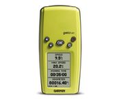
Garmin Geko 201

$90.00 to $140.00


With its distinctive canopy-green case, the powerful Geko 201 from Garmin(r) allows more waypoint and route storage, as well as available PC and external power connectivity, and built-in WAAS capability. In addition, the Geko 201 boasts a user-configurable trip computer, 10,000 trackpoints, a new upcoming-turn feature, as well as PanTrack(tm) and TracBack(r).Minimize

Manufacturer:Garmin Product MPNKey FeaturesDisplayTechnical FeaturesOther FeaturesGPS SystemBatteryWarrantyDimensionsMiscellaneous
MPN010-00318-00
GPS Type   Handheld (Outdoor)
Form FactorHandheld
Enhanced accuracyWAAS enabled
Input Method   Keypad
Receiver Type12 Channels
Screen Size1.7 in.
Display Size0.92 in. x 1.44 in.
Display Type4 Level Grayscale LCD Display
Resolutions64 X 100
Special Features   Waypoint Icons
Trip calculator   Maximum speed, Odometer, Current speed, Trip Timers, Time of sunrise/sunset, Track Log
Grids   Lat/Lon, MGRS, UTM, Maidenhead
PC InterfaceSerial RS-232, NMEA-0183
Environmental ProtectionIPX7 Waterproof Standard
AntennaBuilt-in
Accuisition Time - Cold45 sec
Accuisition Time - Initial Time15 sec
Update rate1 per second, continuous
Max. Horizontal accuracy   Enhanced position accuracy Differential standardsDGPS Ready
Number of routes20
Waypoints   500
Battery Type and Quantity2 x AAA Batteries
Battery Life12 Hours
Warranty1 Year
Width1.9 in.
Depth0.96 in.
Height3.9 in.
Weight0.14 lb.
Family LineGarmin Geko
UPC753759042066


Tags:

garmin, geko, 201,

Garmin GPSMAP 3205

$520.00 to $1,095.00


Plug into the power of the Garmin Marine network with the Garmin 3200 series. Rugged, waterproof, and easy to install, these chartplotters come preloaded with Garmin's detail-rich marine cartography utilizing BlueChart® g2 technology.

Manufacturer:Garmin Product MPNKey FeaturesDisplayTechnical FeaturesOther FeaturesGPS SystemWarrantyDimensionsMiscellaneous
MPN010-00526-00
GPS Type   Marine
Form FactorFixed
Map capabilities   Internal, Map cartridges / Data cards
Enhanced accuracyWAAS enabled
Input Method   Keypad
Receiver Type12 Channels
Display Size5 in.
Display Type256 Color LCD TFT Display
Resolutions640 X 480
Marine FeaturesChart Plotter
Special Features   3D Map View
Audible Features   Proximity Alarm, Anchor Alarm, Arrival Alarm, Off-Course Alarm, Clock Alarm, Low Battary/Voltage Alarm
Included Software/Maps   Marine Cartography
PC InterfaceNMEA-0183
Environmental ProtectionIPX7 Waterproof Standard
Accuisition Time - Cold45 sec
Accuisition Time - Initial Time15 sec
Update rate1 per second, continuous
Max. Horizontal accuracy   Enhanced position accuracy Differential standardsDGPS Ready
Number of routes50
Waypoints   4000
Warranty1 Year
Width7.8 in.
Depth3 in.
Height4.7 in.
Weight1.8 lb.
Family LineGarmin GPSMAP
UPC753759053048


Tags:

garmin, gpsmap, 3205,


Garmin Rino 110


The Rino 110 is a GPS-enabled handheld that integrates radio functionality to provide two-way communications. It's waterproof, can send communications up to five miles (using GMRS channels), and can "beam" your exact location to another Rino user within a two-mile range (on the FRS spectrum) using "Position Reporting". And because the Rino 110 has standard FRS capabilities, you can talk to friends or family who own conventional FRS radios.The Rino 110 has a built-in city point data base, with 1 MB of internal memory for additional points-of-interest data that can be downloaded from a MapSource Points of Interest CD-ROM.Minimize


Garmin GPSMAP 440s


Offshore fishermen and boaters will gravitate toward this sleek, space-saving chartplotter. The GPSMAP 440 features preloaded detailed maps for the U.S. coast as well as an ultra-bright 4” QVGA display; built-in, satellite-enhanced worldwide basemap and simplified user operation.


Garmin GPS 76


The GPS 76 is designed to provide precise GPS positioning using correction data obtained from the Wide Area Augmentation System (WAAS). This unit features a built-in quad helix antenna for superior reception and can provide position accuracy to less than three meters when receiving WAAS corrections.The GPS 76 provides 1 megabyte of internal user memory to be used for storing downloaded Points of Interest data. This 1 megabyte of storage area is preloaded from the factory with worldwide cities (populations greater than 200,000) and nautical navigation aids such as lights, buoys, sound signals and day beacons, and is perfect for downloading points of interest detail from GARMIN's line of MapSource CD-ROMs. The GPS 76 is also preloaded with tide data for the United States.Minimize


Lowrance iFINDER GO2
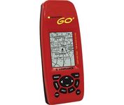

Just grab this bright yellow handheld iFINDER Go 64MB GPS and go, go, go. It's easy to use, waterproof, has a 2.2 diagonal Film SuperTwist display with backlighting and a built-in 64MB background map with coverage of the continental U.S. and Hawaii. The GPS also includes up to 1,000 waypoints, 1,000 event markers and 100 routes; up to 100 retraceable plot trails and up to 10,000 points in any trail; 30+ map zoom ranges and 42 graphic icons to mark spots.Minimize