Products reviews

Garmin GPSMAP 440s

$437.00 to $1,032.00


Offshore fishermen and boaters will gravitate toward this sleek, space-saving chartplotter. The GPSMAP 440 features preloaded detailed maps for the U.S. coast as well as an ultra-bright 4” QVGA display; built-in, satellite-enhanced worldwide basemap and simplified user operation.

Manufacturer:Garmin Product MPNKey FeaturesDisplayTechnical FeaturesOther FeaturesGPS SystemWarrantyDimensionsMiscellaneous
MPN010-00516-44
GPS Type   Marine
Form FactorFixed
Map capabilities   Internal, Map cartridges / Data cards
Enhanced accuracyWAAS enabled, EGNOS enabled
Input Method   Keypad
Receiver Type12 Channels
Screen Size4 in.
Display Size2.4 in. x 3.2 in.
Display TypeLCD Display
Resolutions240 X 320
Marine FeaturesTide Prediction, Split Screen, Water Temp. Sensor, Depth Display, Chart Plotter, Sonar / Sounder, MOB (Man Over Board)
Audible Features   Anchor Alarm, Arrival Alarm, Clock Alarm, Accuracy Alarm, Fish Alarm, Shallow/Deep Alarm, Low Battary/Voltage Alarm, Water Temperature Alarm
Trip calculator   Route Recalculation, Trip Timers, Points-of-Interest (POI)
Included Software/Maps   Marine Cartography
PC InterfaceNMEA-0183
Environmental ProtectionIPX7 Waterproof Standard
Expansion Slot TypeSD (Secure Digital) Card Slot
AntennaBuilt-in, External Antenna Hookup
Accuisition Time - Cold45 sec
Accuisition Time - Initial Time15 sec
Update rate1 per second, continuous
Waypoints   1500
Warranty1 Year
Width5.7 in.
Depth2.7 in.
Height5 in.
Weight1.3 lb.
Family LineGarmin GPSMAP
UPC753759065836


Tags:

garmin, gpsmap, 440s,

Lowrance iFINDER Hunt C

$445.00 to $590.00


The handheld mapping GPS designed by hunters for hunters lets you follow the big game in color with 16-channel GPS precision. The iFINDER® Hunt C with color display offers everything you'd expect in a versatile, precision mapping GPS unit made for the field, including hunting-specific icons, unique "Scout Mode", electronic compass, barometric altimeter, built-in microphone, and more.Minimize

Manufacturer:Lowrance Product MPNKey FeaturesDisplayTechnical FeaturesOther FeaturesGPS SystemBatteryWarrantyDimensionsMiscellaneous
MPN112-73
GPS Type   Handheld (Outdoor)
Form FactorHandheld
Map capabilities   Internal, Map cartridges / Data cards
Enhanced accuracyWAAS enabled, EGNOS enabled
Input Method   Keypad
Receiver Type16 Channels
Display Size2.62 in.
Display Type256 Color LCD TFT Display
Resolutions240 X 160
Marine FeaturesMOB (Man Over Board)
Special Features   Waypoint Icons, Compass, Built-In Barometer, Built-In Altimeter, MP3 Player, Voice Recorder
Included Software/Maps   USA Maps, Hawaii
Grids   Irish, WGS 84
PC InterfaceNMEA-0183
Environmental ProtectionIPX7 Waterproof Standard
Expansion Slot TypeSD (Secure Digital) Card Slot, MultiMediaCard (MMC) slot
AntennaExternal Antenna Hookup
Update rate1 per second, continuous
Enhanced position accuracy Number of routes100
Waypoints   2000
Battery Type and Quantity2 x AA Batteries
Battery Life16 Hours
Warranty1 Year
Width2.5 in.
Depth1.2 in.
Height5.6 in.
Weight0.54 lb.
Family LineLowrance iFINDER
UPC042194524757


Tags:

lowrance, ifinder, hunt, c,

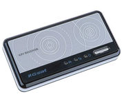
GlobalSat BT-359

$40.00 to $90.00


The GlobalSat BT-359 Bluetooth GPS receiver is our solution of the line Bluetooth GPS, which have both stylish and functional in true GlobalSat tradition. Taking its design criteria from the market leading BT-338 we have pushed the limits of GPS even further with greater sensitivity, more accuracy, and longer battery life than ever beforeMinimize

Manufacturer:GlobalSat Product MPNKey FeaturesOther FeaturesGPS SystemDimensionsMiscellaneous
MPNBT-359
GPS Type   Handheld (Outdoor)
Form FactorWireless Receiver Module
Enhanced accuracyWAAS enabled, EGNOS enabled
Receiver Type20 Channels
PC InterfaceNMEA-0183, Bluetooth
AntennaBuilt-in
Accuisition Time - Cold42 sec
Accuisition Time - Initial Time38 sec
Accuisition Time - Hot1 sec
Max. Horizontal accuracy   Battery
Battery Type and QuantityProprietary Lithium
Battery Life11 Hours
Width3.23 in.
Depth0.53 in.
Height1.61 in.
UPC4043619603046


Tags:

globalsat, bt-359,


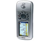
Garmin Rino 110


The Rino 110 is a GPS-enabled handheld that integrates radio functionality to provide two-way communications. It's waterproof, can send communications up to five miles (using GMRS channels), and can "beam" your exact location to another Rino user within a two-mile range (on the FRS spectrum) using "Position Reporting". And because the Rino 110 has standard FRS capabilities, you can talk to friends or family who own conventional FRS radios.The Rino 110 has a built-in city point data base, with 1 MB of internal memory for additional points-of-interest data that can be downloaded from a MapSource Points of Interest CD-ROM.Minimize


Garmin Rino 130


The Rino 130 is the most feature-rich unit in the Rino family with a built-in electronic compass barometric sensor weather receiver for seven NOAA weather channels and 24 MBs of internal memory This handheld radio has a built-in electronic compass to give a heading while the user is standing still and a barometric altimeter to provide extremely accurate elevation and pressure information which will assist users in identifying weather data The Rino 130 provides two-way radio communication with a transmission range of up to two miles using FRS channels and up to five miles with GMRS The integration of two-way radio and GPS enables users to transmit their position with a simple button press allowing others to navigate to their position The Rino 130 also has a polling feature which allows a user to manually request GPS location information from other Rino unitsMinimize


Garmin eTrex Legend


With the eTrex Legend, GARMIN has loaded a full basemap of North and South America into one small unit. The Legend is also designed to provide precise GPS positioning using correction data obtained from the Wide Area Augmentation System (WAAS). This product will provide position accuracy to less than three meters when receiving WAAS corrections.Minimize


Garmin GPSMAP 4212


This preloaded, offshore chartplotter combines the power of networking with brilliant color and slim-line design. The GPSMAP 4212 has preloaded BlueChart® g2 maps of the U.S. coast and displays them on a whopping 12.1” XGA display with crisp, video-quality resolution. By connecting to the Garmin Marine Network, you can add sonar, radar and weather. For even more enhanced features, you can add the optional Bluechart g2 Vision card.Minimize