Products reviews

Furuno GP37

$609.00 to $695.00


The new GP37 DGPS/WAAS Navigator is compact in size, yet big on power, features and performance. This waterproof unit is perfect for a wide range of boats. It is equipped with a WAAS and a DGPS receiver as standard supply. It utilizes both WAAS and differential radio beacon correction methods to give you the most accurate position fix available. The GP37 offers extremely accurate position fixes -- 10m for basic GPS, 5m or better with DGPS and 3m or better where WAAS service is available. It should be noted that DGPS is more reliable and accurate, as the WAAS system is still currently under development. There is no guarantee of accuracy, integrity, continuity or availability of the WAAS signal. For that reason, the GP37 runs with DGPS as the default setting in auto selection mode. In this mode, if the DGPS signal can not be received for any reason, the WAAS mode is automatically selected. Manual setting is also available. The display modes include Plotter, two Customizable displays, Steering, Highway and SpeedMinimize

Manufacturer:Furuno Product MPNKey FeaturesDisplayTechnical FeaturesOther FeaturesGPS SystemMiscellaneous
MPNGP37
GPS Type   Marine
Form FactorFixed
Enhanced accuracyWAAS enabled
Receiver Type12 Channels
Screen Size4.4 in.
Display Size3.74 in. x 2.36 in.
Display TypeLCD Display
Audible Features   Anchor Alarm, Arrival Alarm, Clock Alarm
Grids   Lat/Lon, Loran TD position format
PC InterfaceSerial RS-232
Accuisition Time - Initial Time20 sec
Max. Horizontal accuracy   Enhanced position accuracy Differential standardsDGPS Ready
Number of routes50
Waypoints   999
UPC611679266842


Tags:

furuno, gp37,

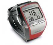
Garmin Forerunner 305

$147.00 to $390.00


Get the most out of your workouts with the Garmin Forerunner 305, a GPS personal trainer. Whether you’re going for a daily jog or training for a triathlon, the Forerunner 305 tracks and stores vital information that you can analyze on your computer with interactive graphs that chart your pace, time, distance traveled, and heart rate. Upload your information to MotionBased.com, Garmin’s web-based application that allows you to track your fitness statistics online, giving you the tools you need to take your training to the next level.Minimize

Manufacturer:Garmin Product MPNKey FeaturesDisplayTechnical FeaturesOther FeaturesGPS SystemWarrantyDimensionsMiscellaneous
MPN010-00467-02
GPS Type   Handheld (Outdoor)
Form FactorHandheld
Screen Size1.5 in.
Display Size1.3 in. x 0.8 in.
Display Type4 Level Grayscale LCD Display
Resolutions160 X 100
Special Features   Heart Rate Monitor, 3D Map View
Trip calculator   Trip Timers
PC InterfaceUSB
Environmental ProtectionIPX7 Waterproof Standard
AntennaBuilt-in
Accuisition Time - Cold45 sec
Accuisition Time - Initial Time38 sec
Accuisition Time - Hot1 sec
Update rate1 per second, continuous
Max. Horizontal accuracy   Battery
Battery Type and QuantityProprietary Lithium
Battery Life10 Hours
Warranty1 Year
Width2.1 in.
Depth2.7 in.
Height0.7 in.
Weight0.17 lb.
Family LineGarmin Forerunner
UPC740617010879


Tags:

garmin, forerunner, 305,

Furuno GP7000F NT

$1,689.00 to $2,637.00


The GP-7000F/NT is a GPS/WAAS plotter designed for a variety of vessels desiring video plotting and echo sounding capabilities. With the GP-7000 series, you can see the highly accurate position of your boat on the chart. The GP-7000 series has four display modes: Course Plot, Nav Data, Steering, and Highway modes. The course plot mode is useful for obtaining general information about surrounding sea areas. The Nav data mode clearly shows important navigational information with large text, which is easy to see even from a distance. The steering mode and highway mode assist the operator in following a predetermined route.Minimize

Manufacturer:Furuno Product MPNKey FeaturesDisplayTechnical FeaturesOther FeaturesGPS SystemDimensionsMiscellaneous
MPNGP7000FNT
GPS Type   Marine
Form FactorFixed
Map capabilities   Map cartridges / Data cards
Enhanced accuracyWAAS enabled
Display Size7 in.
Display TypeLCD TFT Display
Resolutions480 x 234
Marine FeaturesSplit Screen, Chart Plotter
Audible Features   Proximity Alarm, Arrival Alarm
Environmental ProtectionIPX5 Waterproof Standard, IPX6 Waterproof Standard
Expansion Slot TypeSD (Secure Digital) Card Slot
Accuisition Time - Initial Time12 sec
Max. Horizontal accuracy   Enhanced position accuracy Number of routes200
Waypoints   2000
Width10.2 in.
Depth3.2 in.
Height6.1 in.
UPC611679280558


Tags:

furuno, gp7000f, nt,


Garmin eTrex Summit


The eTrex Summit comes on the heels of the extremely popular eTrex, which was designed for both marine and recreation use. This new all-in-one navigation device for the outdoor enthusiast is the first combination GPS, altimeter, and electronic compass. The electronic compass provides bearing information when you're standing still and the altimeter determines precise altitude, so you can tell how high you've climbed and your rate of ascent. Like its predecessor, the eTrex Summit boasts a powerful 12 parallel channel GPS receiver and comes packaged in a small, sleek case with operating buttons located on either side of the unit. The case is completely waterproof to withstand immersion in one meter of water for up to 30 minutes.Minimize


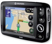
Navman iCN 510


Transferable from car-to-car in seconds, the easy-to-use iCN510 can effortlessly guide drivers to their desired destination using accurate and clear turn-by-turn voice instructions and 3D-map view. Users can also now Drive Away this compact and sleek system straight from the box, with software applications and complete U.K. street-level mapping loaded on a single memory card. The iCN510 incorporates Version 3.0 of Navmans award winning SmartST software, which includes new features such as My POI customable points of interest with approach notification settings, multiple destinations for planning trips with several stops along the way, and a nearest POI search facility.Minimize


Nextar X3B


The Nextar GPS X3B mobile navigation system assures that your days of getting lost are over! Finding an address or any of 1.6 million points of interest such as the nearest gas station or restaurant is a snap anywhere in the U.S. or Canada. Just enter information in the X3B's 3.5 inch touch screen and let the voice prompt and detailed map guide you to the destination. With the latest TTS (Text to Speech) function, street names are clrearly pronounced in English. The X3B's built in MP3 player will entertain you with your favorite tunes while en route. Just copy your favorite play list onto an SD card and insert into the slot. The X3B moves easily from car to car using the convenient vent mount. A recharageable lithium ion battery assures that the unit stays active. Other features of the X3B include built-in maps of the 50 United States and Canada, 1GB built in Flash Memory.Minimize


Garmin Rino 130


The Rino 130 is the most feature-rich unit in the Rino family with a built-in electronic compass barometric sensor weather receiver for seven NOAA weather channels and 24 MBs of internal memory This handheld radio has a built-in electronic compass to give a heading while the user is standing still and a barometric altimeter to provide extremely accurate elevation and pressure information which will assist users in identifying weather data The Rino 130 provides two-way radio communication with a transmission range of up to two miles using FRS channels and up to five miles with GMRS The integration of two-way radio and GPS enables users to transmit their position with a simple button press allowing others to navigate to their position The Rino 130 also has a polling feature which allows a user to manually request GPS location information from other Rino unitsMinimize