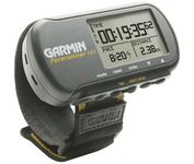
Garmin Forerunner 101$89.00 to $114.00

The Forerunner 101 offers athletes and recreational walkers and runners an entry-level personal training device with GPS. It has the same features as the Forerunner 201, but operates on two AAA batteries. The Forerunner 101 stores lap histories for up to two years to provide an archive of workout performance over time. Users can retrieve lap data for previous workouts by date, week, month, or over a specific time interval. For business travelers who want to train on the road, the Forerunner 101 also doubles as a navigator. Users can mark their hotel as a specific location, see their current position on the plotter display, and follow an electronic breadcrumb trail back to their starting point.Minimize
Manufacturer:Garmin Product MPN MPN | 010-00329-00 | Key Features GPS Type | Handheld (Outdoor) | Form Factor | Handheld | Receiver Type | 12 Channels | Screen Size | 1.7 in. | Display Display Size | 1.5 in. x 0.9 in. | Display Type | LCD Display | Resolutions | 100 X 64 | Technical Features Special Features | Built-In Altimeter | Audible Features | Arrival Alarm | Trip calculator | Maximum speed | Other Features Environmental Protection | IPX7 Waterproof Standard | Antenna | Built-in | GPS System Accuisition Time - Cold | 45 sec | Accuisition Time - Initial Time | 15 sec | Waypoints | 100 | Battery Battery Type and Quantity | 2 x AAA Batteries | Battery Life | 15 Hours | Warranty Warranty | 1 Year | Dimensions Width | 3.3 in. | Depth | 0.9 in. | Height | 1.7 in. | Weight | 0.16 lb. | Miscellaneous Family Line | Garmin Forerunner | UPC | 0753759044114 |
Tags:garmin, forerunner, 101,
| Furuno GP7000F NT$1,689.00 to $2,637.00

The GP-7000F/NT is a GPS/WAAS plotter designed for a variety of vessels desiring video plotting and echo sounding capabilities. With the GP-7000 series, you can see the highly accurate position of your boat on the chart. The GP-7000 series has four display modes: Course Plot, Nav Data, Steering, and Highway modes. The course plot mode is useful for obtaining general information about surrounding sea areas. The Nav data mode clearly shows important navigational information with large text, which is easy to see even from a distance. The steering mode and highway mode assist the operator in following a predetermined route.Minimize
Manufacturer:Furuno Product MPN MPN | GP7000FNT | Key Features GPS Type | Marine | Form Factor | Fixed | Map capabilities | Map cartridges / Data cards | Enhanced accuracy | WAAS enabled | Display Display Size | 7 in. | Display Type | LCD TFT Display | Resolutions | 480 x 234 | Technical Features Marine Features | Split Screen, Chart Plotter | Audible Features | Proximity Alarm, Arrival Alarm | Other Features Environmental Protection | IPX5 Waterproof Standard, IPX6 Waterproof Standard | Expansion Slot Type | SD (Secure Digital) Card Slot | GPS System Accuisition Time - Initial Time | 12 sec | Max. Horizontal accuracy | | Enhanced position accuracy | | Number of routes | 200 | Waypoints | 2000 | Dimensions Width | 10.2 in. | Depth | 3.2 in. | Height | 6.1 in. | Miscellaneous UPC | 611679280558 |
Tags:furuno, gp7000f, nt,
| Magellan eXplorist 200$95.00 to $250.00

For serious outdoor use, the eXplorist series handheld GPS navigation systems are built to cover all requirements. With their tough, impact-resistant, waterproof exterior and their proven Magellan technology inside that packs powerful functionality into an easy-to-use operating system, your outdoor needs will be covered.Minimize
Manufacturer:Magellan Product MPN MPN | eXplorist 200 | Key Features GPS Type | Handheld (Outdoor) | Form Factor | Handheld | Map capabilities | Internal | Enhanced accuracy | WAAS enabled, EGNOS enabled | Input Method | Keypad | Receiver Type | 14 Channels | Screen Size | 2.3 in. | Display Display Size | 1.4 in. x 1.8 in. | Display Type | 4 Level Grayscale LCD Display | Resolutions | 160 X 120 | Technical Features Special Features | Compass | Trip calculator | Track Log, Points-of-Interest (POI) | Included Software/Maps | North America Maps | Grids | Finnish, French, German, Irish, Lat/Lon, MGRS, OSGB, Swedish, Swiss, User Grid, USNG, UTM | Other Features PC Interface | NMEA-0183 | Built in memory | 8 MB | Environmental Protection | IPX7 Waterproof Standard, Rubber Armored Impact Resistant Plastic | GPS System Accuisition Time - Cold | 120 sec | Accuisition Time - Initial Time | 60 sec | Accuisition Time - Hot | 15 sec | Update rate | 1 per second, continuous | Max. Horizontal accuracy | | Enhanced position accuracy | | Number of routes | 20 | Waypoints | 500 | Battery Battery Type and Quantity | 2 x AA Batteries | Warranty Warranty | 1 Year | Dimensions Width | 2.1 in. | Depth | 1.3 in. | Height | 4.6 in. | Weight | 0.25 lb. | Miscellaneous Family Line | Magellan eXplorist | UPC | 763357109375 |
Tags:magellan, explorist, 200,
|

The GPS 76 is designed to provide precise GPS positioning using correction data obtained from the Wide Area Augmentation System (WAAS). This unit features a built-in quad helix antenna for superior reception and can provide position accuracy to less than three meters when receiving WAAS corrections.The GPS 76 provides 1 megabyte of internal user memory to be used for storing downloaded Points of Interest data. This 1 megabyte of storage area is preloaded from the factory with worldwide cities (populations greater than 200,000) and nautical navigation aids such as lights, buoys, sound signals and day beacons, and is perfect for downloading points of interest detail from GARMIN's line of MapSource CD-ROMs. The GPS 76 is also preloaded with tide data for the United States.Minimize

No matter where your outdoor activities take you, the Rino® 530 keeps you on track and in touch. Similar to the 520, this rugged, two-way radio with GPS packs a bold color display, 14-mile communication range, and turn-by-turn directions - giving you peace of mind in the great outdoors. Taking it a step further, the Rino 530 adds an electronic compass, barometric altimeter, and NOAA weather receiver, making it a favorite with hikers and climbers.Minimize

Compact in size, waterproof, yet big on power, features and performance, Furunos GP32 is perfect for a wide range of smaller fishing boats and pleasure craft. This advanced unit, based on the popular GP31, provides accurate and reliable position fixing, thanks to a super sensitive, 12-channel GPS receiver combined with integrated WAAS technology. The unit has a waterproof display and is built to stand up to tough marine conditions. This durable casing houses an impressive memory, capable of storing up to 1,000 points of ships track, 999 points for marks and waypoints, and 50 routes of up to 30 waypoints each. Vital navigation data is presented on a 4.5-inch diagonal Silver Bright LCD screen with adjustable brilliance. Innovative graphic displays include Nav, Highway, Steering, Track Plotting, and two operator programmable modes, all extremely easy to use. The GP32, like all Furuno nav receivers, feature Furunos NMEA 0183 programmable interface system for feeding highly accurate nav data to your Furuno radar, Minimize

This portable GPS navigator features a 256-color TFT display that's easy to read in bright sun along with a built-in basemap and auto routing to provide you with turn-by-turn directions to the marina for a day of boating.


