Products reviews

Furuno GP7000F NT

$1,689.00 to $2,637.00


The GP-7000F/NT is a GPS/WAAS plotter designed for a variety of vessels desiring video plotting and echo sounding capabilities. With the GP-7000 series, you can see the highly accurate position of your boat on the chart. The GP-7000 series has four display modes: Course Plot, Nav Data, Steering, and Highway modes. The course plot mode is useful for obtaining general information about surrounding sea areas. The Nav data mode clearly shows important navigational information with large text, which is easy to see even from a distance. The steering mode and highway mode assist the operator in following a predetermined route.Minimize

Manufacturer:Furuno Product MPNKey FeaturesDisplayTechnical FeaturesOther FeaturesGPS SystemDimensionsMiscellaneous
MPNGP7000FNT
GPS Type   Marine
Form FactorFixed
Map capabilities   Map cartridges / Data cards
Enhanced accuracyWAAS enabled
Display Size7 in.
Display TypeLCD TFT Display
Resolutions480 x 234
Marine FeaturesSplit Screen, Chart Plotter
Audible Features   Proximity Alarm, Arrival Alarm
Environmental ProtectionIPX5 Waterproof Standard, IPX6 Waterproof Standard
Expansion Slot TypeSD (Secure Digital) Card Slot
Accuisition Time - Initial Time12 sec
Max. Horizontal accuracy   Enhanced position accuracy Number of routes200
Waypoints   2000
Width10.2 in.
Depth3.2 in.
Height6.1 in.
UPC611679280558


Tags:

furuno, gp7000f, nt,

Lowrance iFINDER Hunt C

$445.00 to $590.00


The handheld mapping GPS designed by hunters for hunters lets you follow the big game in color with 16-channel GPS precision. The iFINDER® Hunt C with color display offers everything you'd expect in a versatile, precision mapping GPS unit made for the field, including hunting-specific icons, unique "Scout Mode", electronic compass, barometric altimeter, built-in microphone, and more.Minimize

Manufacturer:Lowrance Product MPNKey FeaturesDisplayTechnical FeaturesOther FeaturesGPS SystemBatteryWarrantyDimensionsMiscellaneous
MPN112-73
GPS Type   Handheld (Outdoor)
Form FactorHandheld
Map capabilities   Internal, Map cartridges / Data cards
Enhanced accuracyWAAS enabled, EGNOS enabled
Input Method   Keypad
Receiver Type16 Channels
Display Size2.62 in.
Display Type256 Color LCD TFT Display
Resolutions240 X 160
Marine FeaturesMOB (Man Over Board)
Special Features   Waypoint Icons, Compass, Built-In Barometer, Built-In Altimeter, MP3 Player, Voice Recorder
Included Software/Maps   USA Maps, Hawaii
Grids   Irish, WGS 84
PC InterfaceNMEA-0183
Environmental ProtectionIPX7 Waterproof Standard
Expansion Slot TypeSD (Secure Digital) Card Slot, MultiMediaCard (MMC) slot
AntennaExternal Antenna Hookup
Update rate1 per second, continuous
Enhanced position accuracy Number of routes100
Waypoints   2000
Battery Type and Quantity2 x AA Batteries
Battery Life16 Hours
Warranty1 Year
Width2.5 in.
Depth1.2 in.
Height5.6 in.
Weight0.54 lb.
Family LineLowrance iFINDER
UPC042194524757


Tags:

lowrance, ifinder, hunt, c,

Garmin eTrex Legend Cx

$200.00 to $320.00


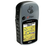
The eTrex Legend Cx is loaded with the same popular features found in the eTrex Legend C, including sunlight-readable color and advanced GPS routing capabilities — all in a waterproof design. In addition, it comes with a blank 32 MB microSD card for storage of optional map detail. Download maps directly to the card or purchase microSD cards preloaded with MapSource® Topo and inland lake maps, BlueChart® marine cartography, and City Navigator™ street maps.Minimize

Manufacturer:Garmin Product MPNKey FeaturesDisplayTechnical FeaturesOther FeaturesGPS SystemBatteryWarrantyDimensionsMiscellaneous
MPN010-00440-02
GPS Type   Handheld (Outdoor)
Form FactorHandheld
Map capabilities   Download maps
Enhanced accuracyWAAS enabled
Input Method   Keypad
Receiver Type12 Channels
Screen Size2.1 in.
Display Size1.3 in. x 1.7 in.
Display Type256 Color LCD TFT Display
Resolutions220 x 176
Trip calculator   Route Recalculation, Points-of-Interest (POI)
Included Software/Maps   North America Maps, South America Maps
Grids   Lat/Lon, MGRS, User Grid, UTM, Loran TD position format, Maidenhead
PC InterfaceUSB
Environmental ProtectionIPX7 Waterproof Standard
Expansion Slot TypeSD (Secure Digital) Card Slot
AntennaBuilt-in
Accuisition Time - Cold45 sec
Accuisition Time - Initial Time15 sec
Update rate1 per second, continuous
Max. Horizontal accuracy   Enhanced position accuracy Differential standardsDGPS Ready
Number of routes50
Waypoints   500
Battery Type and Quantity2 x AA Batteries
Battery Life32 Hours
Warranty1 Year
Width2.2 in.
Depth1.2 in.
Height4.2 in.
Weight0.35 lb.
Family LineGarmin eTrex
UPC753759049140


Tags:

garmin, etrex, legend, cx,


Teletype Gps WorldNav 3100 Deluxe


The TeleType WorldNav 3100 Deluxe Portable GPS Navigator is a simple, stylish and user-friendly street navigator at a reasonable price. With the WorldNav 3100 Deluxe you get affordable, in-car navigation with the added benefits of easy touch-screen use, pre-loaded maps, as well as MP3 and video entertainment capabilities.Minimize


Garmin nuvi 255W


Go wide and get peace of mind with nuvi 255W. This affordable, widescreen navigator leads the way with voice-prompted turn-by-turn directions that speak street names and optional MSN Direct® services to get you there on time and keep you informed. It's packed with millions of destinations and maps for North America or Europe. Like the rest of the sleek nüvi 2x5-series, this portable navigator is priced right and ultra-easy to use.Minimize


Garmin Edge 305


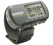
Rugged, lightweight Edge attaches easily to the stem or handlebars of your bike with the included bike mount. Just turn it on, acquire GPS satellites and go. Edge 305 automatically measures your speed, distance, time, calories burned, altitude, climb and descent, and also records the route you have taken for review. For extra-precise climb and descent data, Edge 305 also incorporates a barometric altimeter to pinpoint changes in elevation.Minimize


Garmin StreetPilot c530


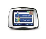
StreetPilot c530 comes ready to go right out of the box with preloaded City Navigator® NT street maps and a hefty points of interest (POIs) database, including motels, restaurants, fuel, ATMs and more. Simply touch the super-bright sunlight-readable color screen to enter a destination, and the c530 takes you there with 2D or 3D maps and turn-by-turn voice directions. In addition, the c530 accepts custom points of interest (POIs) such as school zones and safety cameras and lets you set proximity alerts to warn you of upcoming POIs.Minimize