Furuno GP7000F NT$1,689.00 to $2,637.00

The GP-7000F/NT is a GPS/WAAS plotter designed for a variety of vessels desiring video plotting and echo sounding capabilities. With the GP-7000 series, you can see the highly accurate position of your boat on the chart. The GP-7000 series has four display modes: Course Plot, Nav Data, Steering, and Highway modes. The course plot mode is useful for obtaining general information about surrounding sea areas. The Nav data mode clearly shows important navigational information with large text, which is easy to see even from a distance. The steering mode and highway mode assist the operator in following a predetermined route.Minimize
Manufacturer:Furuno Product MPN MPN | GP7000FNT | Key Features GPS Type | Marine | Form Factor | Fixed | Map capabilities | Map cartridges / Data cards | Enhanced accuracy | WAAS enabled | Display Display Size | 7 in. | Display Type | LCD TFT Display | Resolutions | 480 x 234 | Technical Features Marine Features | Split Screen, Chart Plotter | Audible Features | Proximity Alarm, Arrival Alarm | Other Features Environmental Protection | IPX5 Waterproof Standard, IPX6 Waterproof Standard | Expansion Slot Type | SD (Secure Digital) Card Slot | GPS System Accuisition Time - Initial Time | 12 sec | Max. Horizontal accuracy | | Enhanced position accuracy | | Number of routes | 200 | Waypoints | 2000 | Dimensions Width | 10.2 in. | Depth | 3.2 in. | Height | 6.1 in. | Miscellaneous UPC | 611679280558 |
Tags:furuno, gp7000f, nt,
| Garmin Edge 205$138.00 to $286.00
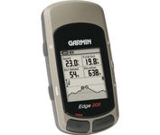
Take your ride to the next level with the Edge 205Garmin's GPS-enabled personal trainer and cycle computer. Perfect for touring and the trails, the lightweight Edge is the ultimate fitness partner. With the easy-to-use Edge 205 on your bike, you always know where you're going and how far you've gone. For advanced cyclists, the Edge 305 is available with either a heart rate monitor or a wireless speed/pedaling cadence sensor to help you achieve your personal best.Minimize
Manufacturer:Garmin Product MPN MPN | 0100044710 | Key Features GPS Type | Handheld (Outdoor) | Form Factor | Handheld | Input Method | Keypad | Screen Size | 1.9 in. | Display Display Size | 1.17 in. x 1.44 in. | Display Type | 4 Level Grayscale LCD Display | Technical Features Special Features | Training Computer | Trip calculator | Maximum speed | Other Features PC Interface | USB | Environmental Protection | IPX7 Waterproof Standard | Antenna | Built-in | Battery Battery Type and Quantity | Proprietary Lithium | Battery Life | 12 Hours | Warranty Warranty | 1 Year | Dimensions Width | 1.75 in. | Depth | 0.9 in. | Height | 3.7 in. | Weight | 0.19 lb. | Miscellaneous UPC | 753759051754 |
Tags:garmin, edge, 205,
| Dual Electronics XNAV3550$219.00 to $228.00

The Dual XNA3550 features an easy to use touch screen graphic interface with MP3 playback capability. Turn-by-turn instructions with voice guidance. Visual left/right LED indicators. 3D Map view. Level selectable map view. Start route guidance search by:- Address/intersection- Points of interest- Address book- Recent destination. GPS status indicator.Minimize
Manufacturer:Dual Electronics Product MPN MPN | XNAV3550 | Key Features GPS Type | Automobile | Form Factor | Fixed | Map capabilities | Internal | Input Method | Touch Screen | Receiver Type | 12 Channels | Display Display Size | 3.5 in. | Display Type | 16.7M Colors LCD TFT Display | Resolutions | 320 X 240 | Technical Features Special Features | Address Book, MP3 Player, 3D Map View | Trip calculator | Route Recalculation, Points-of-Interest (POI) | Included Software/Maps | USA Maps | Other Features Built in memory | 64 MB | Expansion Slot Type | SD (Secure Digital) Card Slot | Antenna | Built-in | PDA Features Plug-in Interface | Secure Digital (SD) | Compatible PDA OS | Windows CE | Battery Battery Type and Quantity | Rechargeable Li-Ion Battery | Battery Life | 2 Hours | Dimensions Width | 5.25 in. | Depth | 1.25 in. | Height | 3.13 in. | Weight | 2.1 lb. | Miscellaneous UPC | 827204101636 |
Tags:dual, electronics, xnav3550,
|
Take your ride to the next level with the Edge 205Garmin's GPS-enabled personal trainer and cycle computer. Perfect for touring and the trails, the lightweight Edge is the ultimate fitness partner. With the easy-to-use Edge 205 on your bike, you always know where you're going and how far you've gone. For advanced cyclists, the Edge 305 is available with either a heart rate monitor or a wireless speed/pedaling cadence sensor to help you achieve your personal best.Minimize
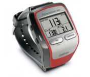
Get the most out of your workouts with the Garmin Forerunner 305, a GPS personal trainer. Whether you’re going for a daily jog or training for a triathlon, the Forerunner 305 tracks and stores vital information that you can analyze on your computer with interactive graphs that chart your pace, time, distance traveled, and heart rate. Upload your information to MotionBased.com, Garmin’s web-based application that allows you to track your fitness statistics online, giving you the tools you need to take your training to the next level.Minimize
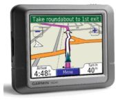
Packed with features and available in a variety of hip colors, the Garmin nuvi 250 is affordably priced and easy to use. The nuvi 250 comes preloaded with City Navigator map data giving you quick, turn-by-turn directions to anywhere in the continental United States. Pull up colorful, 2-D or 3-D maps on the sunlight-readable screen and voice directions will guide you safely and quickly to your selected destination. You can also set custom points of interest on the nuvi 250 such as your favorite restaurants or coffee shops, and with proximity alerts you’re always aware of where you’re going, and where you’ve been.Minimize
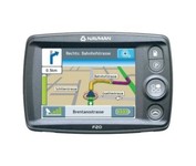
The F20, provides you with a lot for very little. Loaded with features normally found in other, more expensive car navigators, the F20 packs them all into a neat, pocket-sized compact unit. It’s the advanced features that separate the F20 from other entry-level navigators. The ‘Nearest Parking and Petrol’ buttons, previously only found on our more expensive models, are a simple but brilliant idea, exclusive to Navman.Minimize