Furuno GP7000F NT$1,689.00 to $2,637.00

The GP-7000F/NT is a GPS/WAAS plotter designed for a variety of vessels desiring video plotting and echo sounding capabilities. With the GP-7000 series, you can see the highly accurate position of your boat on the chart. The GP-7000 series has four display modes: Course Plot, Nav Data, Steering, and Highway modes. The course plot mode is useful for obtaining general information about surrounding sea areas. The Nav data mode clearly shows important navigational information with large text, which is easy to see even from a distance. The steering mode and highway mode assist the operator in following a predetermined route.Minimize
Manufacturer:Furuno Product MPN MPN | GP7000FNT | Key Features GPS Type | Marine | Form Factor | Fixed | Map capabilities | Map cartridges / Data cards | Enhanced accuracy | WAAS enabled | Display Display Size | 7 in. | Display Type | LCD TFT Display | Resolutions | 480 x 234 | Technical Features Marine Features | Split Screen, Chart Plotter | Audible Features | Proximity Alarm, Arrival Alarm | Other Features Environmental Protection | IPX5 Waterproof Standard, IPX6 Waterproof Standard | Expansion Slot Type | SD (Secure Digital) Card Slot | GPS System Accuisition Time - Initial Time | 12 sec | Max. Horizontal accuracy | | Enhanced position accuracy | | Number of routes | 200 | Waypoints | 2000 | Dimensions Width | 10.2 in. | Depth | 3.2 in. | Height | 6.1 in. | Miscellaneous UPC | 611679280558 |
Tags:furuno, gp7000f, nt,
| Garmin Rino 110$140.00 to $226.00

The Rino 110 is a GPS-enabled handheld that integrates radio functionality to provide two-way communications. It's waterproof, can send communications up to five miles (using GMRS channels), and can "beam" your exact location to another Rino user within a two-mile range (on the FRS spectrum) using "Position Reporting". And because the Rino 110 has standard FRS capabilities, you can talk to friends or family who own conventional FRS radios.The Rino 110 has a built-in city point data base, with 1 MB of internal memory for additional points-of-interest data that can be downloaded from a MapSource Points of Interest CD-ROM.Minimize
Manufacturer:Garmin Product MPN MPN | 010-N0270-00 | Key Features GPS Type | Handheld (Outdoor) | Form Factor | Handheld | Map capabilities | Internal, Download maps | Enhanced accuracy | WAAS enabled | Input Method | Keypad | Receiver Type | 12 Channels | Screen Size | 2 in. | Display Display Size | 1.4 in. x 1.4 in. | Display Type | LCD Display | Resolutions | 160 X 160 | Technical Features Special Features | Waypoint Icons | Trip calculator | Maximum speed, Current speed, Points-of-Interest (POI) | Grids | Lat/Lon, MGRS, UTM, Loran TD position format, Maidenhead | Other Features PC Interface | Serial RS-232, NMEA-0183 | Built in memory | 1 MB | Environmental Protection | IPX7 Waterproof Standard | Antenna | Quadrifilar Helix | GPS System Accuisition Time - Cold | 45 sec | Accuisition Time - Initial Time | 15 sec | Update rate | 1 per second, continuous | Max. Horizontal accuracy | | Enhanced position accuracy | | Differential standards | DGPS Ready | Number of routes | 20 | Waypoints | 500 | Battery Battery Type and Quantity | 3 x AA Batteries | Battery Life | 28 Hours | Warranty Warranty | 1 Year | Dimensions Width | 2.3 in. | Depth | 1.6 in. | Height | 4.5 in. | Weight | 0.48 lb. | Miscellaneous Family Line | Garmin Rino | UPC | 689076139793 |
Tags:garmin, rino, 110,
| Kenwood KNA-G510$250.00 to $799.00
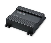
You'll give your Kenwood in-dash mobile video system a potent extra dimension when you connect the KNA-G510 navigation system. You'll drive with confidence as it guides you to your destination efficiently and accurately. The system can even keep you up to date on what's happening with traffic flow along your programmed route.Minimize
Manufacturer:Kenwood Product MPN MPN | KNA-G510 | Key Features GPS Type | Automobile | Form Factor | Fixed | Map capabilities | Internal | Enhanced accuracy | WAAS enabled | Input Method | Touch Screen | Receiver Type | 12 Channels | Technical Features Audible Features | Voice Navigation Instructions | Trip calculator | Trip Timers, Points-of-Interest (POI) | Included Software/Maps | North America Maps | Other Features Expansion Slot Type | SD (Secure Digital) Card Slot | Antenna | Built-in | Dimensions Width | 4.5 in. | Depth | 1.5 in. | Height | 4 in. |
Tags:kenwood, kna-g510,
|
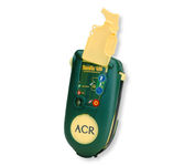
Accidents happen every day in the outdoors, whether you fall out of a tree stand, break a leg during a hike, or roll over on an ATV. In the outdoors, an every day accident instantly can become a life threatening situation, and rescues may take days or weeks if you’re not prepared.
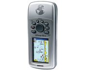
The GPSMAP 76CSx is a refreshing upgrade of the GPSMAP 76CS, one of our most popular models for outdoor and marine use. This unit features a removable microSD card for detailed mapping memory and a waterproof, rugged housing. The microSD card slot is located inside the waterproof battery compartment. Users can load map data and transfer routes and waypoints through the unit’s fast USB connection.Minimize

The eTrex Summit comes on the heels of the extremely popular eTrex, which was designed for both marine and recreation use. This new all-in-one navigation device for the outdoor enthusiast is the first combination GPS, altimeter, and electronic compass. The electronic compass provides bearing information when you're standing still and the altimeter determines precise altitude, so you can tell how high you've climbed and your rate of ascent. Like its predecessor, the eTrex Summit boasts a powerful 12 parallel channel GPS receiver and comes packaged in a small, sleek case with operating buttons located on either side of the unit. The case is completely waterproof to withstand immersion in one meter of water for up to 30 minutes.Minimize

Rugged, lightweight Edge attaches easily to the stem or handlebars of your bike with the included bike mount. Just turn it on, acquire GPS satellites and go. Edge 305 automatically measures your speed, distance, time, calories burned, altitude, climb and descent, and also records the route you have taken for review. For extra-precise climb and descent data, Edge 305 also incorporates a barometric altimeter to pinpoint changes in elevation.Minimize