Furuno GP7000F NT$1,689.00 to $2,637.00

The GP-7000F/NT is a GPS/WAAS plotter designed for a variety of vessels desiring video plotting and echo sounding capabilities. With the GP-7000 series, you can see the highly accurate position of your boat on the chart. The GP-7000 series has four display modes: Course Plot, Nav Data, Steering, and Highway modes. The course plot mode is useful for obtaining general information about surrounding sea areas. The Nav data mode clearly shows important navigational information with large text, which is easy to see even from a distance. The steering mode and highway mode assist the operator in following a predetermined route.Minimize
Manufacturer:Furuno Product MPN MPN | GP7000FNT | Key Features GPS Type | Marine | Form Factor | Fixed | Map capabilities | Map cartridges / Data cards | Enhanced accuracy | WAAS enabled | Display Display Size | 7 in. | Display Type | LCD TFT Display | Resolutions | 480 x 234 | Technical Features Marine Features | Split Screen, Chart Plotter | Audible Features | Proximity Alarm, Arrival Alarm | Other Features Environmental Protection | IPX5 Waterproof Standard, IPX6 Waterproof Standard | Expansion Slot Type | SD (Secure Digital) Card Slot | GPS System Accuisition Time - Initial Time | 12 sec | Max. Horizontal accuracy | | Enhanced position accuracy | | Number of routes | 200 | Waypoints | 2000 | Dimensions Width | 10.2 in. | Depth | 3.2 in. | Height | 6.1 in. | Miscellaneous UPC | 611679280558 |
Tags:furuno, gp7000f, nt,
| Garmin Forerunner 305$147.00 to $390.00
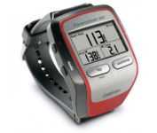
Get the most out of your workouts with the Garmin Forerunner 305, a GPS personal trainer. Whether you’re going for a daily jog or training for a triathlon, the Forerunner 305 tracks and stores vital information that you can analyze on your computer with interactive graphs that chart your pace, time, distance traveled, and heart rate. Upload your information to MotionBased.com, Garmin’s web-based application that allows you to track your fitness statistics online, giving you the tools you need to take your training to the next level.Minimize
Manufacturer:Garmin Product MPN MPN | 010-00467-02 | Key Features GPS Type | Handheld (Outdoor) | Form Factor | Handheld | Screen Size | 1.5 in. | Display Display Size | 1.3 in. x 0.8 in. | Display Type | 4 Level Grayscale LCD Display | Resolutions | 160 X 100 | Technical Features Special Features | Heart Rate Monitor, 3D Map View | Trip calculator | Trip Timers | Other Features PC Interface | USB | Environmental Protection | IPX7 Waterproof Standard | Antenna | Built-in | GPS System Accuisition Time - Cold | 45 sec | Accuisition Time - Initial Time | 38 sec | Accuisition Time - Hot | 1 sec | Update rate | 1 per second, continuous | Max. Horizontal accuracy | Battery | Battery Type and Quantity | Proprietary Lithium | Battery Life | 10 Hours | Warranty Warranty | 1 Year | Dimensions Width | 2.1 in. | Depth | 2.7 in. | Height | 0.7 in. | Weight | 0.17 lb. | Miscellaneous Family Line | Garmin Forerunner | UPC | 740617010879 |
Tags:garmin, forerunner, 305,
| Navman NavPix N40i$80.00 to $230.00
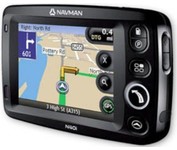
The N40i includes an integrated digital camera for taking NavPix to create an unmistakeable reminder of your chosen destination. So you can find your way there - no matter how far away it is – whenever you want.
Manufacturer:Navman Product MPN MPN | N40i | Key Features GPS Type | Automobile | Input Method | Touch Screen | Display Display Size | 3.5 in. | Display Type | LCD Display | Technical Features Audible Features | Voice Navigation Instructions | Included Software/Maps | USA Maps, Europe Maps, Australia Maps, Ireland | Other Features PC Interface | USB 1.1 | Built in memory | 64 MB | GPS System Update rate | 1 per second, continuous | Battery Battery Type and Quantity | Rechargeable Li-Ion Battery | Battery Life | 5 Hours | Dimensions Width | 4.65 in. | Depth | 0.89 in. | Height | 3.19 in. | Weight | 0.44 lb. | Miscellaneous UPC | 817186001376 |
Tags:navman, navpix, n40i,
|
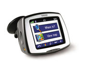
Receive door-to-door directions while staying on top of weather, traffic and localized information with the StreetPilot c580. Similar to the c550, StreetPilot c580 comes with hands-free calling, preloaded maps and an MP3 player, then takes it up a notch by adding dynamic content from MSN® Direct.

Rugged, lightweight Edge attaches easily to the stem or handlebars of your bike with the included bike mount. Just turn it on, acquire GPS satellites and go. Edge 305 automatically measures your speed, distance, time, calories burned, altitude, climb and descent, and also records the route you have taken for review. For extra-precise climb and descent data, Edge 305 also incorporates a barometric altimeter to pinpoint changes in elevation.Minimize
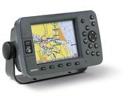
Plug into the power of the Garmin Marine network with the Garmin 3200 series. Rugged, waterproof, and easy to install, these chartplotters come preloaded with Garmin's detail-rich marine cartography utilizing BlueChart® g2 technology.
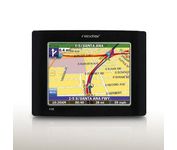
The Nextar GPS X3B mobile navigation system assures that your days of getting lost are over! Finding an address or any of 1.6 million points of interest such as the nearest gas station or restaurant is a snap anywhere in the U.S. or Canada. Just enter information in the X3B's 3.5 inch touch screen and let the voice prompt and detailed map guide you to the destination. With the latest TTS (Text to Speech) function, street names are clrearly pronounced in English. The X3B's built in MP3 player will entertain you with your favorite tunes while en route. Just copy your favorite play list onto an SD card and insert into the slot. The X3B moves easily from car to car using the convenient vent mount. A recharageable lithium ion battery assures that the unit stays active. Other features of the X3B include built-in maps of the 50 United States and Canada, 1GB built in Flash Memory.Minimize