Products reviews

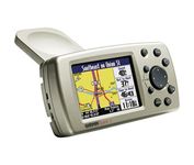
Garmin Quest 2

$441.00 to $649.00


The Garmin® Quest 2 in-car GPS unit comes pre-loaded with City Select® with NT data providing mapping detail throughout the United States, Canada and Puerto Rico (including rural areas). Since there's no need to download, the Quest 2 comes to you ready to go. Its built-in database features nearly 6 million points of interest, including hotels, restaurants, gas stations, ATM's, and attractions.Minimize

Manufacturer:Garmin Product MPNKey FeaturesDisplayTechnical FeaturesOther FeaturesGPS SystemBatteryDimensionsMiscellaneous
MPN010-00454-00
GPS Type   Automobile
Form FactorHandheld
Map capabilities   Internal, Download maps
Enhanced accuracyWAAS enabled
Input Method   Keypad
Receiver Type12 Channels
Screen Size2.7 in.
Display Size2.2 in. x 1.5 in.
Display Type256 Color LCD TFT Display
Resolutions240 X 160
Audible Features   Voice Navigation Instructions
Trip calculator   Moving average, Maximum speed, Odometer, Route Recalculation, Detour Feature, Points-of-Interest (POI)
Included Software/Maps   USA Maps, Canada Maps
Grids   Lat/Lon, MGRS, User Grid, UTM, Loran TD position format, Maidenhead
PC InterfaceUSB 1.1
Built in memory140 MB
Environmental ProtectionIPX7 Waterproof Standard
AntennaBuilt-in
Accuisition Time - Cold45 sec
Accuisition Time - Initial Time15 sec
Update rate1 per second, continuous
Max. Horizontal accuracy   Number of routes50
Waypoints   500
Battery Type and QuantityProprietary Lithium
Battery Life20 Hours
Width4.5 in.
Depth0.9 in.
Height2.2 in.
Weight0.34 lb.
UPC753759049263


Tags:

garmin, quest, 2,

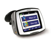
Garmin StreetPilot c580

$270.00 to $940.00


Receive door-to-door directions while staying on top of weather, traffic and localized information with the StreetPilot c580. Similar to the c550, StreetPilot c580 comes with hands-free calling, preloaded maps and an MP3 player, then takes it up a notch by adding dynamic content from MSN® Direct.

Manufacturer:Garmin Product MPNKey FeaturesDisplayTechnical FeaturesOther FeaturesGPS SystemPDA FeaturesBatteryWarrantyDimensionsMiscellaneous
MPN010-00522-06
GPS Type   Automobile
Form FactorFixed
Map capabilities   Internal, Download maps
Enhanced accuracyWAAS enabled, EGNOS enabled
Input Method   Touch Screen
Receiver Type18 Channels
Screen Size3.5 in.
Display Size2.8 in. x 2.1 in.
Display Type16-bit Color LCD TFT Display
Resolutions320 X 240
Special Features   MP3 Player, JPEG Image Viewer, 3D Map View
Trip calculator   Shortest time, Maximum speed, Current speed, Route Recalculation, Points-of-Interest (POI)
Included Software/Maps   North America Maps, Canada Maps, Europe Maps, Australia Maps, South Africa Maps, South America Maps, Middle East Maps, Great Britain
PC InterfaceUSB
Expansion Slot TypeSD (Secure Digital) Card Slot
AntennaBuilt-in, External Antenna Hookup
Accuisition Time - Cold38 sec
Accuisition Time - Initial Time1 sec
Update rate1 per second, continuous
Waypoints   500
Compatible PDA OSWindows 2000
Compatible DevicesNotebook
Battery Type and QuantityProprietary Li-Ion
Battery Life8 Hours
Warranty1 Year
Width4.4 in.
Depth2.2 in.
Height3.2 in.
Weight0.59 lb.
Family LineGarmin StreetPilot
UPC753759068004


Tags:

garmin, streetpilot, c580,

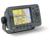
Garmin GPSMAP 3205

$520.00 to $1,095.00


Plug into the power of the Garmin Marine network with the Garmin 3200 series. Rugged, waterproof, and easy to install, these chartplotters come preloaded with Garmin's detail-rich marine cartography utilizing BlueChart® g2 technology.

Manufacturer:Garmin Product MPNKey FeaturesDisplayTechnical FeaturesOther FeaturesGPS SystemWarrantyDimensionsMiscellaneous
MPN010-00526-00
GPS Type   Marine
Form FactorFixed
Map capabilities   Internal, Map cartridges / Data cards
Enhanced accuracyWAAS enabled
Input Method   Keypad
Receiver Type12 Channels
Display Size5 in.
Display Type256 Color LCD TFT Display
Resolutions640 X 480
Marine FeaturesChart Plotter
Special Features   3D Map View
Audible Features   Proximity Alarm, Anchor Alarm, Arrival Alarm, Off-Course Alarm, Clock Alarm, Low Battary/Voltage Alarm
Included Software/Maps   Marine Cartography
PC InterfaceNMEA-0183
Environmental ProtectionIPX7 Waterproof Standard
Accuisition Time - Cold45 sec
Accuisition Time - Initial Time15 sec
Update rate1 per second, continuous
Max. Horizontal accuracy   Enhanced position accuracy Differential standardsDGPS Ready
Number of routes50
Waypoints   4000
Warranty1 Year
Width7.8 in.
Depth3 in.
Height4.7 in.
Weight1.8 lb.
Family LineGarmin GPSMAP
UPC753759053048


Tags:

garmin, gpsmap, 3205,


Navman F20


The F20, provides you with a lot for very little. Loaded with features normally found in other, more expensive car navigators, the F20 packs them all into a neat, pocket-sized compact unit. It’s the advanced features that separate the F20 from other entry-level navigators. The ‘Nearest Parking and Petrol’ buttons, previously only found on our more expensive models, are a simple but brilliant idea, exclusive to Navman.Minimize


Lowrance iFINDER GO2


Just grab this bright yellow handheld iFINDER Go 64MB GPS and go, go, go. It's easy to use, waterproof, has a 2.2 diagonal Film SuperTwist display with backlighting and a built-in 64MB background map with coverage of the continental U.S. and Hawaii. The GPS also includes up to 1,000 waypoints, 1,000 event markers and 100 routes; up to 100 retraceable plot trails and up to 10,000 points in any trail; 30+ map zoom ranges and 42 graphic icons to mark spots.Minimize


Furuno GP7000F NT


The GP-7000F/NT is a GPS/WAAS plotter designed for a variety of vessels desiring video plotting and echo sounding capabilities. With the GP-7000 series, you can see the highly accurate position of your boat on the chart. The GP-7000 series has four display modes: Course Plot, Nav Data, Steering, and Highway modes. The course plot mode is useful for obtaining general information about surrounding sea areas. The Nav data mode clearly shows important navigational information with large text, which is easy to see even from a distance. The steering mode and highway mode assist the operator in following a predetermined route.Minimize


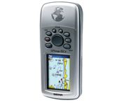
Garmin Rino 130


The Rino 130 is the most feature-rich unit in the Rino family with a built-in electronic compass barometric sensor weather receiver for seven NOAA weather channels and 24 MBs of internal memory This handheld radio has a built-in electronic compass to give a heading while the user is standing still and a barometric altimeter to provide extremely accurate elevation and pressure information which will assist users in identifying weather data The Rino 130 provides two-way radio communication with a transmission range of up to two miles using FRS channels and up to five miles with GMRS The integration of two-way radio and GPS enables users to transmit their position with a simple button press allowing others to navigate to their position The Rino 130 also has a polling feature which allows a user to manually request GPS location information from other Rino unitsMinimize