Products reviews

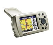
Garmin Quest 2

$441.00 to $649.00


The Garmin® Quest 2 in-car GPS unit comes pre-loaded with City Select® with NT data providing mapping detail throughout the United States, Canada and Puerto Rico (including rural areas). Since there's no need to download, the Quest 2 comes to you ready to go. Its built-in database features nearly 6 million points of interest, including hotels, restaurants, gas stations, ATM's, and attractions.Minimize

Manufacturer:Garmin Product MPNKey FeaturesDisplayTechnical FeaturesOther FeaturesGPS SystemBatteryDimensionsMiscellaneous
MPN010-00454-00
GPS Type   Automobile
Form FactorHandheld
Map capabilities   Internal, Download maps
Enhanced accuracyWAAS enabled
Input Method   Keypad
Receiver Type12 Channels
Screen Size2.7 in.
Display Size2.2 in. x 1.5 in.
Display Type256 Color LCD TFT Display
Resolutions240 X 160
Audible Features   Voice Navigation Instructions
Trip calculator   Moving average, Maximum speed, Odometer, Route Recalculation, Detour Feature, Points-of-Interest (POI)
Included Software/Maps   USA Maps, Canada Maps
Grids   Lat/Lon, MGRS, User Grid, UTM, Loran TD position format, Maidenhead
PC InterfaceUSB 1.1
Built in memory140 MB
Environmental ProtectionIPX7 Waterproof Standard
AntennaBuilt-in
Accuisition Time - Cold45 sec
Accuisition Time - Initial Time15 sec
Update rate1 per second, continuous
Max. Horizontal accuracy   Number of routes50
Waypoints   500
Battery Type and QuantityProprietary Lithium
Battery Life20 Hours
Width4.5 in.
Depth0.9 in.
Height2.2 in.
Weight0.34 lb.
UPC753759049263


Tags:

garmin, quest, 2,

Garmin GPSMAP 4212

$2,200.00 to $3,000.00


This preloaded, offshore chartplotter combines the power of networking with brilliant color and slim-line design. The GPSMAP 4212 has preloaded BlueChart® g2 maps of the U.S. coast and displays them on a whopping 12.1” XGA display with crisp, video-quality resolution. By connecting to the Garmin Marine Network, you can add sonar, radar and weather. For even more enhanced features, you can add the optional Bluechart g2 Vision card.Minimize

Manufacturer:Garmin Product MPNKey FeaturesDisplayTechnical FeaturesOther FeaturesGPS SystemDimensionsMiscellaneous
MPN010-00592-01
GPS Type   Marine
Form FactorFixed
Map capabilities   Internal
Enhanced accuracyWAAS enabled
Input Method   Keypad
Receiver Type12 Channels
Screen Size12.1 in.
Display Size9.7 in. x 7.3 in.
Resolutions640 X 480
Audible Features   Proximity Alarm, Anchor Alarm, Arrival Alarm, Off-Course Alarm, Clock Alarm, Accuracy Alarm, Low Battary/Voltage Alarm
Trip calculator   Track Log, Points-of-Interest (POI)
Included Software/Maps   Marine Cartography
Expansion Slot TypeSD (Secure Digital) Card Slot
Number of routes20
Waypoints   1500
Width14.8 in.
Depth4.6 in.
Height9.5 in.
Weight10 lb.
Family LineGarmin GPSMAP
UPC753759066062


Tags:

garmin, gpsmap, 4212,

Garmin GPS 18

$48.00 to $169.00


Turn your laptop PC into a powerful street navigator with the GPS 18 a GPS sensor bundled with nRoute and City Select software that automatically guides you with turn-by-turn directions and voice prompts to get you safely to your destination.

Manufacturer:Garmin Product MPNKey FeaturesTechnical FeaturesOther FeaturesGPS SystemWarrantyDimensionsMiscellaneous
MPN010-00321-54
GPS Type   Handheld (Outdoor)
Form FactorHandheld, Plug-in
Map capabilities   Download maps
Enhanced accuracyWAAS enabled
Receiver Type12 Channels
Audible Features   Voice Navigation Instructions
Trip calculator   Points-of-Interest (POI)
Included Software/Maps   North America Maps, Europe Maps, South America Maps
PC InterfaceUSB 2.0, USB
Accuisition Time - Cold45 sec
Accuisition Time - Initial Time15 sec
Update rate1 per second, continuous
Max. Horizontal accuracy   Enhanced position accuracy Differential standardsDGPS Ready
Warranty1 Year
Width2.4 in.
Depth2.4 in.
Height0.77 in.
Weight0.22 lb.
Family LineGarmin GPS
UPC753759042714


Tags:

garmin, gps, 18,


Magellan eXplorist 200


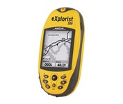
For serious outdoor use, the eXplorist series handheld GPS navigation systems are built to cover all requirements. With their tough, impact-resistant, waterproof exterior and their proven Magellan technology inside that packs powerful functionality into an easy-to-use operating system, your outdoor needs will be covered.Minimize


Lowrance M68C
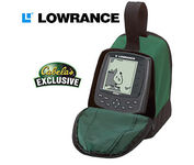

Combining the 256-color technology of the sonar industry and the superior precision of Lowrance GPS units, the M-68c sonar/map gives you all the capabilities of the extreme high-end combo units in a smaller, more affordable package. Features a full 12-parallel channel GPS and WAAS receiver and 40 map ranges from .02 to 4,000 miles with easy zoom. The high-bright 3.5" diagonal TFT active matrix transflective display delivers a wide viewing angle and superb readability in direct sunlight. And, it includes an advanced LED screen and keypad backlighting for night and low-light operation.Minimize


Pharos Science PF080
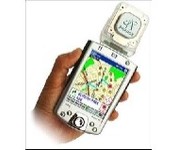

Pharos, the leader in advanced, affordable navigation solutions for handheld computing, has created the ultimate navigation tool for Windows Mobile-based Pocket PCs and mobile devices. Use Pharos Pocket GPS Navigator with CompactFlash to navigate door-to-door or point-to-point. Use it for hiking, walking tours or other outdoor activities. With audio voice prompts to guide you to your destination, the Pocket GPS Navigator is great for your car, too. In fact, the Pharos GPS Navigator performs just like more expensive, factory-installed, in-vehicle navigation systems, at a fraction of the cost yet, its easy to load into your Pocket PC and simple to use.Minimize


Pharos Science iGPS-360
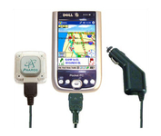

Compatible with most Pocket PCs with a CompactFlash slot, the Pharos Pocket GPS Navigator with CompactFlash inlcludes Pharos' iGPS-360 convertible receiver with a CompactFlash adaptor.Use it directly connected to the CompactFlash Adaptor, or for added flexibilty use the CF extension cable for placement and reception.Threre is no need for an external antenna!With Ostia, Pharos' award-winning navigation software installed on your Pocket PC, you can drive or walk through any city in the US, and locate your current position or quickly find a destination or point of interest. Routes can be calculated and viewed. The automated voice prompts will instruct you when and where to turn. If by chance you go "off-route," the automated voice will give an off-route warning and the system will automatically reroute you to your destination from your current position. Minimize