Navman NavPix N40i$80.00 to $230.00

The N40i includes an integrated digital camera for taking NavPix to create an unmistakeable reminder of your chosen destination. So you can find your way there - no matter how far away it is – whenever you want.
Manufacturer:Navman Product MPN MPN | N40i | Key Features GPS Type | Automobile | Input Method | Touch Screen | Display Display Size | 3.5 in. | Display Type | LCD Display | Technical Features Audible Features | Voice Navigation Instructions | Included Software/Maps | USA Maps, Europe Maps, Australia Maps, Ireland | Other Features PC Interface | USB 1.1 | Built in memory | 64 MB | GPS System Update rate | 1 per second, continuous | Battery Battery Type and Quantity | Rechargeable Li-Ion Battery | Battery Life | 5 Hours | Dimensions Width | 4.65 in. | Depth | 0.89 in. | Height | 3.19 in. | Weight | 0.44 lb. | Miscellaneous UPC | 817186001376 |
Tags:navman, navpix, n40i,
| Navman F20$80.00

The F20, provides you with a lot for very little. Loaded with features normally found in other, more expensive car navigators, the F20 packs them all into a neat, pocket-sized compact unit. It’s the advanced features that separate the F20 from other entry-level navigators. The ‘Nearest Parking and Petrol’ buttons, previously only found on our more expensive models, are a simple but brilliant idea, exclusive to Navman.Minimize
Manufacturer:Navman Product MPN MPN | AA005819-6E2 | Key Features GPS Type | Automobile | Form Factor | Fixed | Map capabilities | Map cartridges / Data cards | Enhanced accuracy | WAAS enabled, EGNOS enabled | Input Method | Touch Screen | Receiver Type | 12 Channels | Display Display Size | 3.5 in. | Technical Features Special Features | Compass | Audible Features | Voice Navigation Instructions | Trip calculator | Shortest time, Current speed, Route Recalculation | Included Software/Maps | USA Maps, Canada Maps | Grids | Lat/Lon | Other Features PC Interface | USB | Built in memory | 32 MB | Expansion Slot Type | SD (Secure Digital) Card Slot | Antenna | External Antenna Hookup | GPS System Update rate | 1 per second, continuous | Max. Horizontal accuracy | Battery | Battery Type and Quantity | Rechargeable Li-Ion Battery | Battery Life | 3.5 Hours | Dimensions Width | 4.57 in. | Depth | 0.95 in. | Height | 3.13 in. | Weight | 0.44 lb. | Miscellaneous UPC | 9419777105879 |
Tags:navman, f20,
| Pharos Science PSD80$86.00 to $262.00

The Pharos Pocket GPS Navigator is an excellent navigation solution for your Dell Pocket PC. The package comes with a compact iGPS-SD receiver and the Ostia Smart Navigator software with detailed street-level maps of entire US. It even includes a car charger that powers the GPS while charging your Pocket PC simultaneously. The iGPS-SD receiver is a small, slim and sensitive GPS receiver that plugs in the Pocket PC's SDIO slot. Ostia helps you locate your current position, find a destination or point of interest (POI) and get a route to your destination. Simply activate the GPS navigation program and begin traveling; the automated voice-prompts will tell you when and where to turn. If by chance you go 'off route', the Pocket GPS Navigator will always reroute you to your destination from your current GPS position.Minimize
Manufacturer:Pharos Science Product MPN MPN | PSD80 | Key Features GPS Type | Handheld (Outdoor) | Form Factor | Plug-in | Map capabilities | Internal, Download maps | Receiver Type | 12 Channels | Technical Features Audible Features | Voice Navigation Instructions | Trip calculator | Real-time Traffic Reports, Points-of-Interest (POI) | Included Software/Maps | City Navigation Maps | Other Features PC Interface | NMEA-0183 | GPS System Accuisition Time - Cold | 8 sec | Accuisition Time - Initial Time | 45 sec | Accuisition Time - Hot | 60 sec | Max. Horizontal accuracy | PDA Features | Compatible PDA OS | Pocket PC | Compatible Devices | Pocket PC Based PDA | Dimensions Width | 1.2 in. | Depth | 0.55 in. | Height | 1.3 in. | Miscellaneous UPC | 818948001115 |
Tags:pharos, science, psd80,
|

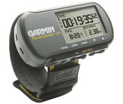
The Forerunner 101 offers athletes and recreational walkers and runners an entry-level personal training device with GPS. It has the same features as the Forerunner 201, but operates on two AAA batteries. The Forerunner 101 stores lap histories for up to two years to provide an archive of workout performance over time. Users can retrieve lap data for previous workouts by date, week, month, or over a specific time interval. For business travelers who want to train on the road, the Forerunner 101 also doubles as a navigator. Users can mark their hotel as a specific location, see their current position on the plotter display, and follow an electronic breadcrumb trail back to their starting point.Minimize

For serious outdoor use, the eXplorist series handheld GPS navigation systems are built to cover all requirements. With their tough, impact-resistant, waterproof exterior and their proven Magellan technology inside that packs powerful functionality into an easy-to-use operating system, your outdoor needs will be covered.Minimize

The Garmin nuvi 650 isn’t just a portable GPS system; it’s a fully featured multimedia device capable of MP3 playback and JPEG picture viewing. The nuvi 650 comes preloaded with City Navigator NT street maps that are loaded with hundreds of useful points of interest including gas stations, restaurants, and movie theaters. The touch screen interface gives you quick and easy access the nuvi 650’s many functions, and with the slim, sleek design you can easily stow it in your purse, backpack, or pocket. A rechargeable lithium-ion battery makes it suitable for navigation while in the car or even on foot.Minimize

Plug into the power of the Garmin Marine network with the Garmin 3200 series. Rugged, waterproof, and easy to install, these chartplotters come preloaded with Garmin's detail-rich marine cartography utilizing BlueChart® g2 technology.


