Teletype Gps WorldNav 3100 Deluxe$225.00 to $484.00
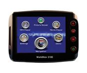
The TeleType WorldNav 3100 Deluxe Portable GPS Navigator is a simple, stylish and user-friendly street navigator at a reasonable price. With the WorldNav 3100 Deluxe you get affordable, in-car navigation with the added benefits of easy touch-screen use, pre-loaded maps, as well as MP3 and video entertainment capabilities.Minimize
Manufacturer:Teletype Gps Product MPN MPN | 31002 | Key Features GPS Type | Automobile | Form Factor | Fixed | Map capabilities | Map cartridges / Data cards | Input Method | Touch Screen | Receiver Type | 20 Channels | Display Display Size | 3.5 in. | Display Type | LCD TFT Display | Technical Features Special Features | MP3 Player | Audible Features | Voice Navigation Instructions | Trip calculator | Shortest time, Shortest distance, Odometer, Trip Timers, Elevation Computer | Included Software/Maps | City Navigation Maps, USA Maps, Puerto Rico | Grids | Lat/Lon | Other Features PC Interface | Mini-USB | Built in memory | 64 MB | Expansion Slot Type | SD (Secure Digital) Card Slot, MultiMediaCard (MMC) slot | Antenna | External Antenna Hookup | PDA Features Compatible PDA OS | Windows CE | Battery Battery Type and Quantity | Rechargeable Li-Ion Battery | Battery Life | 4 Hours | Warranty Warranty | 1 Year | Dimensions Width | 4.37 in. | Depth | 1 in. | Height | 3.12 in. | Weight | 0.38 lb. | Miscellaneous UPC | 745311031007 |
Tags:teletype, gps, worldnav, 3100, deluxe,
| Navman NavPix N40i$80.00 to $230.00
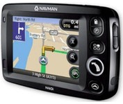
The N40i includes an integrated digital camera for taking NavPix to create an unmistakeable reminder of your chosen destination. So you can find your way there - no matter how far away it is – whenever you want.
Manufacturer:Navman Product MPN MPN | N40i | Key Features GPS Type | Automobile | Input Method | Touch Screen | Display Display Size | 3.5 in. | Display Type | LCD Display | Technical Features Audible Features | Voice Navigation Instructions | Included Software/Maps | USA Maps, Europe Maps, Australia Maps, Ireland | Other Features PC Interface | USB 1.1 | Built in memory | 64 MB | GPS System Update rate | 1 per second, continuous | Battery Battery Type and Quantity | Rechargeable Li-Ion Battery | Battery Life | 5 Hours | Dimensions Width | 4.65 in. | Depth | 0.89 in. | Height | 3.19 in. | Weight | 0.44 lb. | Miscellaneous UPC | 817186001376 |
Tags:navman, navpix, n40i,
| Furuno GP7000F NT$1,689.00 to $2,637.00

The GP-7000F/NT is a GPS/WAAS plotter designed for a variety of vessels desiring video plotting and echo sounding capabilities. With the GP-7000 series, you can see the highly accurate position of your boat on the chart. The GP-7000 series has four display modes: Course Plot, Nav Data, Steering, and Highway modes. The course plot mode is useful for obtaining general information about surrounding sea areas. The Nav data mode clearly shows important navigational information with large text, which is easy to see even from a distance. The steering mode and highway mode assist the operator in following a predetermined route.Minimize
Manufacturer:Furuno Product MPN MPN | GP7000FNT | Key Features GPS Type | Marine | Form Factor | Fixed | Map capabilities | Map cartridges / Data cards | Enhanced accuracy | WAAS enabled | Display Display Size | 7 in. | Display Type | LCD TFT Display | Resolutions | 480 x 234 | Technical Features Marine Features | Split Screen, Chart Plotter | Audible Features | Proximity Alarm, Arrival Alarm | Other Features Environmental Protection | IPX5 Waterproof Standard, IPX6 Waterproof Standard | Expansion Slot Type | SD (Secure Digital) Card Slot | GPS System Accuisition Time - Initial Time | 12 sec | Max. Horizontal accuracy | | Enhanced position accuracy | | Number of routes | 200 | Waypoints | 2000 | Dimensions Width | 10.2 in. | Depth | 3.2 in. | Height | 6.1 in. | Miscellaneous UPC | 611679280558 |
Tags:furuno, gp7000f, nt,
|
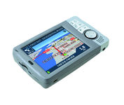
Transferable from car-to-car in seconds, the easy-to-use iCN510 can effortlessly guide drivers to their desired destination using accurate and clear turn-by-turn voice instructions and 3D-map view. Users can also now Drive Away this compact and sleek system straight from the box, with software applications and complete U.K. street-level mapping loaded on a single memory card. The iCN510 incorporates Version 3.0 of Navmans award winning SmartST software, which includes new features such as My POI customable points of interest with approach notification settings, multiple destinations for planning trips with several stops along the way, and a nearest POI search facility.Minimize
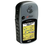
The eTrex Legend Cx is loaded with the same popular features found in the eTrex Legend C, including sunlight-readable color and advanced GPS routing capabilities — all in a waterproof design. In addition, it comes with a blank 32 MB microSD card for storage of optional map detail. Download maps directly to the card or purchase microSD cards preloaded with MapSource® Topo and inland lake maps, BlueChart® marine cartography, and City Navigator™ street maps.Minimize
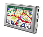
The Garmin nuvi 650 isn’t just a portable GPS system; it’s a fully featured multimedia device capable of MP3 playback and JPEG picture viewing. The nuvi 650 comes preloaded with City Navigator NT street maps that are loaded with hundreds of useful points of interest including gas stations, restaurants, and movie theaters. The touch screen interface gives you quick and easy access the nuvi 650’s many functions, and with the slim, sleek design you can easily stow it in your purse, backpack, or pocket. A rechargeable lithium-ion battery makes it suitable for navigation while in the car or even on foot.Minimize

The new GP37 DGPS/WAAS Navigator is compact in size, yet big on power, features and performance. This waterproof unit is perfect for a wide range of boats. It is equipped with a WAAS and a DGPS receiver as standard supply. It utilizes both WAAS and differential radio beacon correction methods to give you the most accurate position fix available. The GP37 offers extremely accurate position fixes -- 10m for basic GPS, 5m or better with DGPS and 3m or better where WAAS service is available. It should be noted that DGPS is more reliable and accurate, as the WAAS system is still currently under development. There is no guarantee of accuracy, integrity, continuity or availability of the WAAS signal. For that reason, the GP37 runs with DGPS as the default setting in auto selection mode. In this mode, if the DGPS signal can not be received for any reason, the WAAS mode is automatically selected. Manual setting is also available. The display modes include Plotter, two Customizable displays, Steering, Highway and SpeedMinimize