Kenwood KNA-G510$250.00 to $799.00

You'll give your Kenwood in-dash mobile video system a potent extra dimension when you connect the KNA-G510 navigation system. You'll drive with confidence as it guides you to your destination efficiently and accurately. The system can even keep you up to date on what's happening with traffic flow along your programmed route.Minimize
Manufacturer:Kenwood Product MPN MPN | KNA-G510 | Key Features GPS Type | Automobile | Form Factor | Fixed | Map capabilities | Internal | Enhanced accuracy | WAAS enabled | Input Method | Touch Screen | Receiver Type | 12 Channels | Technical Features Audible Features | Voice Navigation Instructions | Trip calculator | Trip Timers, Points-of-Interest (POI) | Included Software/Maps | North America Maps | Other Features Expansion Slot Type | SD (Secure Digital) Card Slot | Antenna | Built-in | Dimensions Width | 4.5 in. | Depth | 1.5 in. | Height | 4 in. |
Tags:kenwood, kna-g510,
| Magellan Maestro 3100$99.00 to $212.00

Magellan Maestro 3100 offers simple, sophisticated GPS navigation that's remarkably affordable. The most intuitive graphical 3.5" touch-screen interface available makes navigation easy. Enter virtually any destination and get turn-by-turn voice guidance to locations all over the contiguous United States. Smart touch-icons and Magellan's unique QuickSpell function enable error-free spelling, minimizing steps, so you get a customized route to your destination with just a few touches of the screen. Hundreds of thousands of preprogrammed points of interest make it easy to find restaurants, gas stations, ATM and more. Minimize
Manufacturer:Magellan Product MPN MPN | 980934-01 | Key Features GPS Type | Automobile | Form Factor | Fixed | Map capabilities | Map cartridges / Data cards | Receiver Type | 20 Channels | Display Display Type | 64k Colors LCD TFT Display | Resolutions | 320 X 240 | Technical Features Special Features | Waypoint Icons | Trip calculator | Route Recalculation, Detour Feature, Points-of-Interest (POI) | Included Software/Maps | USA Maps | Other Features Antenna | Built-in | GPS System Max. Horizontal accuracy | Battery | Battery Life | 3 Hours | Dimensions Width | 4.3 in. | Depth | 1.1 in. | Height | 3.5 in. | Weight | 6.5 lb. | Miscellaneous UPC | 763357117226 |
Tags:magellan, maestro, 3100,
| Garmin nüvi 350$185.00 to $410.00

Sleek and portable, the Garmin nuvi 350 comes preloaded with City Navigator NT street maps that highlight countless points of interest including hotels, restaurants, gas stations, ATMs and much more. A simple touch-screen interface allows you to quickly pull up 2-D or 3-D maps, and with turn-by-turn voice directions, you’ll never have to take your eyes off the road to get your bearings. The nuvi 350 also includes MP3 playback, a JPEG picture viewer, currency converters, and a host of other travel handy applications.Minimize
Manufacturer:Garmin Product MPN MPN | NUVI350NOH | Key Features GPS Type | Automobile | Form Factor | Handheld, Fixed | Map capabilities | Internal, Map cartridges / Data cards | Enhanced accuracy | WAAS enabled | Input Method | Touch Screen | Screen Size | 3.5 in. | Display Display Size | 2.8 in. x 2.1 in. | Display Type | LCD TFT Display | Resolutions | 320 X 240 | Technical Features Special Features | MP3 Player, 3D Map View | Audible Features | Voice Navigation Instructions | Trip calculator | Maximum speed, Elevation Computer, Detour Feature, Points-of-Interest (POI) | Included Software/Maps | North America Maps, Canada Maps, Europe Maps | Other Features PC Interface | USB | Built in memory | 700 MB | Expansion Slot Type | SD (Secure Digital) Card Slot | Antenna | Flip-up | GPS System Accuisition Time - Cold | 38 sec | Accuisition Time - Initial Time | 1 sec | Max. Horizontal accuracy | | Enhanced position accuracy | Battery | Battery Type and Quantity | Proprietary Lithium | Battery Life | 8 Hours | Warranty Warranty | 1 Year | Dimensions Width | 3.87 in. | Depth | 0.87 in. | Height | 2.91 in. | Weight | 0.32 lb. | Miscellaneous UPC | 753759077174 |
Tags:garmin, nvi, 350,
|

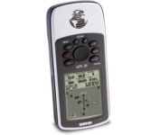
The GPS 76 is designed to provide precise GPS positioning using correction data obtained from the Wide Area Augmentation System (WAAS). This unit features a built-in quad helix antenna for superior reception and can provide position accuracy to less than three meters when receiving WAAS corrections.The GPS 76 provides 1 megabyte of internal user memory to be used for storing downloaded Points of Interest data. This 1 megabyte of storage area is preloaded from the factory with worldwide cities (populations greater than 200,000) and nautical navigation aids such as lights, buoys, sound signals and day beacons, and is perfect for downloading points of interest detail from GARMIN's line of MapSource CD-ROMs. The GPS 76 is also preloaded with tide data for the United States.Minimize

With its distinctive canopy-green case, the powerful Geko 201 from Garmin(r) allows more waypoint and route storage, as well as available PC and external power connectivity, and built-in WAAS capability. In addition, the Geko 201 boasts a user-configurable trip computer, 10,000 trackpoints, a new upcoming-turn feature, as well as PanTrack(tm) and TracBack(r).Minimize

The TeleType WorldNav 3100 Deluxe Portable GPS Navigator is a simple, stylish and user-friendly street navigator at a reasonable price. With the WorldNav 3100 Deluxe you get affordable, in-car navigation with the added benefits of easy touch-screen use, pre-loaded maps, as well as MP3 and video entertainment capabilities.Minimize

With the eTrex Legend, GARMIN has loaded a full basemap of North and South America into one small unit. The Legend is also designed to provide precise GPS positioning using correction data obtained from the Wide Area Augmentation System (WAAS). This product will provide position accuracy to less than three meters when receiving WAAS corrections.Minimize


