Kenwood KNA-G510$250.00 to $799.00
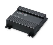
You'll give your Kenwood in-dash mobile video system a potent extra dimension when you connect the KNA-G510 navigation system. You'll drive with confidence as it guides you to your destination efficiently and accurately. The system can even keep you up to date on what's happening with traffic flow along your programmed route.Minimize
Manufacturer:Kenwood Product MPN MPN | KNA-G510 | Key Features GPS Type | Automobile | Form Factor | Fixed | Map capabilities | Internal | Enhanced accuracy | WAAS enabled | Input Method | Touch Screen | Receiver Type | 12 Channels | Technical Features Audible Features | Voice Navigation Instructions | Trip calculator | Trip Timers, Points-of-Interest (POI) | Included Software/Maps | North America Maps | Other Features Expansion Slot Type | SD (Secure Digital) Card Slot | Antenna | Built-in | Dimensions Width | 4.5 in. | Depth | 1.5 in. | Height | 4 in. |
Tags:kenwood, kna-g510,
| Garmin GPSMAP 440s$437.00 to $1,032.00

Offshore fishermen and boaters will gravitate toward this sleek, space-saving chartplotter. The GPSMAP 440 features preloaded detailed maps for the U.S. coast as well as an ultra-bright 4” QVGA display; built-in, satellite-enhanced worldwide basemap and simplified user operation.
Manufacturer:Garmin Product MPN MPN | 010-00516-44 | Key Features GPS Type | Marine | Form Factor | Fixed | Map capabilities | Internal, Map cartridges / Data cards | Enhanced accuracy | WAAS enabled, EGNOS enabled | Input Method | Keypad | Receiver Type | 12 Channels | Screen Size | 4 in. | Display Display Size | 2.4 in. x 3.2 in. | Display Type | LCD Display | Resolutions | 240 X 320 | Technical Features Marine Features | Tide Prediction, Split Screen, Water Temp. Sensor, Depth Display, Chart Plotter, Sonar / Sounder, MOB (Man Over Board) | Audible Features | Anchor Alarm, Arrival Alarm, Clock Alarm, Accuracy Alarm, Fish Alarm, Shallow/Deep Alarm, Low Battary/Voltage Alarm, Water Temperature Alarm | Trip calculator | Route Recalculation, Trip Timers, Points-of-Interest (POI) | Included Software/Maps | Marine Cartography | Other Features PC Interface | NMEA-0183 | Environmental Protection | IPX7 Waterproof Standard | Expansion Slot Type | SD (Secure Digital) Card Slot | Antenna | Built-in, External Antenna Hookup | GPS System Accuisition Time - Cold | 45 sec | Accuisition Time - Initial Time | 15 sec | Update rate | 1 per second, continuous | Waypoints | 1500 | Warranty Warranty | 1 Year | Dimensions Width | 5.7 in. | Depth | 2.7 in. | Height | 5 in. | Weight | 1.3 lb. | Miscellaneous Family Line | Garmin GPSMAP | UPC | 753759065836 |
Tags:garmin, gpsmap, 440s,
| Garmin eTrex Summit$165.00 to $299.00

The eTrex Summit comes on the heels of the extremely popular eTrex, which was designed for both marine and recreation use. This new all-in-one navigation device for the outdoor enthusiast is the first combination GPS, altimeter, and electronic compass. The electronic compass provides bearing information when you're standing still and the altimeter determines precise altitude, so you can tell how high you've climbed and your rate of ascent. Like its predecessor, the eTrex Summit boasts a powerful 12 parallel channel GPS receiver and comes packaged in a small, sleek case with operating buttons located on either side of the unit. The case is completely waterproof to withstand immersion in one meter of water for up to 30 minutes.Minimize
Manufacturer:Garmin Product MPN MPN | eTrexSummit | Key Features GPS Type | Marine | Form Factor | Handheld | Receiver Type | 12 Channels | Screen Size | 2.4 in. | Display Display Size | 1.1 in. x 2.1 in. | Display Type | 4 Level Grayscale LCD Display | Technical Features Special Features | Waypoint Icons, Compass, Built-In Barometer, Built-In Altimeter | Trip calculator | Maximum speed, Current speed, Trip Timers, Elevation Computer, Time of sunrise/sunset, Track Log, Points-of-Interest (POI) | Grids | Lat/Lon, MGRS, UTM, Maidenhead | Other Features PC Interface | Serial RS-232, NMEA-0183 | Environmental Protection | IPX7 Waterproof Standard | Antenna | Built-in | GPS System Accuisition Time - Cold | 45 sec | Accuisition Time - Initial Time | 15 sec | Update rate | 1 per second, continuous | Max. Horizontal accuracy | | Differential standards | DGPS Ready | Number of routes | 20 | Waypoints | 500 | Battery Battery Type and Quantity | 2 x AA Batteries | Battery Life | 16 Hours | Warranty Warranty | 1 Year | Dimensions Width | 2 in. | Depth | 1.2 in. | Height | 4.4 in. | Weight | 0.33 lb. | Miscellaneous Family Line | Garmin eTrex | UPC | 753759072926 |
Tags:garmin, etrex, summit,
|
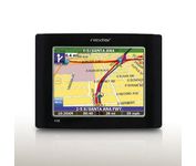
The Nextar GPS X3B mobile navigation system assures that your days of getting lost are over! Finding an address or any of 1.6 million points of interest such as the nearest gas station or restaurant is a snap anywhere in the U.S. or Canada. Just enter information in the X3B's 3.5 inch touch screen and let the voice prompt and detailed map guide you to the destination. With the latest TTS (Text to Speech) function, street names are clrearly pronounced in English. The X3B's built in MP3 player will entertain you with your favorite tunes while en route. Just copy your favorite play list onto an SD card and insert into the slot. The X3B moves easily from car to car using the convenient vent mount. A recharageable lithium ion battery assures that the unit stays active. Other features of the X3B include built-in maps of the 50 United States and Canada, 1GB built in Flash Memory.Minimize
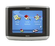
Magellan Maestro 3100 offers simple, sophisticated GPS navigation that's remarkably affordable. The most intuitive graphical 3.5" touch-screen interface available makes navigation easy. Enter virtually any destination and get turn-by-turn voice guidance to locations all over the contiguous United States. Smart touch-icons and Magellan's unique QuickSpell function enable error-free spelling, minimizing steps, so you get a customized route to your destination with just a few touches of the screen. Hundreds of thousands of preprogrammed points of interest make it easy to find restaurants, gas stations, ATM and more. Minimize
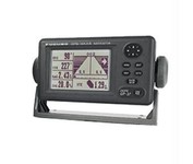
Compact in size, waterproof, yet big on power, features and performance, Furunos GP32 is perfect for a wide range of smaller fishing boats and pleasure craft. This advanced unit, based on the popular GP31, provides accurate and reliable position fixing, thanks to a super sensitive, 12-channel GPS receiver combined with integrated WAAS technology. The unit has a waterproof display and is built to stand up to tough marine conditions. This durable casing houses an impressive memory, capable of storing up to 1,000 points of ships track, 999 points for marks and waypoints, and 50 routes of up to 30 waypoints each. Vital navigation data is presented on a 4.5-inch diagonal Silver Bright LCD screen with adjustable brilliance. Innovative graphic displays include Nav, Highway, Steering, Track Plotting, and two operator programmable modes, all extremely easy to use. The GP32, like all Furuno nav receivers, feature Furunos NMEA 0183 programmable interface system for feeding highly accurate nav data to your Furuno radar, Minimize
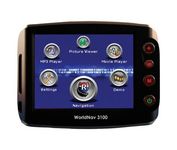
The TeleType WorldNav 3100 Deluxe Portable GPS Navigator is a simple, stylish and user-friendly street navigator at a reasonable price. With the WorldNav 3100 Deluxe you get affordable, in-car navigation with the added benefits of easy touch-screen use, pre-loaded maps, as well as MP3 and video entertainment capabilities.Minimize