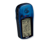
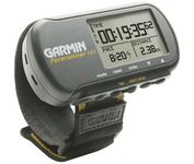
Garmin GPSMAP 4212$2,200.00 to $3,000.00

This preloaded, offshore chartplotter combines the power of networking with brilliant color and slim-line design. The GPSMAP 4212 has preloaded BlueChart® g2 maps of the U.S. coast and displays them on a whopping 12.1” XGA display with crisp, video-quality resolution. By connecting to the Garmin Marine Network, you can add sonar, radar and weather. For even more enhanced features, you can add the optional Bluechart g2 Vision card.Minimize
Manufacturer:Garmin Product MPN MPN | 010-00592-01 | Key Features GPS Type | Marine | Form Factor | Fixed | Map capabilities | Internal | Enhanced accuracy | WAAS enabled | Input Method | Keypad | Receiver Type | 12 Channels | Screen Size | 12.1 in. | Display Display Size | 9.7 in. x 7.3 in. | Resolutions | 640 X 480 | Technical Features Audible Features | Proximity Alarm, Anchor Alarm, Arrival Alarm, Off-Course Alarm, Clock Alarm, Accuracy Alarm, Low Battary/Voltage Alarm | Trip calculator | Track Log, Points-of-Interest (POI) | Included Software/Maps | Marine Cartography | Other Features Expansion Slot Type | SD (Secure Digital) Card Slot | GPS System Number of routes | 20 | Waypoints | 1500 | Dimensions Width | 14.8 in. | Depth | 4.6 in. | Height | 9.5 in. | Weight | 10 lb. | Miscellaneous Family Line | Garmin GPSMAP | UPC | 753759066062 |
Tags:garmin, gpsmap, 4212,
| Garmin GPSMAP 3205$520.00 to $1,095.00
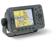
Plug into the power of the Garmin Marine network with the Garmin 3200 series. Rugged, waterproof, and easy to install, these chartplotters come preloaded with Garmin's detail-rich marine cartography utilizing BlueChart® g2 technology.
Manufacturer:Garmin Product MPN MPN | 010-00526-00 | Key Features GPS Type | Marine | Form Factor | Fixed | Map capabilities | Internal, Map cartridges / Data cards | Enhanced accuracy | WAAS enabled | Input Method | Keypad | Receiver Type | 12 Channels | Display Display Size | 5 in. | Display Type | 256 Color LCD TFT Display | Resolutions | 640 X 480 | Technical Features Marine Features | Chart Plotter | Special Features | 3D Map View | Audible Features | Proximity Alarm, Anchor Alarm, Arrival Alarm, Off-Course Alarm, Clock Alarm, Low Battary/Voltage Alarm | Included Software/Maps | Marine Cartography | Other Features PC Interface | NMEA-0183 | Environmental Protection | IPX7 Waterproof Standard | GPS System Accuisition Time - Cold | 45 sec | Accuisition Time - Initial Time | 15 sec | Update rate | 1 per second, continuous | Max. Horizontal accuracy | | Enhanced position accuracy | | Differential standards | DGPS Ready | Number of routes | 50 | Waypoints | 4000 | Warranty Warranty | 1 Year | Dimensions Width | 7.8 in. | Depth | 3 in. | Height | 4.7 in. | Weight | 1.8 lb. | Miscellaneous Family Line | Garmin GPSMAP | UPC | 753759053048 |
Tags:garmin, gpsmap, 3205,
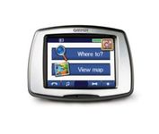
| Garmin nuvi 650$150.00 to $419.00
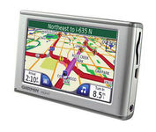
The Garmin nuvi 650 isn’t just a portable GPS system; it’s a fully featured multimedia device capable of MP3 playback and JPEG picture viewing. The nuvi 650 comes preloaded with City Navigator NT street maps that are loaded with hundreds of useful points of interest including gas stations, restaurants, and movie theaters. The touch screen interface gives you quick and easy access the nuvi 650’s many functions, and with the slim, sleek design you can easily stow it in your purse, backpack, or pocket. A rechargeable lithium-ion battery makes it suitable for navigation while in the car or even on foot.Minimize
Manufacturer:Garmin Product MPN MPN | 010-00540-70 | Key Features GPS Type | Automobile | Form Factor | Fixed | Map capabilities | Map cartridges / Data cards, Download maps | Enhanced accuracy | WAAS enabled | Input Method | Touch Screen | Screen Size | 4.4 in. | Display Display Size | 3.81 in. x 2.25 in. | Display Type | LCD TFT Display | Resolutions | 480 x 272 | Technical Features Special Features | MP3 Player, Audio Book Player, JPEG Image Viewer, Converter, Calculator, 3D Map View | Audible Features | Proximity Alarm, Voice Navigation Instructions | Trip calculator | Detour Feature, Points-of-Interest (POI) | Included Software/Maps | North America Maps, USA Maps, Europe Maps | Other Features PC Interface | USB | Expansion Slot Type | SD (Secure Digital) Card Slot | Antenna | Flip-up | Battery Battery Type and Quantity | Rechargeable Li-Ion Battery | Battery Life | 7 Hours | Warranty Warranty | 1 Year | Dimensions Width | 4.9 in. | Depth | 0.9 in. | Height | 2.9 in. | Weight | 0.39 lb. | Miscellaneous Family Line | Garmin nuvi | UPC | 718122378609 |
Tags:garmin, nuvi, 650,
|