Products reviews
Garmin GPSMAP 4212$2,200.00 to $3,000.00
Tags:garmin, gpsmap, 4212, | Magellan eXplorist 200$95.00 to $250.00
Tags:magellan, explorist, 200, | Garmin nuvi 250$123.00 to $330.00
Tags:garmin, nuvi, 250, |
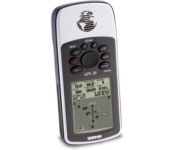
Garmin GPS 76

The GPS 76 is designed to provide precise GPS positioning using correction data obtained from the Wide Area Augmentation System (WAAS). This unit features a built-in quad helix antenna for superior reception and can provide position accuracy to less than three meters when receiving WAAS corrections.The GPS 76 provides 1 megabyte of internal user memory to be used for storing downloaded Points of Interest data. This 1 megabyte of storage area is preloaded from the factory with worldwide cities (populations greater than 200,000) and nautical navigation aids such as lights, buoys, sound signals and day beacons, and is perfect for downloading points of interest detail from GARMIN's line of MapSource CD-ROMs. The GPS 76 is also preloaded with tide data for the United States.Minimize
Nextar X3B

The Nextar GPS X3B mobile navigation system assures that your days of getting lost are over! Finding an address or any of 1.6 million points of interest such as the nearest gas station or restaurant is a snap anywhere in the U.S. or Canada. Just enter information in the X3B's 3.5 inch touch screen and let the voice prompt and detailed map guide you to the destination. With the latest TTS (Text to Speech) function, street names are clrearly pronounced in English. The X3B's built in MP3 player will entertain you with your favorite tunes while en route. Just copy your favorite play list onto an SD card and insert into the slot. The X3B moves easily from car to car using the convenient vent mount. A recharageable lithium ion battery assures that the unit stays active. Other features of the X3B include built-in maps of the 50 United States and Canada, 1GB built in Flash Memory.Minimize
Garmin nüvi 350

Sleek and portable, the Garmin nuvi 350 comes preloaded with City Navigator NT street maps that highlight countless points of interest including hotels, restaurants, gas stations, ATMs and much more. A simple touch-screen interface allows you to quickly pull up 2-D or 3-D maps, and with turn-by-turn voice directions, you’ll never have to take your eyes off the road to get your bearings. The nuvi 350 also includes MP3 playback, a JPEG picture viewer, currency converters, and a host of other travel handy applications.Minimize
Garmin eTrex Legend Cx

The eTrex Legend Cx is loaded with the same popular features found in the eTrex Legend C, including sunlight-readable color and advanced GPS routing capabilities — all in a waterproof design. In addition, it comes with a blank 32 MB microSD card for storage of optional map detail. Download maps directly to the card or purchase microSD cards preloaded with MapSource® Topo and inland lake maps, BlueChart® marine cartography, and City Navigator™ street maps.Minimize


