Products reviews

Garmin GPSMAP 4212

$2,200.00 to $3,000.00


This preloaded, offshore chartplotter combines the power of networking with brilliant color and slim-line design. The GPSMAP 4212 has preloaded BlueChart® g2 maps of the U.S. coast and displays them on a whopping 12.1” XGA display with crisp, video-quality resolution. By connecting to the Garmin Marine Network, you can add sonar, radar and weather. For even more enhanced features, you can add the optional Bluechart g2 Vision card.Minimize

Manufacturer:Garmin Product MPNKey FeaturesDisplayTechnical FeaturesOther FeaturesGPS SystemDimensionsMiscellaneous
MPN010-00592-01
GPS Type   Marine
Form FactorFixed
Map capabilities   Internal
Enhanced accuracyWAAS enabled
Input Method   Keypad
Receiver Type12 Channels
Screen Size12.1 in.
Display Size9.7 in. x 7.3 in.
Resolutions640 X 480
Audible Features   Proximity Alarm, Anchor Alarm, Arrival Alarm, Off-Course Alarm, Clock Alarm, Accuracy Alarm, Low Battary/Voltage Alarm
Trip calculator   Track Log, Points-of-Interest (POI)
Included Software/Maps   Marine Cartography
Expansion Slot TypeSD (Secure Digital) Card Slot
Number of routes20
Waypoints   1500
Width14.8 in.
Depth4.6 in.
Height9.5 in.
Weight10 lb.
Family LineGarmin GPSMAP
UPC753759066062


Tags:

garmin, gpsmap, 4212,

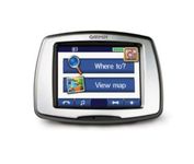
Garmin StreetPilot c550

$199.00 to $400.00


From Garmin, the leader in portable GPS solutions, the StreetPilot c550 is easy to use, and rich with features. The StreetPilot c550 comes preloaded with City Navigator NT street maps and includes a large database of points of interest including motels, restaurants, gas stations, and grocery stores. The simple touch screen interface gives you excellent control over menus and settings, and with Bluetooth support, you can even use the c550 for hands-free calling using the built-in speaker and microphone.Minimize

Manufacturer:Garmin Product MPNKey FeaturesDisplayTechnical FeaturesOther FeaturesGPS SystemBatteryWarrantyDimensionsMiscellaneous
MPN010-00522-02
GPS Type   Automobile
Form FactorFixed
Map capabilities   Internal, Map cartridges / Data cards
Enhanced accuracyWAAS enabled
Input Method   Touch Screen
Screen Size3.5 in.
Display Size2.8 in. x 2.1 in.
Display TypeLCD TFT Display
Resolutions320 X 240
Special Features   Waypoint Icons, MP3 Player, 3D Map View
Audible Features   Voice Navigation Instructions
Trip calculator   Maximum speed, Odometer, Route Recalculation, Trip Timers, Real-time Traffic Reports, Detour Feature, Points-of-Interest (POI)
Included Software/Maps   North America Maps, Europe Maps
PC InterfaceUSB 2.0, Bluetooth
Expansion Slot TypeSD (Secure Digital) Card Slot
AntennaBuilt-in, External Antenna Hookup
Waypoints   500
Battery Life8 Hours
Warranty1 Year
Width4.4 in.
Depth2.2 in.
Height3.2 in.
Weight0.59 lb.
Family LineGarmin StreetPilot
UPC753759054489


Tags:

garmin, streetpilot, c550,

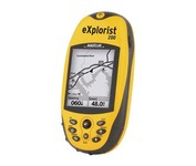
Magellan eXplorist 200

$95.00 to $250.00


For serious outdoor use, the eXplorist series handheld GPS navigation systems are built to cover all requirements. With their tough, impact-resistant, waterproof exterior and their proven Magellan technology inside that packs powerful functionality into an easy-to-use operating system, your outdoor needs will be covered.Minimize

Manufacturer:Magellan Product MPNKey FeaturesDisplayTechnical FeaturesOther FeaturesGPS SystemBatteryWarrantyDimensionsMiscellaneous
MPNeXplorist 200
GPS Type   Handheld (Outdoor)
Form FactorHandheld
Map capabilities   Internal
Enhanced accuracyWAAS enabled, EGNOS enabled
Input Method   Keypad
Receiver Type14 Channels
Screen Size2.3 in.
Display Size1.4 in. x 1.8 in.
Display Type4 Level Grayscale LCD Display
Resolutions160 X 120
Special Features   Compass
Trip calculator   Track Log, Points-of-Interest (POI)
Included Software/Maps   North America Maps
Grids   Finnish, French, German, Irish, Lat/Lon, MGRS, OSGB, Swedish, Swiss, User Grid, USNG, UTM
PC InterfaceNMEA-0183
Built in memory8 MB
Environmental ProtectionIPX7 Waterproof Standard, Rubber Armored Impact Resistant Plastic
Accuisition Time - Cold120 sec
Accuisition Time - Initial Time60 sec
Accuisition Time - Hot15 sec
Update rate1 per second, continuous
Max. Horizontal accuracy   Enhanced position accuracy Number of routes20
Waypoints   500
Battery Type and Quantity2 x AA Batteries
Warranty1 Year
Width2.1 in.
Depth1.3 in.
Height4.6 in.
Weight0.25 lb.
Family LineMagellan eXplorist
UPC763357109375


Tags:

magellan, explorist, 200,


Garmin GPS 72


The GPS 72 is a low-cost solution for land or marine navigation designed to provide precise GPS positioning using correction data obtained from the Wide Area Augmentation System (WAAS). The GPS 72 can provide position accuracy to less than three meters when receiving WAAS corrections. This rugged, waterproof, unsinkable GPS receiver offers a large, 4-level grayscale screen. It's designed as the next generation in basic, entry-level GARMIN GPS.Minimize


Garmin Rino 120


The Rino 120 is state-of-the-art GPS navigation and two-way communications combined, with enough memory to download detailed mapping for driving, hiking, hunting, fishing--or just about anything else you can dream up.


Garmin Rino 110


The Rino 110 is a GPS-enabled handheld that integrates radio functionality to provide two-way communications. It's waterproof, can send communications up to five miles (using GMRS channels), and can "beam" your exact location to another Rino user within a two-mile range (on the FRS spectrum) using "Position Reporting". And because the Rino 110 has standard FRS capabilities, you can talk to friends or family who own conventional FRS radios.The Rino 110 has a built-in city point data base, with 1 MB of internal memory for additional points-of-interest data that can be downloaded from a MapSource Points of Interest CD-ROM.Minimize


Nextar X3B


The Nextar GPS X3B mobile navigation system assures that your days of getting lost are over! Finding an address or any of 1.6 million points of interest such as the nearest gas station or restaurant is a snap anywhere in the U.S. or Canada. Just enter information in the X3B's 3.5 inch touch screen and let the voice prompt and detailed map guide you to the destination. With the latest TTS (Text to Speech) function, street names are clrearly pronounced in English. The X3B's built in MP3 player will entertain you with your favorite tunes while en route. Just copy your favorite play list onto an SD card and insert into the slot. The X3B moves easily from car to car using the convenient vent mount. A recharageable lithium ion battery assures that the unit stays active. Other features of the X3B include built-in maps of the 50 United States and Canada, 1GB built in Flash Memory.Minimize