Garmin Edge 305$175.00 to $449.00

Rugged, lightweight Edge attaches easily to the stem or handlebars of your bike with the included bike mount. Just turn it on, acquire GPS satellites and go. Edge 305 automatically measures your speed, distance, time, calories burned, altitude, climb and descent, and also records the route you have taken for review. For extra-precise climb and descent data, Edge 305 also incorporates a barometric altimeter to pinpoint changes in elevation.Minimize
Manufacturer:Garmin Product MPN MPN | GE305CAD | Key Features GPS Type | Handheld (Outdoor) | Form Factor | Handheld | Screen Size | 1.9 in. | Display Display Size | 1.17 in. x 1.44 in. | Display Type | 4 Level Grayscale LCD Display | Resolutions | 128 x 160 | Technical Features Special Features | Built-In Barometer, Built-In Altimeter, Heart Rate Monitor, Training Computer | Trip calculator | Maximum speed, Elevation Computer | Other Features PC Interface | USB | Environmental Protection | IPX7 Waterproof Standard | Antenna | Built-in | Battery Battery Type and Quantity | Proprietary Lithium | Battery Life | 12 Hours | Warranty Warranty | 1 Year | Dimensions Width | 1.75 in. | Depth | 0.9 in. | Height | 3.7 in. | Weight | 0.19 lb. | Miscellaneous UPC | 753759051716 |
Tags:garmin, edge, 305,
| Magellan Maestro 3100$99.00 to $212.00

Magellan Maestro 3100 offers simple, sophisticated GPS navigation that's remarkably affordable. The most intuitive graphical 3.5" touch-screen interface available makes navigation easy. Enter virtually any destination and get turn-by-turn voice guidance to locations all over the contiguous United States. Smart touch-icons and Magellan's unique QuickSpell function enable error-free spelling, minimizing steps, so you get a customized route to your destination with just a few touches of the screen. Hundreds of thousands of preprogrammed points of interest make it easy to find restaurants, gas stations, ATM and more. Minimize
Manufacturer:Magellan Product MPN MPN | 980934-01 | Key Features GPS Type | Automobile | Form Factor | Fixed | Map capabilities | Map cartridges / Data cards | Receiver Type | 20 Channels | Display Display Type | 64k Colors LCD TFT Display | Resolutions | 320 X 240 | Technical Features Special Features | Waypoint Icons | Trip calculator | Route Recalculation, Detour Feature, Points-of-Interest (POI) | Included Software/Maps | USA Maps | Other Features Antenna | Built-in | GPS System Max. Horizontal accuracy | Battery | Battery Life | 3 Hours | Dimensions Width | 4.3 in. | Depth | 1.1 in. | Height | 3.5 in. | Weight | 6.5 lb. | Miscellaneous UPC | 763357117226 |
Tags:magellan, maestro, 3100,
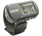
| Garmin Forerunner 101$89.00 to $114.00

The Forerunner 101 offers athletes and recreational walkers and runners an entry-level personal training device with GPS. It has the same features as the Forerunner 201, but operates on two AAA batteries. The Forerunner 101 stores lap histories for up to two years to provide an archive of workout performance over time. Users can retrieve lap data for previous workouts by date, week, month, or over a specific time interval. For business travelers who want to train on the road, the Forerunner 101 also doubles as a navigator. Users can mark their hotel as a specific location, see their current position on the plotter display, and follow an electronic breadcrumb trail back to their starting point.Minimize
Manufacturer:Garmin Product MPN MPN | 010-00329-00 | Key Features GPS Type | Handheld (Outdoor) | Form Factor | Handheld | Receiver Type | 12 Channels | Screen Size | 1.7 in. | Display Display Size | 1.5 in. x 0.9 in. | Display Type | LCD Display | Resolutions | 100 X 64 | Technical Features Special Features | Built-In Altimeter | Audible Features | Arrival Alarm | Trip calculator | Maximum speed | Other Features Environmental Protection | IPX7 Waterproof Standard | Antenna | Built-in | GPS System Accuisition Time - Cold | 45 sec | Accuisition Time - Initial Time | 15 sec | Waypoints | 100 | Battery Battery Type and Quantity | 2 x AAA Batteries | Battery Life | 15 Hours | Warranty Warranty | 1 Year | Dimensions Width | 3.3 in. | Depth | 0.9 in. | Height | 1.7 in. | Weight | 0.16 lb. | Miscellaneous Family Line | Garmin Forerunner | UPC | 0753759044114 |
Tags:garmin, forerunner, 101,
|


